TopoQuest Logo
Do you find TopoQuest useful?
Help keep TopoQuest running and adding new maps/features by donating!
Bitcoin:  19c7KJd3qBynnjoSw5npx9KScwjBe4ifkT
Litecoin:  LXs6TkuXGGXo1vDsWCkWVdjQX94eUKd6ui
Home View Maps Find Maps Find Places Resources & Links


Mound City, Missouri Topographic Map

USGS Map Title: Mound City, MO
USGS Map MRC: 40095B2
DRG (GeoTIFF) Download: o40095b2.tif


Neighboring USGS Topographic Map Quads:


  Tarkio SE, MO  
40095C3
 

  Dotham, MO  
40095C2
 

  Skidmore, MO  
40095C1
 

  Craig, MO  
40095B3
 

  Mound City, MO  
40095B2
 

  Maitland, MO  
40095B1
 

  Big Lake, MO  
40095A3
 

  Kimsey Creek, MO  
40095A2
 

  New Point, MO  
40095A1


Map MRC Location:

N41°
W96°
N41°
W95°
H8 H7 H6 H5 H4 H3 H2 H1
G8 G7 G6 G5 G4 G3 G2 G1
F8 F7 F6 F5 F4 F3 F2 F1
E8 E7 E6 E5 E4 E3 E2 E1
D8 D7 D6 D5 D4 D3 D2 D1
C8 C7 C6 C5 C4 C3 C2 C1
B8 B7 B6 B5 B4 B3 B2 B1
A8 A7 A6 A5 A4 A3 A2 A1
N40°
W96°
N40°
W95°

Mound City, MO USGS 1:24K Topographic Map Preview:
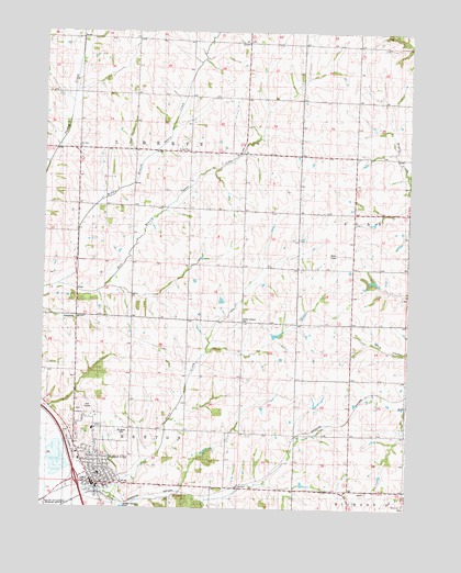
Mound City, MO USGS Topographic Map
Click on map above to begin viewing in our Map Viewer.

This topographic map contains these locations and features:
Feature Name Type Latitude Longitude GNIS ID View Map
Bethel ChurchChurchN40.2189°W95.2014°714076View Map
Center District CemeteryCemeteryN40.1742°W95.1822°743367View Map
Center School (historical)SchoolN40.1750°W95.1816°730069View Map
City of Mound CityCivilN40.1365°W95.2337°2395113View Map
Crop Care AirportAirportN40.1430°W95.2406°745547View Map
Crosen School (historical)SchoolN40.1302°W95.1257°718892View Map
Earl Limpp Lake DamDamN40.1317°W95.1619°761017View Map
Ebenezer ChurchChurchN40.1744°W95.2025°717385View Map
Franklin School (historical)SchoolN40.1736°W95.1450°718177View Map
Gillis LakeReservoirN40.1717°W95.1719°760920View Map
Gillis Lake DamDamN40.1717°W95.1719°760919View Map
Gordon School (historical)SchoolN40.1446°W95.1498°718619View Map
Harmony School (historical)SchoolN40.2461°W95.1616°719123View Map
Limpp LakeReservoirN40.1317°W95.1619°761018View Map
Lloyd Norman DamDamN40.1750°W95.1619°761013View Map
Lloyd Norman LakeReservoirN40.1750°W95.1619°761014View Map
Middle Branch Squaw CreekStreamN40.1831°W95.2480°722268View Map
Mineral Springs School (historical)SchoolN40.1453°W95.1900°747048View Map
Minnesota Valley School (historical)SchoolN40.2403°W95.2366°722443View Map
Mound CityPopulated PlaceN40.1311°W95.2316°730155View Map
Mound City Elementary SchoolSchoolN40.1336°W95.2304°2545417View Map
Mound City High SchoolSchoolN40.1340°W95.2305°2545098View Map
Mound City Police DepartmentBuildingN40.1324°W95.2306°2752166View Map
Mound City Post OfficePost OfficeN40.1310°W95.2331°2782649View Map
Mound City Rural Fire and RescueBuildingN40.1425°W95.2399°2621269View Map
Mount Hope CemeteryCemeteryN40.1450°W95.2225°743368View Map
Number 1 CanalCanalN40.1294°W95.2444°755339View Map
Pine Hill School (historical)SchoolN40.2030°W95.1261°724382View Map
Pleasant Hill School (historical)SchoolN40.1739°W95.2383°747049View Map
Ross Grove School (historical)SchoolN40.2031°W95.2286°725580View Map
Shiloh CemeteryCemeteryN40.1260°W95.1268°2702326View Map
Shiloh ChurchChurchN40.1264°W95.1264°743366View Map
Squaw Creek School (historical)SchoolN40.2169°W95.1828°726978View Map
Tenney-Hall DamDamN40.1717°W95.1886°760753View Map
Tenney-Hall LakeReservoirN40.1717°W95.1886°760754View Map
Township of LibertyCivilN40.2188°W95.2382°766768View Map
Trena Bomar DamDamN40.1350°W95.1853°761021View Map
Trenas LakeReservoirN40.1350°W95.1853°761022View Map

Note: Coordinates in the location and feature list above are referenced to NAD83 datum.


Copyright (C) 2008-2025 Ryan Niemi / Sunset Dynamics ... All Rights Reserved