TopoQuest Logo
Do you find TopoQuest useful?
Help keep TopoQuest running and adding new maps/features by donating!
Bitcoin:  19c7KJd3qBynnjoSw5npx9KScwjBe4ifkT
Litecoin:  LXs6TkuXGGXo1vDsWCkWVdjQX94eUKd6ui
Home View Maps Find Maps Find Places Resources & Links


Crane, Montana Topographic Map

USGS Map Title: Crane, MT
USGS Map MRC: 47104E3
DRG (GeoTIFF) Download: o47104e3.tif


Neighboring USGS Topographic Map Quads:


  Crane NW, MT  
47104F4
 

  Crane NE, MT  
47104F3
 

  Sidney, MT  
47104F2
 

  Larson School, MT  
47104E4
 

  Crane, MT  
47104E3
 

  Piche, MT  
47104E2
 

  Knife River Mine, MT  
47104D4
 

  Savage, MT  
47104D3
 

  Skaar NW, MT  
47104D2


Map MRC Location:

N48°
W105°
N48°
W104°
H8 H7 H6 H5 H4 H3 H2 H1
G8 G7 G6 G5 G4 G3 G2 G1
F8 F7 F6 F5 F4 F3 F2 F1
E8 E7 E6 E5 E4 E3 E2 E1
D8 D7 D6 D5 D4 D3 D2 D1
C8 C7 C6 C5 C4 C3 C2 C1
B8 B7 B6 B5 B4 B3 B2 B1
A8 A7 A6 A5 A4 A3 A2 A1
N47°
W105°
N47°
W104°

Crane, MT USGS 1:24K Topographic Map Preview:
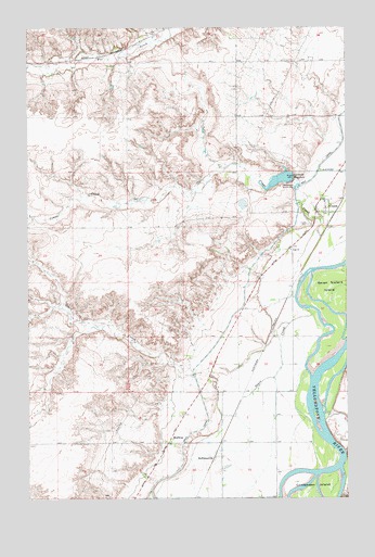
Crane, MT USGS Topographic Map
Click on map above to begin viewing in our Map Viewer.

This topographic map contains these locations and features:
Feature Name Type Latitude Longitude GNIS ID View Map
20N58E02AB__01 WellWellN47.5272°W104.2880°823609View Map
20N58E02AD__01 WellWellN47.5236°W104.2827°823595View Map
20N58E02BB__01 WellWellN47.5272°W104.2986°823610View Map
20N58E02CD__01 WellWellN47.5164°W104.2933°823541View Map
20N58E02DC__01 WellWellN47.5164°W104.2880°823540View Map
20N58E02DD__01 WellWellN47.5164°W104.2827°823539View Map
20N58E03CC__01 WellWellN47.5164°W104.3197°823542View Map
20N58E03DA__01 WellWellN47.5200°W104.3038°823567View Map
20N58E09DD__01 WellWellN47.5020°W104.3252°823439View Map
20N58E09DD__02 WellWellN47.5020°W104.3252°823440View Map
20N58E10BA__01 WellWellN47.5128°W104.3144°823501View Map
20N58E10DC__01 WellWellN47.5020°W104.3091°823438View Map
20N58E11AA__01 WellWellN47.5128°W104.2827°823500View Map
20N58E11BC__01 WellWellN47.5092°W104.2986°823475View Map
20N58E11CB__01 WellWellN47.5056°W104.2986°823456View Map
20N58E11CC__01 WellWellN47.5020°W104.2986°823436View Map
20N58E11CC__02 WellWellN47.5020°W104.2986°823437View Map
20N58E11DC__01 WellWellN47.5020°W104.2880°823435View Map
20N58E12BC__01 WellWellN47.5092°W104.2772°823474View Map
21N57E13ACDC01 WellWellN47.5797°W104.3441°823862View Map
21N57E14CDCC01 WellWellN47.5731°W104.3722°823829View Map
21N57E23AA__01 WellWellN47.5714°W104.3605°823820View Map
21N57E36CDCC01 WellWellN47.5286°W104.3516°823617View Map
21N58E03CBBC01 WellWellN47.6072°W104.2702°824026View Map
21N58E03DBB_01 WellWellN47.6075°W104.2608°824028View Map
21N58E05BA__01 WellWellN47.6139°W104.3072°824060View Map
21N58E06ABBC01 WellWellN47.6145°W104.3241°824063View Map
21N58E08DD__01 WellWellN47.5886°W104.2966°823925View Map
21N58E10DC__01 WellWellN47.5886°W104.2594°823924View Map
21N58E15AC__01 WellWellN47.5814°W104.2594°823875View Map
21N58E15CA__01 WellWellN47.5778°W104.2647°823855View Map
21N58E15CA__02 WellWellN47.5778°W104.2647°823856View Map
21N58E15DA__01 WellWellN47.5778°W104.2541°823850View Map
21N58E15DB__01 WellWellN47.5778°W104.2594°823851View Map
21N58E15DB__02 WellWellN47.5778°W104.2594°823852View Map
21N58E15DB__03 WellWellN47.5778°W104.2594°823853View Map
21N58E15DB__04 SpringSpringN47.5778°W104.2594°823854View Map
21N58E15DC__01 WellWellN47.5742°W104.2594°823833View Map
21N58E16BB__01 WellWellN47.5850°W104.2913°823896View Map
21N58E18DC__01 WellWellN47.5742°W104.3233°823834View Map
21N58E20AA__01 WellWellN47.5703°W104.2966°823815View Map
21N58E21AC__01 WellWellN47.5667°W104.2808°823800View Map
21N58E21BD__01 WellWellN47.5667°W104.2861°823801View Map
21N58E21DB__02 WellWellN47.5631°W104.2808°823787View Map
21N58E22CB__01 WellWellN47.5631°W104.2699°823786View Map
21N58E27BB__01 WellWellN47.5558°W104.2699°823748View Map
21N58E27CC__01 WellWellN47.5450°W104.2699°823702View Map
21N58E29BB__01 WellWellN47.5558°W104.3124°823749View Map
21N58E30DDA_01 WellWellN47.5456°W104.3163°823709View Map
21N58E31ADDD01 WellWellN47.5358°W104.3147°823658View Map
21N58E32AB__01 WellWellN47.5414°W104.3019°823683View Map
21N58E32BC__01 WellWellN47.5378°W104.3124°823670View Map
21N58E32CA__01 WellWellN47.5342°W104.3072°823647View Map
21N58E32CD__01 WellWellN47.5306°W104.3072°823629View Map
21N58E32DA__01 WellWellN47.5342°W104.2966°823646View Map
21N58E33AD__01 WellWellN47.5378°W104.2755°823669View Map
21N58E33BB__01 WellWellN47.5414°W104.2913°823682View Map
21N58E33DD__01 WellWellN47.5306°W104.2755°823628View Map
CraneLocaleN47.5756°W104.2574°1714994View Map
CranePopulated PlaceN47.5758°W104.2624°770276View Map
Crane CemeteryCemeteryN47.5728°W104.2655°770277View Map
Crane Census Designated PlaceCensusN47.5772°W104.2509°2583803View Map
Crane Congregational ChurchChurchN47.5772°W104.2583°1715292View Map
Crane Post OfficePost OfficeN47.5790°W104.2591°1714993View Map
Crane School (historical)SchoolN47.5789°W104.2588°1715234View Map
Epworth (historical)LocaleN47.6231°W104.3249°1714988View Map
Gartside DamDamN47.5850°W104.2705°795339View Map
Gartside ReservoirReservoirN47.5846°W104.2760°795340View Map
Gartside Reservoir Fishing Access SiteLocaleN47.5836°W104.2719°1744325View Map
HoffmanvillePopulated PlaceN47.5108°W104.3024°772449View Map
Log ChurchChurchN47.5661°W104.2724°773543View Map
MidwayPopulated PlaceN47.5150°W104.3205°774195View Map
Midway School (historical)SchoolN47.5153°W104.3194°1715221View Map
Savage-Crane DivisionCivilN47.5063°W104.2912°1940702View Map
Sears (historical)Populated PlaceN47.5425°W104.2924°1714947View Map
Sears (historical)LocaleN47.5425°W104.2924°1714948View Map
Sears CreekStreamN47.5503°W104.2655°776319View Map
Sears Post Office (historical)Post OfficeN47.5425°W104.2924°1714946View Map
Sears School (historical)SchoolN47.5411°W104.2927°1715223View Map
Shadwell CreekStreamN47.5120°W104.2513°776390View Map

Note: Coordinates in the location and feature list above are referenced to NAD83 datum.


Copyright (C) 2008-2025 Ryan Niemi / Sunset Dynamics ... All Rights Reserved