TopoQuest Logo
Do you find TopoQuest useful?
Help keep TopoQuest running and adding new maps/features by donating!
Bitcoin:  19c7KJd3qBynnjoSw5npx9KScwjBe4ifkT
Litecoin:  LXs6TkuXGGXo1vDsWCkWVdjQX94eUKd6ui
Home View Maps Find Maps Find Places Resources & Links


Piche, Montana Topographic Map

USGS Map Title: Piche, MT
USGS Map MRC: 47104E2
DRG (GeoTIFF) Download: o47104e2.tif


Neighboring USGS Topographic Map Quads:


  Crane NE, MT  
47104F3
 

  Sidney, MT  
47104F2
 

  Sidney NE, MT  
47104F1
 

  Crane, MT  
47104E3
 

  Piche, MT  
47104E2
 

  Sidney SE, MT  
47104E1
 

  Savage, MT  
47104D3
 

  Skaar NW, MT  
47104D2
 

  Skaar NE, MT  
47104D1


Map MRC Location:

N48°
W105°
N48°
W104°
H8 H7 H6 H5 H4 H3 H2 H1
G8 G7 G6 G5 G4 G3 G2 G1
F8 F7 F6 F5 F4 F3 F2 F1
E8 E7 E6 E5 E4 E3 E2 E1
D8 D7 D6 D5 D4 D3 D2 D1
C8 C7 C6 C5 C4 C3 C2 C1
B8 B7 B6 B5 B4 B3 B2 B1
A8 A7 A6 A5 A4 A3 A2 A1
N47°
W105°
N47°
W104°

Piche, MT USGS 1:24K Topographic Map Preview:
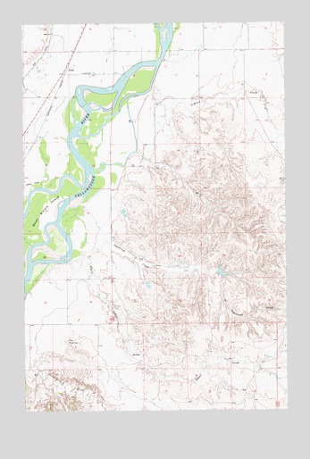
Piche, MT USGS Topographic Map
Click on map above to begin viewing in our Map Viewer.

This topographic map contains these locations and features:
Feature Name Type Latitude Longitude GNIS ID View Map
20N59E03DBA_01 WellWellN47.5200°W104.1808°823566View Map
20N59E04DDDB01 WellWellN47.5147°W104.1960°823523View Map
20N59E08BC__01 WellWellN47.5089°W104.2352°823472View Map
20N59E11BDC_01 WellWellN47.5072°W104.1674°823465View Map
21N58E01AA__01 WellWellN47.6139°W104.2116°824059View Map
21N58E02AD__01 WellWellN47.6103°W104.2330°824044View Map
21N58E02DD__01 WellWellN47.6031°W104.2330°824006View Map
21N58E11BB__01 WellWellN47.5995°W104.2488°823982View Map
21N58E11BD__01 WellWellN47.5958°W104.2436°823961View Map
21N58E11DC__01 WellWellN47.5886°W104.2383°823923View Map
21N58E14BB__01 WellWellN47.5850°W104.2488°823895View Map
21N58E14DB__01 WellWellN47.5778°W104.2383°823849View Map
21N59E03CC__01 WellWellN47.6045°W104.1413°824014View Map
21N59E08AA__01 WellWellN47.6008°W104.1683°823988View Map
21N59E08BB__01 WellWellN47.6008°W104.1844°823989View Map
21N59E08BCD_01 WellWellN47.5947°W104.1833°823951View Map
21N59E08DB__01 WellWellN47.5936°W104.1735°823945View Map
21N59E15DDBA01 WellWellN47.5745°W104.1269°823839View Map
21N59E18CD__01 WellWellN47.5753°W104.2005°823842View Map
21N59E20AAAC01 WellWellN47.5703°W104.1694°823814View Map
21N59E22DDC_01 WellWellN47.5583°W104.1274°823758View Map
21N59E30BBCA01 WellWellN47.5545°W104.2055°823741View Map
21N59E33DBBB01 WellWellN47.5350°W104.1544°823654View Map
22N58E36DD__01 WellWellN47.6178°W104.2099°824097View Map
22N58E36DDD_01 WellWellN47.6164°W104.2099°824083View Map
22N59E31CB__01 WellWellN47.6220°W104.2038°824117View Map
22N59E31CC__01 WellWellN47.6183°W104.2038°824106View Map
22N59E31DD__01 WellWellN47.6183°W104.1877°824105View Map
22N59E32CD__01 WellWellN47.6183°W104.1769°824104View Map
22N59E32DA__01 WellWellN47.6220°W104.1663°824116View Map
22N59E32DD__01 WellWellN47.6183°W104.1663°824103View Map
22N59E34CA__01 WellWellN47.6220°W104.1341°824114View Map
22N59E34CB__01 WellWellN47.6220°W104.1394°824115View Map
Alkali CreekStreamN47.5689°W104.2222°768186View Map
Buella IslandIslandN47.6064°W104.1949°1715256View Map
Coal Bank SloughStreamN47.6017°W104.1958°1715257View Map
Crane CreekStreamN47.5720°W104.2405°770278View Map
Diamond IslandIslandN47.5936°W104.2158°1714950View Map
Hastetter Number 1 DamDamN47.5450°W104.1572°797713View Map
Hastetter Number 2 DamDamN47.5400°W104.1905°797712View Map
Main CanalCanalN47.6147°W104.2411°773835View Map
O'Brien CreekStreamN47.6041°W104.1888°774895View Map
PichePopulated PlaceN47.6086°W104.2308°775204View Map
Sagebrush CreekStreamN47.5608°W104.2102°776094View Map
Seven Sisters Fishing Access SiteLocaleN47.5792°W104.2316°1744326View Map
Seven Sisters IslandIslandN47.5617°W104.2444°776351View Map
The PyramidSummitN47.5225°W104.2299°777535View Map

Note: Coordinates in the location and feature list above are referenced to NAD83 datum.


Copyright (C) 2008-2025 Ryan Niemi / Sunset Dynamics ... All Rights Reserved