TopoQuest Logo
Do you find TopoQuest useful?
Help keep TopoQuest running and adding new maps/features by donating!
Bitcoin:  19c7KJd3qBynnjoSw5npx9KScwjBe4ifkT
Litecoin:  LXs6TkuXGGXo1vDsWCkWVdjQX94eUKd6ui
Home View Maps Find Maps Find Places Resources & Links


Crane Mountain, Oregon Topographic Map

USGS Map Title: Crane Mountain, OR
USGS Map MRC: 42120A2
DRG (GeoTIFF) Download: o42120a2.tif


Neighboring USGS Topographic Map Quads:


  Lakeview, OR  
42120B3
 

  Horse Prairie, OR  
42120B2
 

  Sage Hen Butte, OR  
42120B1
 

  Crane Creek, OR  
42120A3
 

  Crane Mountain, OR  
42120A2
 

  Collins Rim, OR  
42120A1
 

  Willow Ranch, CA  
41120H3
 

  Mount Bidwell, CA  
41120H2
 

  Lake Annie, CA  
41120H1


Map MRC Location:

N43°
W121°
N43°
W120°
H8 H7 H6 H5 H4 H3 H2 H1
G8 G7 G6 G5 G4 G3 G2 G1
F8 F7 F6 F5 F4 F3 F2 F1
E8 E7 E6 E5 E4 E3 E2 E1
D8 D7 D6 D5 D4 D3 D2 D1
C8 C7 C6 C5 C4 C3 C2 C1
B8 B7 B6 B5 B4 B3 B2 B1
A8 A7 A6 A5 A4 A3 A2 A1
N42°
W121°
N42°
W120°

Crane Mountain, OR USGS 1:24K Topographic Map Preview:
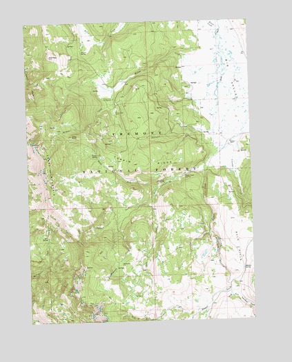
Crane Mountain, OR USGS Topographic Map
Click on map above to begin viewing in our Map Viewer.

This topographic map contains these locations and features:
Feature Name Type Latitude Longitude GNIS ID View Map
Bald HillsSummitN42.0304°W120.1341°1137442View Map
Boulder SpringSpringN42.0214°W120.1313°1138493View Map
Bow SpringSpringN42.0361°W120.2410°1138514View Map
Burnt CreekStreamN42.1227°W120.1422°1138992View Map
Crane MountainSummitN42.0627°W120.2408°1140381View Map
Crane Mountain National Recreation TrailTrailN42.0352°W120.2238°275084View Map
Crane Mountain ViewpointLocaleN42.0628°W120.2409°2548190View Map
Cressler CreekStreamN42.0771°W120.1313°1140443View Map
Deep Creek Recreation SiteLocaleN42.0574°W120.1752°1140806View Map
Deep Creek SpringSpringN42.0605°W120.1629°1140810View Map
Dismal CreekStreamN42.0666°W120.1511°1164088View Map
Dismal Creek Recreation SiteLocaleN42.0652°W120.1525°1952922View Map
Middle Fork Deep CreekStreamN42.0493°W120.1825°1146143View Map
Mosquito CreekStreamN42.0441°W120.2002°1146488View Map
Mosquito FlatFlatN42.0238°W120.2002°1146494View Map
North Fork Deep CreekStreamN42.0563°W120.1788°1146941View Map
O'Keefe MeadowFlatN42.1193°W120.2150°1153724View Map
Polander CreekStreamN42.0799°W120.1466°1147833View Map
Red PeakSummitN42.1107°W120.2375°1148327View Map
Robinson RanchLocaleN42.0743°W120.1372°1148555View Map
South Fork Deep CreekStreamN42.0493°W120.1825°1149963View Map
Turpin RidgeRidgeN42.0654°W120.1922°1151538View Map
Turpin SpringSpringN42.0695°W120.2117°1151539View Map
Vernon SpringSpringN42.1125°W120.2196°1151754View Map
West Fork Dismal CreekStreamN42.0046°W120.1555°1152068View Map
Willow CreekStreamN42.1024°W120.1416°1152407View Map
Willow Creek CabinLocaleN42.0877°W120.2013°1152418View Map
Willow Creek Guard StationLocaleN42.0888°W120.2011°1153725View Map
Willow Creek Recreation SiteLocaleN42.0929°W120.2027°1152419View Map
Willow PointSummitN42.0774°W120.2261°1152428View Map

Note: Coordinates in the location and feature list above are referenced to NAD83 datum.


Copyright (C) 2008-2025 Ryan Niemi / Sunset Dynamics ... All Rights Reserved