TopoQuest Logo
Do you find TopoQuest useful?
Help keep TopoQuest running and adding new maps/features by donating!
Bitcoin:  19c7KJd3qBynnjoSw5npx9KScwjBe4ifkT
Litecoin:  LXs6TkuXGGXo1vDsWCkWVdjQX94eUKd6ui
Home View Maps Find Maps Find Places Resources & Links


Sage Hen Butte, Oregon Topographic Map

USGS Map Title: Sage Hen Butte, OR
USGS Map MRC: 42120B1
DRG (GeoTIFF) Download: o42120b1.tif


Neighboring USGS Topographic Map Quads:


  Crook Peak, OR  
42120C2
 

  Drake Peak, OR  
42120C1
 

  Priday Reservoir, OR  
42119C8
 

  Horse Prairie, OR  
42120B2
 

  Sage Hen Butte, OR  
42120B1
 

  Adel, OR  
42119B8
 

  Crane Mountain, OR  
42120A2
 

  Collins Rim, OR  
42120A1
 

  May Lake, OR  
42119A8


Map MRC Location:

N43°
W121°
N43°
W120°
H8 H7 H6 H5 H4 H3 H2 H1
G8 G7 G6 G5 G4 G3 G2 G1
F8 F7 F6 F5 F4 F3 F2 F1
E8 E7 E6 E5 E4 E3 E2 E1
D8 D7 D6 D5 D4 D3 D2 D1
C8 C7 C6 C5 C4 C3 C2 C1
B8 B7 B6 B5 B4 B3 B2 B1
A8 A7 A6 A5 A4 A3 A2 A1
N42°
W121°
N42°
W120°

Sage Hen Butte, OR USGS 1:24K Topographic Map Preview:
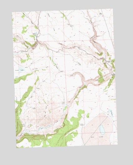
Sage Hen Butte, OR USGS Topographic Map
Click on map above to begin viewing in our Map Viewer.

This topographic map contains these locations and features:
Feature Name Type Latitude Longitude GNIS ID View Map
Big LakeFlatN42.1327°W120.0266°1138036View Map
Big ReservoirReservoirN42.1545°W120.0078°1138054View Map
Blue CreekStreamN42.2157°W120.1050°1138294View Map
Camas CreekStreamN42.1824°W120.0375°1139171View Map
Crane CreekStreamN42.1929°W120.0766°1140371View Map
Drake CreekStreamN42.1893°W120.0038°1141229View Map
Hickey WaterholeReservoirN42.1996°W120.0449°1160833View Map
Irish SpringSpringN42.2456°W120.0149°1144109View Map
Joe LakeFlatN42.1996°W120.0455°1161398View Map
Lane Reservoir Number OneReservoirN42.1280°W120.0874°1153726View Map
Limburger CabinLocaleN42.1654°W120.0650°1145019View Map
Little Parsnip CreekStreamN42.2210°W120.0950°1145221View Map
Parsnip CreekStreamN42.2021°W120.0130°1147468View Map
Parsnip SpringsSpringN42.2289°W120.0965°1147471View Map
Peddlers CreekStreamN42.2252°W120.0761°1147556View Map
Sage Hen ButteSummitN42.1560°W120.0844°1148923View Map
Sage Hen CreekStreamN42.1938°W120.0686°1148925View Map
Sage Hen CrossingLocaleN42.1935°W120.0680°1161497View Map
Schadler Cow CampLocaleN42.1610°W120.1041°1149118View Map
Thompson CabinLocaleN42.2360°W120.0550°1151086View Map
Tule SwampSwampN42.1967°W120.1169°1153728View Map
Wakefield CabinLocaleN42.1435°W120.0427°1151814View Map
Wakefield ReservoirReservoirN42.1542°W120.0390°1153727View Map
White Rock SpringSpringN42.2009°W120.0068°1152250View Map

Note: Coordinates in the location and feature list above are referenced to NAD83 datum.


Copyright (C) 2008-2025 Ryan Niemi / Sunset Dynamics ... All Rights Reserved