TopoQuest Logo
Do you find TopoQuest useful?
Help keep TopoQuest running and adding new maps/features by donating!
Bitcoin:  19c7KJd3qBynnjoSw5npx9KScwjBe4ifkT
Litecoin:  LXs6TkuXGGXo1vDsWCkWVdjQX94eUKd6ui
Home View Maps Find Maps Find Places Resources & Links


Crane Prairie, Oregon Topographic Map

USGS Map Title: Crane Prairie, OR
USGS Map MRC: 44118B4
DRG (GeoTIFF) Download: o44118b4.tif


Neighboring USGS Topographic Map Quads:


  Roberts Creek, OR  
44118C5
 

  Little Baldy Mountain, OR  
44118C4
 

  Bullrun Rock, OR  
44118C3
 

  Logan Valley East, OR  
44118B5
 

  Crane Prairie, OR  
44118B4
 

  Flag Prairie, OR  
44118B3
 

  Dollar Basin, OR  
44118A5
 

  Knox Mountain, OR  
44118A4
 

  Buck Trough Spring, OR  
44118A3


Map MRC Location:

N45°
W119°
N45°
W118°
H8 H7 H6 H5 H4 H3 H2 H1
G8 G7 G6 G5 G4 G3 G2 G1
F8 F7 F6 F5 F4 F3 F2 F1
E8 E7 E6 E5 E4 E3 E2 E1
D8 D7 D6 D5 D4 D3 D2 D1
C8 C7 C6 C5 C4 C3 C2 C1
B8 B7 B6 B5 B4 B3 B2 B1
A8 A7 A6 A5 A4 A3 A2 A1
N44°
W119°
N44°
W118°

Crane Prairie, OR USGS 1:24K Topographic Map Preview:
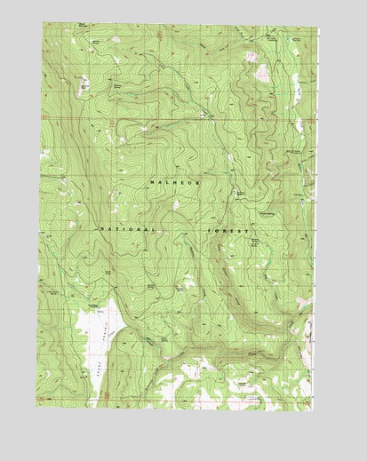
Crane Prairie, OR USGS Topographic Map
Click on map above to begin viewing in our Map Viewer.

This topographic map contains these locations and features:
Feature Name Type Latitude Longitude GNIS ID View Map
Barnett SpringSpringN44.1800°W118.4009°1137536View Map
Barrel SpringSpringN44.1648°W118.4473°1137542View Map
Burke SpringSpringN44.1481°W118.4440°1138969View Map
Buttermilk CreekStreamN44.1402°W118.4402°1139070View Map
Crane PrairieFlatN44.1449°W118.4724°1140382View Map
Crane Prairie Guard StationLocaleN44.1577°W118.4722°1140385View Map
Cruiser SpringSpringN44.1691°W118.4664°1140499View Map
Dugout CreekStreamN44.1979°W118.3805°1141386View Map
Elk Creek Recreation SiteLocaleN44.2452°W118.3983°1162592View Map
Halfway CreekStreamN44.1446°W118.4285°1143209View Map
Hawkins SpringSpringN44.1893°W118.4008°1161386View Map
Kooney SpringSpringN44.2438°W118.4778°1144701View Map
L and H SpringSpringN44.1791°W118.4049°1144721View Map
Little Crane CreekStreamN44.1515°W118.3866°1145134View Map
Little Crane Recreation SiteLocaleN44.1949°W118.4108°1145133View Map
Lost Camp SpringSpringN44.1619°W118.4905°1145503View Map
North Fork Cow CampLocaleN44.2452°W118.3866°1146935View Map
North Fork Elk CreekStreamN44.2446°W118.4085°1146949View Map
North Fork Malheur Recreation SiteLocaleN44.2085°W118.3824°1146975View Map
Rattlesnake CanyonValleyN44.1490°W118.3841°1148232View Map
Rimrock SpringSpringN44.1336°W118.4054°1148471View Map
Roaring SpringSpringN44.2291°W118.4674°1148526View Map
South Fork Elk CreekStreamN44.2446°W118.4085°1149969View Map
Stink CreekStreamN44.2049°W118.3816°1150438View Map
Summit RockSummitN44.2321°W118.4816°1150639View Map
Telephone GulchValleyN44.2307°W118.3830°1150947View Map
Wet CreekStreamN44.1557°W118.3838°1152162View Map
Winegar SpringSpringN44.1640°W118.4343°1152524View Map

Note: Coordinates in the location and feature list above are referenced to NAD83 datum.


Copyright (C) 2008-2025 Ryan Niemi / Sunset Dynamics ... All Rights Reserved