TopoQuest Logo
Do you find TopoQuest useful?
Help keep TopoQuest running and adding new maps/features by donating!
Bitcoin:  19c7KJd3qBynnjoSw5npx9KScwjBe4ifkT
Litecoin:  LXs6TkuXGGXo1vDsWCkWVdjQX94eUKd6ui
Home View Maps Find Maps Find Places Resources & Links


Buck Trough Spring, Oregon Topographic Map

USGS Map Title: Buck Trough Spring, OR
USGS Map MRC: 44118A3
DRG (GeoTIFF) Download: o44118a3.tif


Neighboring USGS Topographic Map Quads:


  Crane Prairie, OR  
44118B4
 

  Flag Prairie, OR  
44118B3
 

  Clevenger Butte, OR  
44118B2
 

  Knox Mountain, OR  
44118A4
 

  Buck Trough Spring, OR  
44118A3
 

  Castle Rock, OR  
44118A2
 

  Otis Mountain, OR  
43118H4
 

  Cottonwood Reservoir, OR  
43118H3
 

  Beulah, OR  
43118H2


Map MRC Location:

N45°
W119°
N45°
W118°
H8 H7 H6 H5 H4 H3 H2 H1
G8 G7 G6 G5 G4 G3 G2 G1
F8 F7 F6 F5 F4 F3 F2 F1
E8 E7 E6 E5 E4 E3 E2 E1
D8 D7 D6 D5 D4 D3 D2 D1
C8 C7 C6 C5 C4 C3 C2 C1
B8 B7 B6 B5 B4 B3 B2 B1
A8 A7 A6 A5 A4 A3 A2 A1
N44°
W119°
N44°
W118°

Buck Trough Spring, OR USGS 1:24K Topographic Map Preview:
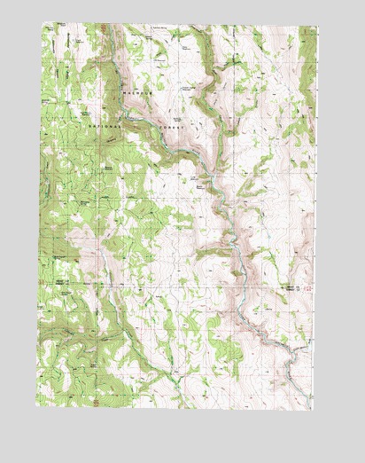
Buck Trough Spring, OR USGS Topographic Map
Click on map above to begin viewing in our Map Viewer.

This topographic map contains these locations and features:
Feature Name Type Latitude Longitude GNIS ID View Map
Anderson SpringSpringN44.0992°W118.3749°1137208View Map
Bathtub SpringSpringN44.0938°W118.3116°1137576View Map
Bear CreekStreamN44.0752°W118.2960°1137681View Map
Breaks ReservoirReservoirN44.0718°W118.3041°1138586View Map
Buck Trough SpringSpringN44.0483°W118.3681°1138833View Map
Chalk ReservoirReservoirN44.1191°W118.3608°1116637View Map
Dead Horse ReservoirReservoirN44.0954°W118.3524°1140696View Map
Flag CreekStreamN44.1221°W118.3019°1142212View Map
Forks ReservoirReservoirN44.1014°W118.3554°1142308View Map
Happy CanyonValleyN44.0896°W118.2922°1143277View Map
Little Malheur RiverStreamN44.0188°W118.2588°1145204View Map
Lost SpringSpringN44.0143°W118.3495°1145561View Map
Mahogany SpringSpringN44.0659°W118.3565°1145750View Map
Pine Tree SpringSpringN44.1227°W118.3693°1147734View Map
Powder Spring ReservoirReservoirN44.1041°W118.3117°1147960View Map
Red Trough SpringSpringN44.0370°W118.3650°1148341View Map
Sidehill SpringSpringN44.1202°W118.3251°1149467View Map
Sixtynine ReservoirReservoirN44.1130°W118.3243°1149575View Map
Skagway CreekStreamN44.0954°W118.3352°1149577View Map
Skagway ReservoirReservoirN44.0778°W118.3460°1149578View Map
Slate GulchValleyN44.1243°W118.3099°1149664View Map
Slate ReservoirReservoirN44.1172°W118.3118°1149665View Map
Smith CanyonValleyN44.0971°W118.2974°1149744View Map
Tamarack CreekStreamN44.0252°W118.3360°1150866View Map
Tin Wagon CanyonValleyN44.1102°W118.2977°1151264View Map
TJW ReservoirReservoirN44.0743°W118.3070°1150805View Map
Tureman SpringSpringN44.1236°W118.3258°1151526View Map

Note: Coordinates in the location and feature list above are referenced to NAD83 datum.


Copyright (C) 2008-2025 Ryan Niemi / Sunset Dynamics ... All Rights Reserved