TopoQuest Logo
Do you find TopoQuest useful?
Help keep TopoQuest running and adding new maps/features by donating!
Bitcoin:  19c7KJd3qBynnjoSw5npx9KScwjBe4ifkT
Litecoin:  LXs6TkuXGGXo1vDsWCkWVdjQX94eUKd6ui
Home View Maps Find Maps Find Places Resources & Links


Creighton, Nebraska Topographic Map

USGS Map Title: Creighton, NE
USGS Map MRC: 42097D8
DRG (GeoTIFF) Download: o42097d8.tif


Neighboring USGS Topographic Map Quads:


  Verdigre, NE  
42098E1
 

  Center West, NE  
42097E8
 

  Center East, NE  
42097E7
 

  Orchard NE, NE  
42098D1
 

  Creighton, NE  
42097D8
 

  Plainview NE, NE  
42097D7
 

  Royal, NE  
42098C1
 

  Brunswick, NE  
42097C8
 

  Plainview, NE  
42097C7


Map MRC Location:

N43°
W98°
N43°
W97°
H8 H7 H6 H5 H4 H3 H2 H1
G8 G7 G6 G5 G4 G3 G2 G1
F8 F7 F6 F5 F4 F3 F2 F1
E8 E7 E6 E5 E4 E3 E2 E1
D8 D7 D6 D5 D4 D3 D2 D1
C8 C7 C6 C5 C4 C3 C2 C1
B8 B7 B6 B5 B4 B3 B2 B1
A8 A7 A6 A5 A4 A3 A2 A1
N42°
W98°
N42°
W97°

Creighton, NE USGS 1:24K Topographic Map Preview:
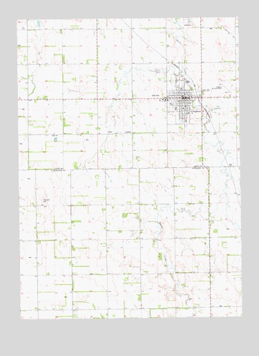
Creighton, NE USGS Topographic Map
Click on map above to begin viewing in our Map Viewer.

This topographic map contains these locations and features:
Feature Name Type Latitude Longitude GNIS ID View Map
Black Horse Inn CampgroundLocaleN42.4556°W97.9017°1884860View Map
Bruce ParkParkN42.4633°W97.9134°827700View Map
Bruce Park CampgroundLocaleN42.4639°W97.9137°1884872View Map
City of CreightonCivilN42.4649°W97.9071°837947View Map
Congregational Baptist ChurchChurchN42.4647°W97.9065°1884877View Map
Council HillSummitN42.4247°W97.9873°828405View Map
CreightonPopulated PlaceN42.4667°W97.9062°828452View Map
Creighton (historical)LocaleN42.4667°W97.8984°1884866View Map
Creighton Ambulance ServiceBuildingN42.4659°W97.9169°2553667View Map
Creighton Avera HospitalHospitalN42.4660°W97.9168°1884869View Map
Creighton Care CenterHospitalN42.4658°W97.9184°1884870View Map
Creighton Community Golf CourseLocaleN42.4653°W97.8970°1884859View Map
Creighton Family DentistryHospitalN42.4661°W97.9128°1884868View Map
Creighton Municipal AirportAirportN42.4685°W97.8816°837530View Map
Creighton Police DepartmentBuildingN42.4679°W97.9052°1884863View Map
Creighton Post OfficePost OfficeN42.4663°W97.9072°1884862View Map
Creighton Public LibraryBuildingN42.4664°W97.9081°1884865View Map
Creighton Public SchoolSchoolN42.4569°W97.9098°1884867View Map
Creighton Volunteer Fire DepartmentBuildingN42.4683°W97.9060°1884864View Map
Faith Hope and Love FellowshipChurchN42.4819°W97.9092°1884879View Map
Grace Bible ChurchChurchN42.4661°W97.9101°1884875View Map
Greenwood CemeteryCemeteryN42.4746°W97.9100°837766View Map
Greg Paesi Memorial FieldParkN42.4633°W97.9142°1884871View Map
Morrill Grain Company Incorporated ElevatorBuildingN42.4669°W97.8992°1884861View Map
Saint Ludger Elementary SchoolSchoolN42.4706°W97.9084°1884893View Map
Saint Ludgers Catholic ChurchChurchN42.4700°W97.9081°1884876View Map
Saint Marks Episcopal ChurchChurchN42.4653°W97.9059°1884873View Map
Township of BazileCivilN42.3939°W97.8928°837868View Map
Township of CreightonCivilN42.4816°W97.8962°837948View Map
United Church of ChristChurchN42.4667°W97.9062°1884881View Map
United Methodist ChurchChurchN42.4672°W97.9081°1884878View Map
Zion Lutheran ChurchChurchN42.4631°W97.9059°1884874View Map

Note: Coordinates in the location and feature list above are referenced to NAD83 datum.


Copyright (C) 2008-2025 Ryan Niemi / Sunset Dynamics ... All Rights Reserved