TopoQuest Logo
Do you find TopoQuest useful?
Help keep TopoQuest running and adding new maps/features by donating!
Bitcoin:  19c7KJd3qBynnjoSw5npx9KScwjBe4ifkT
Litecoin:  LXs6TkuXGGXo1vDsWCkWVdjQX94eUKd6ui
Home View Maps Find Maps Find Places Resources & Links


Verdigre, Nebraska Topographic Map

USGS Map Title: Verdigre, NE
USGS Map MRC: 42098E1
DRG (GeoTIFF) Download: o42098e1.tif


Neighboring USGS Topographic Map Quads:


  Pishelville, NE  
42098F2
 

  Verdigre NE, NE  
42098F1
 

  Sparta, NE  
42097F8
 

  Walnut, NE  
42098E2
 

  Verdigre, NE  
42098E1
 

  Center West, NE  
42097E8
 

  Orchard NW, NE  
42098D2
 

  Orchard NE, NE  
42098D1
 

  Creighton, NE  
42097D8


Map MRC Location:

N43°
W99°
N43°
W98°
H8 H7 H6 H5 H4 H3 H2 H1
G8 G7 G6 G5 G4 G3 G2 G1
F8 F7 F6 F5 F4 F3 F2 F1
E8 E7 E6 E5 E4 E3 E2 E1
D8 D7 D6 D5 D4 D3 D2 D1
C8 C7 C6 C5 C4 C3 C2 C1
B8 B7 B6 B5 B4 B3 B2 B1
A8 A7 A6 A5 A4 A3 A2 A1
N42°
W99°
N42°
W98°

Verdigre, NE USGS 1:24K Topographic Map Preview:
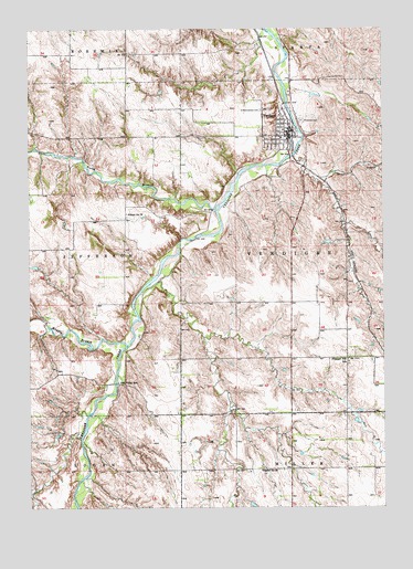
Verdigre, NE USGS Topographic Map
Click on map above to begin viewing in our Map Viewer.

This topographic map contains these locations and features:
Feature Name Type Latitude Longitude GNIS ID View Map
Alpine Village of VerdigreHospitalN42.5922°W98.0390°1884826View Map
Bethlehem Lutheran ChurchChurchN42.6014°W98.0362°1884822View Map
Historic Grist Mill (historical)LocaleN42.5986°W98.0340°1884810View Map
Middle Branch Verdigre CreekStreamN42.5428°W98.0912°831258View Map
North Branch Verdigre CreekStreamN42.5778°W98.0598°831671View Map
Oak Valley SchoolSchoolN42.5325°W98.0942°831816View Map
Pleasant Hill SchoolSchoolN42.5386°W98.0128°832198View Map
Riverside CemeteryCemeteryN42.6011°W98.0290°832581View Map
Saint Wenceslaus Catholic ChurchChurchN42.5967°W98.0362°1884820View Map
Saint Wenceslaus CemeteryCemeteryN42.6036°W98.0433°833116View Map
School Number 24SchoolN42.5097°W98.0440°836447View Map
School Number 39SchoolN42.5769°W98.0912°836678View Map
Township of VerdigreCivilN42.5680°W98.0133°838303View Map
United Methodist ChurchChurchN42.5969°W98.0345°1884821View Map
VerdigrePopulated PlaceN42.5969°W98.0337°834365View Map
Verdigre (historical)LocaleN42.5967°W98.0320°1884813View Map
Verdigre Heritage MuseumBuildingN42.5992°W98.0340°1884811View Map
Verdigre Police DepartmentBuildingN42.5969°W98.0337°1884819View Map
Verdigre Post OfficePost OfficeN42.5965°W98.0338°1884817View Map
Verdigre Public LibraryBuildingN42.5978°W98.0331°1884816View Map
Verdigre Public SchoolSchoolN42.5986°W98.0353°1884825View Map
Verdigre Volunteer Fire DepartmentBuildingN42.5982°W98.0343°1884818View Map
Verdigre Volunteer Rescue SquadBuildingN42.5983°W98.0342°2553662View Map
Veterans Memorial ParkParkN42.5994°W98.0340°1884812View Map
Village of VerdigreCivilN42.5973°W98.0356°2400055View Map
Wildwood Acres CampgroundLocaleN42.5939°W98.0281°1884814View Map
Wildwood Acres ParkParkN42.5939°W98.0281°1884815View Map

Note: Coordinates in the location and feature list above are referenced to NAD83 datum.


Copyright (C) 2008-2025 Ryan Niemi / Sunset Dynamics ... All Rights Reserved