TopoQuest Logo
Do you find TopoQuest useful?
Help keep TopoQuest running and adding new maps/features by donating!
Bitcoin:  19c7KJd3qBynnjoSw5npx9KScwjBe4ifkT
Litecoin:  LXs6TkuXGGXo1vDsWCkWVdjQX94eUKd6ui
Home View Maps Find Maps Find Places Resources & Links


Crosby, Mississippi Topographic Map

USGS Map Title: Crosby, MS
USGS Map MRC: 31091C1
DRG (GeoTIFF) Download: o31091c1.tif


Neighboring USGS Topographic Map Quads:


  Jeannette, MS  
31091D2
 

  Knoxville, MS  
31091D1
 

  Meadville, MS  
31090D8
 

  Garden City, MS  
31091C2
 

  Crosby, MS  
31091C1
 

  Homochitto, MS  
31090C8
 

  Wilkinson, MS  
31091B2
 

  Gloster, MS  
31091B1
 

  Bewelcome, MS  
31090B8


Map MRC Location:

N32°
W92°
N32°
W91°
H8 H7 H6 H5 H4 H3 H2 H1
G8 G7 G6 G5 G4 G3 G2 G1
F8 F7 F6 F5 F4 F3 F2 F1
E8 E7 E6 E5 E4 E3 E2 E1
D8 D7 D6 D5 D4 D3 D2 D1
C8 C7 C6 C5 C4 C3 C2 C1
B8 B7 B6 B5 B4 B3 B2 B1
A8 A7 A6 A5 A4 A3 A2 A1
N31°
W92°
N31°
W91°

Crosby, MS USGS 1:24K Topographic Map Preview:
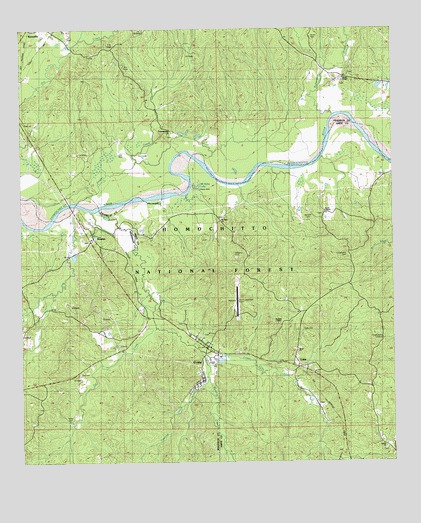
Crosby, MS USGS Topographic Map
Click on map above to begin viewing in our Map Viewer.

This topographic map contains these locations and features:
Feature Name Type Latitude Longitude GNIS ID View Map
Berryhill CemeteryCemeteryN31.3202°W91.0287°692543View Map
Bond ChurchChurchN31.2818°W91.0329°705528View Map
Bond ChurchChurchN31.2821°W91.0323°705324View Map
Brown CemeteryCemeteryN31.2596°W91.0065°705023View Map
Butler CemeteryCemeteryN31.3724°W91.0265°692783View Map
Campbellite CemeteryCemeteryN31.3099°W91.0148°692821View Map
ColesPopulated PlaceN31.2774°W91.0318°692944View Map
CrosbyPopulated PlaceN31.2838°W91.0632°693015View Map
Crosby Attendance CenterSchoolN31.2863°W91.0670°707317View Map
Crosby CemeteryCemeteryN31.2782°W91.0598°705211View Map
Crosby CemeteryCemeteryN31.2868°W91.0637°705032View Map
Crosby Methodist ChurchChurchN31.2860°W91.0637°705033View Map
Crosby Municipal AirportAirportN31.2940°W91.0534°695265View Map
Crosby Police DepartmentBuildingN31.2803°W91.0624°2754151View Map
Crosby Post OfficePost OfficeN31.2833°W91.0631°2768755View Map
Cypress CreekStreamN31.2743°W91.0626°693039View Map
Day CemeteryCemeteryN31.2757°W91.1059°705527View Map
Douglas ChapelChurchN31.2902°W91.0382°693106View Map
Dry CreekStreamN31.3216°W91.1082°693119View Map
Foster CreekStreamN31.3210°W91.0954°693252View Map
FreewoodsPopulated PlaceN31.3457°W91.0748°693267View Map
Freewoods CemeteryCemeteryN31.3432°W91.0759°707574View Map
Freewoods Oil FieldLocaleN31.3388°W91.0851°693268View Map
Hammack CemeteryCemeteryN31.3627°W91.0145°707577View Map
Harvard Ferry (historical)CrossingN31.3229°W91.1070°707616View Map
Huff CemeteryCemeteryN31.3154°W91.0607°685298View Map
Lusk CemeteryCemeteryN31.2877°W91.0301°693846View Map
McDowell CemeteryCemeteryN31.2924°W91.0637°705062View Map
McDowell CemeteryCemeteryN31.2785°W91.0404°705063View Map
Mount Nebo CemeteryCemeteryN31.3204°W91.0576°705069View Map
Mount Nebo ChurchChurchN31.3199°W91.0582°694070View Map
Mount Nebo LakeLakeN31.3296°W91.0654°694075View Map
Mount Nebo Recreation AreaParkN31.3288°W91.0651°711536View Map
Nebo Lake Oil FieldOilfieldN31.3349°W91.0654°705548View Map
North Freewoods Oil FieldOilfieldN31.3652°W91.0923°694209View Map
Northeast Freewoods Oil FieldOilfieldN31.3682°W91.0659°705550View Map
Oak Ridge ChurchChurchN31.2713°W91.0068°694239View Map
Parker CemeteryCemeteryN31.2632°W91.1087°694312View Map
Redding CreekStreamN31.2821°W91.0648°694536View Map
Richardson CreekStreamN31.3479°W91.0195°694555View Map
RosettaPopulated PlaceN31.3166°W91.1009°694615View Map
Royal ChapelChurchN31.3229°W91.0226°694622View Map
Royal Chapel CemeteryCemeteryN31.3210°W91.0234°705085View Map
Spring Hill ChurchChurchN31.3746°W91.1196°705666View Map
Spring Hill Oil FieldOilfieldN31.3571°W91.1140°705556View Map
StephensonPopulated PlaceN31.2785°W91.0557°705090View Map
Stephenson Lookout TowerTowerN31.2857°W91.0037°705327View Map
Tar CreekStreamN31.2891°W91.0801°694942View Map
Town of CrosbyCivilN31.2791°W91.0630°2406337View Map
Union CemeteryCemeteryN31.2541°W91.0032°705100View Map
Union ChurchChurchN31.2543°W91.0029°695043View Map
Union School (historical)SchoolN31.2555°W91.0048°705099View Map
Wesley ChapelChurchN31.3607°W91.0159°695121View Map
Wesley Chapel CemeteryCemeteryN31.3591°W91.0165°707610View Map
Wilk - Amite Fire DepartmentBuildingN31.2833°W91.0630°2667870View Map
Williams CemeteryCemeteryN31.3104°W91.0529°695184View Map
Wilsons Ferry (historical)CrossingN31.3391°W91.0645°705106View Map
Zeigler CreekStreamN31.3277°W91.1023°695233View Map
Ziegler Creek Oil FieldOilfieldN31.3585°W91.0668°705558View Map

Note: Coordinates in the location and feature list above are referenced to NAD83 datum.


Copyright (C) 2008-2024 Ryan Niemi / Sunset Dynamics ... All Rights Reserved