TopoQuest Logo
Do you find TopoQuest useful?
Help keep TopoQuest running and adding new maps/features by donating!
Bitcoin:  19c7KJd3qBynnjoSw5npx9KScwjBe4ifkT
Litecoin:  LXs6TkuXGGXo1vDsWCkWVdjQX94eUKd6ui
Home View Maps Find Maps Find Places Resources & Links


Meadville, Mississippi Topographic Map

USGS Map Title: Meadville, MS
USGS Map MRC: 31090D8
DRG (GeoTIFF) Download: o31090d8.tif


Neighboring USGS Topographic Map Quads:


  Roxie, MS  
31091E1
 

  Kirby, MS  
31090E8
 

  Eddiceton, MS  
31090E7
 

  Knoxville, MS  
31091D1
 

  Meadville, MS  
31090D8
 

  Bude, MS  
31090D7
 

  Crosby, MS  
31091C1
 

  Homochitto, MS  
31090C8
 

  Busy Corner, MS  
31090C7


Map MRC Location:

N32°
W91°
N32°
W90°
H8 H7 H6 H5 H4 H3 H2 H1
G8 G7 G6 G5 G4 G3 G2 G1
F8 F7 F6 F5 F4 F3 F2 F1
E8 E7 E6 E5 E4 E3 E2 E1
D8 D7 D6 D5 D4 D3 D2 D1
C8 C7 C6 C5 C4 C3 C2 C1
B8 B7 B6 B5 B4 B3 B2 B1
A8 A7 A6 A5 A4 A3 A2 A1
N31°
W91°
N31°
W90°

Meadville, MS USGS 1:24K Topographic Map Preview:
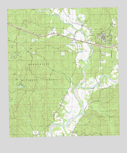
Meadville, MS USGS Topographic Map
Click on map above to begin viewing in our Map Viewer.

This topographic map contains these locations and features:
Feature Name Type Latitude Longitude GNIS ID View Map
Bean BranchStreamN31.3877°W90.9512°692487View Map
Bleecker CemeteryCemeteryN31.4466°W90.9265°692637View Map
Brown CemeteryCemeteryN31.4888°W90.9159°692725View Map
Bunkley Oil FieldOilfieldN31.3941°W90.9934°705536View Map
Butler (historical)LocaleN31.4802°W90.9070°707561View Map
Cameron CemeteryCemeteryN31.4777°W90.9490°692806View Map
Campbell CemeteryCemeteryN31.4679°W90.9287°692818View Map
Clear Springs DamDamN31.4252°W90.9901°695383View Map
Clear Springs LakeReservoirN31.4246°W90.9884°692934View Map
Clear Springs Recreation AreaParkN31.4252°W90.9862°711537View Map
Frankin County CourthouseBuildingN31.4718°W90.8934°707570View Map
Frankin Elementary SchoolSchoolN31.4696°W90.8904°707572View Map
Franklin CountyCivilN31.4771°W90.8979°695743View Map
Franklin County Memorial HospitalHospitalN31.4733°W90.8844°707571View Map
Franklin County Sheriff's OfficeBuildingN31.4720°W90.8933°2754076View Map
Franklin High SchoolSchoolN31.4691°W90.8912°707573View Map
Franklin Lookout TowerTowerN31.4802°W90.9876°711538View Map
Franklin Lookout TowerTowerN31.4802°W90.9884°711341View Map
Galverth Lake DamDamN31.4602°W90.9134°695391View Map
Grass Patch BranchStreamN31.3854°W90.9537°693340View Map
Grisham BranchStreamN31.3907°W90.9290°693376View Map
Hegan CemeteryCemeteryN31.4804°W90.9509°693445View Map
Homochitto National ForestForestN31.4429°W90.9414°711539View Map
King BranchStreamN31.4041°W90.9345°693656View Map
Kirby Oil FieldOilfieldN31.4854°W90.9765°705544View Map
MeadvillePopulated PlaceN31.4724°W90.8968°693939View Map
Meadville CemeteryCemeteryN31.4732°W90.8987°707584View Map
Meadville Police DepartmentBuildingN31.4727°W90.8924°2754069View Map
Meadville Post OfficePost OfficeN31.4714°W90.8935°2768586View Map
Meadville Volunteer Fire Department District 5BuildingN31.4729°W90.8924°2667800View Map
Middle Fork Homochitto RiverStreamN31.4238°W90.9209°693951View Map
Middleton CreekStreamN31.4021°W90.9170°693953View Map
Midway CemeteryCemeteryN31.4704°W90.8795°693956View Map
Mills BranchStreamN31.4457°W90.9893°694007View Map
Moore CemeteryCemeteryN31.4735°W90.9057°694030View Map
Morgan ForkStreamN31.4774°W90.9201°694035View Map
Mount Pleasant ChurchChurchN31.3879°W90.9618°694094View Map
Mount Zinia ChurchChurchN31.3968°W90.9495°705492View Map
Mount Zinia ChurchChurchN31.3810°W90.9715°694107View Map
Mulkey CemeteryCemeteryN31.4535°W90.9920°694131View Map
New Fork ChurchChurchN31.4660°W90.9012°694161View Map
Oak Grove CemeteryCemeteryN31.3779°W90.9259°694225View Map
Owen CreekStreamN31.4785°W90.9240°694286View Map
Pine Ridge ChurchChurchN31.4093°W90.9034°694388View Map
Providence Baptist ChurchChurchN31.4616°W90.9757°694480View Map
Providence CemeteryCemeteryN31.4618°W90.9759°707602View Map
Providence Oil FieldOilfieldN31.4632°W90.9945°705553View Map
Quarterlot BranchStreamN31.4199°W90.9279°694496View Map
Smyrna CemeteryCemeteryN31.4429°W90.9762°694830View Map
South Providence Oil FieldOilfieldN31.4543°W90.9904°705585View Map
SuffolkPopulated PlaceN31.4613°W90.9662°705205View Map
Sullivan CemeteryCemeteryN31.4827°W90.8832°694904View Map
Supervisor District 3CivilN31.4181°W90.9514°711850View Map
Tallys CreekStreamN31.4232°W90.9257°694934View Map
Tallys Creek Oil FieldOilfieldN31.4460°W90.9612°705557View Map
Town of MeadvilleCivilN31.4721°W90.8929°2406139View Map
Townsel CemeteryCemeteryN31.4877°W90.9140°695000View Map
Whitington Roadside ParkParkN31.4741°W90.9448°695164View Map

Note: Coordinates in the location and feature list above are referenced to NAD83 datum.


Copyright (C) 2008-2024 Ryan Niemi / Sunset Dynamics ... All Rights Reserved