TopoQuest Logo
Do you find TopoQuest useful?
Help keep TopoQuest running and adding new maps/features by donating!
Bitcoin:  19c7KJd3qBynnjoSw5npx9KScwjBe4ifkT
Litecoin:  LXs6TkuXGGXo1vDsWCkWVdjQX94eUKd6ui
Home View Maps Find Maps Find Places Resources & Links


Crystal Lake, California Topographic Map

USGS Map Title: Crystal Lake, CA
USGS Map MRC: 34117C7
DRG (GeoTIFF) Download: o34117c7.tif


Neighboring USGS Topographic Map Quads:


  Juniper Hills, CA  
34117D8
 

  Valyermo, CA  
34117D7
 

  Mescal Creek, CA  
34117D6
 

  Waterman Mountain, CA  
34117C8
 

  Crystal Lake, CA  
34117C7
 

  Mount San Antonio, CA  
34117C6
 

  Azusa, CA  
34117B8
 

  Glendora, CA  
34117B7
 

  Mount Baldy, CA  
34117B6


Map MRC Location:

N35°
W118°
N35°
W117°
H8 H7 H6 H5 H4 H3 H2 H1
G8 G7 G6 G5 G4 G3 G2 G1
F8 F7 F6 F5 F4 F3 F2 F1
E8 E7 E6 E5 E4 E3 E2 E1
D8 D7 D6 D5 D4 D3 D2 D1
C8 C7 C6 C5 C4 C3 C2 C1
B8 B7 B6 B5 B4 B3 B2 B1
A8 A7 A6 A5 A4 A3 A2 A1
N34°
W118°
N34°
W117°

Crystal Lake, CA USGS 1:24K Topographic Map Preview:
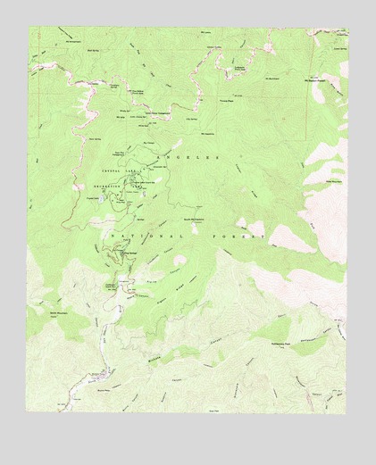
Crystal Lake, CA USGS Topographic Map
Click on map above to begin viewing in our Map Viewer.

This topographic map contains these locations and features:
Feature Name Type Latitude Longitude GNIS ID View Map
Alexander SpringSpringN34.3299°W117.8269°238503View Map
Alpine CanyonValleyN34.2925°W117.8345°238552View Map
Bear Creek TrailTrailN34.2872°W117.8615°239095View Map
Bichota CanyonValleyN34.2631°W117.8420°255352View Map
Bichota MesaSummitN34.2631°W117.8456°1656438View Map
Big CienegaSpringN34.3372°W117.8306°239281View Map
BSA MonumentPillarN34.3625°W117.7609°276776View Map
Burro PeakSummitN34.2564°W117.8453°239881View Map
Cedar CreekStreamN34.3114°W117.8337°240385View Map
Chamisal MesaSummitN34.2719°W117.8392°276786View Map
Cloudburst CanyonValleyN34.2906°W117.8384°240709View Map
Coldbrook CampgroundLocaleN34.2917°W117.8390°276783View Map
Coldbrook CreekStreamN34.2908°W117.8403°240763View Map
Coldbrook Guard StationLocaleN34.2906°W117.8409°1655158View Map
Copter RidgeRidgeN34.3261°W117.7917°240914View Map
Cortelyou SpringSpringN34.3561°W117.8437°240949View Map
Crystal LakeLakeN34.3188°W117.8471°241140View Map
Crystal Lake Guard StationLocaleN34.3242°W117.8348°241141View Map
Crystal Lake Recreation AreaParkN34.3256°W117.8381°1655161View Map
Dawson SaddleGapN34.3678°W117.8034°241294View Map
Dawson Saddle TrailTrailN34.3686°W117.8028°1802854View Map
Deer Flat CampgroundLocaleN34.3328°W117.8390°1655162View Map
Devil GulchValleyN34.2797°W117.7537°254016View Map
Falling Springs (historical)Populated PlaceN34.3017°W117.8392°1656511View Map
Golden Cup Oaks PlantationLocaleN34.3064°W117.8420°1802881View Map
Islip SaddleGapN34.3569°W117.8506°243931View Map
Islip TrailheadLocaleN34.3569°W117.8515°276775View Map
Jarva Memorial VistaLocaleN34.3558°W117.8601°1802856View Map
Johnson CornerPopulated PlaceN34.3072°W117.7526°1802857View Map
La Cienega SpringSpringN34.3019°W117.8403°244392View Map
Lamel SpringSpringN34.3679°W117.7572°244556View Map
Lily SpringSpringN34.3453°W117.8095°244798View Map
Little Jimmy CampgroundLocaleN34.3475°W117.8301°1655168View Map
Little Jimmy SpringSpringN34.3453°W117.8292°244919View Map
Lodgepole Picnic AreaAreaN34.3614°W117.7906°245001View Map
Lost CanyonValleyN34.2722°W117.8456°245204View Map
Maple CanyonValleyN34.2800°W117.8403°245470View Map
Mount Baden-PowellSummitN34.3586°W117.7645°255344View Map
Mount BurnhamSummitN34.3592°W117.7814°255383View Map
Mount HawkinsSummitN34.3414°W117.8051°243287View Map
Mount IslipSummitN34.3450°W117.8398°243932View Map
Mount LewisSummitN34.3719°W117.8059°244771View Map
Mount WilliamsonSummitN34.3711°W117.8578°251607View Map
Pigeon RidgeRidgeN34.2881°W117.8173°247462View Map
Pigeon Target Shooting AreaLocaleN34.2731°W117.8256°276781View Map
Pine FlatsFlatN34.3225°W117.8373°254148View Map
Pine Hollow Picnic AreaParkN34.3536°W117.8351°247504View Map
Pinyon TrailTrailN34.3208°W117.8303°247555View Map
Rattlesnake CanyonValleyN34.2775°W117.7539°247988View Map
Rattlesnake PeakSummitN34.2719°W117.7770°1802858View Map
Reed SpringSpringN34.3669°W117.8476°248109View Map
Rockbound CanyonValleyN34.2978°W117.8356°248290View Map
Ross MountainSummitN34.3250°W117.7567°248407View Map
Shoemaker CanyonValleyN34.2556°W117.7601°254240View Map
Smith MountainSummitN34.2811°W117.8634°249591View Map
Snow SpringSpringN34.3382°W117.8519°249626View Map
Snowslide CanyonValleyN34.3258°W117.8365°249629View Map
Soldier CreekStreamN34.2908°W117.8403°1655016View Map
South Fork Iron ForkStreamN34.3031°W117.7617°249708View Map
South Mount HawkinsSummitN34.3114°W117.8103°243288View Map
South Mount Hawkins LookoutLocaleN34.3117°W117.8101°276777View Map
Tecolate PlantationLocaleN34.2544°W117.8612°276785View Map
Throop PeakSummitN34.3506°W117.7995°252256View Map
Valley of the Moon PlantationLocaleN34.2867°W117.8434°276782View Map
Vincent GapGapN34.3736°W117.7523°251060View Map
Wawona Lodge (historical)LocaleN34.3167°W117.8476°1669939View Map
West Pine FlatFlatN34.3194°W117.8387°251367View Map
White Fir SpringSpringN34.3453°W117.8198°276774View Map
Windy GapGapN34.3433°W117.8287°251719View Map
Windy SpringSpringN34.3483°W117.8356°251723View Map
Yerba Santa AmphitheaterBasinN34.3239°W117.8356°276778View Map

Note: Coordinates in the location and feature list above are referenced to NAD83 datum.


Copyright (C) 2008-2024 Ryan Niemi / Sunset Dynamics ... All Rights Reserved