TopoQuest Logo
Do you find TopoQuest useful?
Help keep TopoQuest running and adding new maps/features by donating!
Bitcoin:  19c7KJd3qBynnjoSw5npx9KScwjBe4ifkT
Litecoin:  LXs6TkuXGGXo1vDsWCkWVdjQX94eUKd6ui
Home View Maps Find Maps Find Places Resources & Links


Crystal River, Florida Topographic Map

USGS Map Title: Crystal River, FL
USGS Map MRC: 28082H5
DRG (GeoTIFF) Download: o28082h5.tif


Neighboring USGS Topographic Map Quads:


  Yankeetown, FL  
29082A6
 

  Yankeetown SE, FL  
29082A5
 

  Dunnellon, FL  
29082A4
 

  Red Level, FL  
28082H6
 

  Crystal River, FL  
28082H5
 

  Holder, FL  
28082H4
 

  Ozello, FL  
28082G6
 

  Homosassa, FL  
28082G5
 

  Lecanto, FL  
28082G4


Map MRC Location:

N29°
W83°
N29°
W82°
H8 H7 H6 H5 H4 H3 H2 H1
G8 G7 G6 G5 G4 G3 G2 G1
F8 F7 F6 F5 F4 F3 F2 F1
E8 E7 E6 E5 E4 E3 E2 E1
D8 D7 D6 D5 D4 D3 D2 D1
C8 C7 C6 C5 C4 C3 C2 C1
B8 B7 B6 B5 B4 B3 B2 B1
A8 A7 A6 A5 A4 A3 A2 A1
N28°
W83°
N28°
W82°

Crystal River, FL USGS 1:24K Topographic Map Preview:
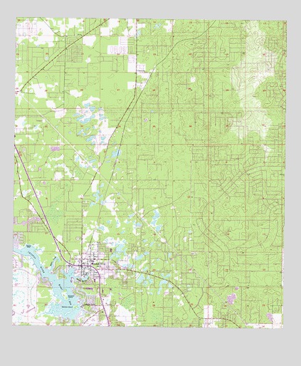
Crystal River, FL USGS Topographic Map
Click on map above to begin viewing in our Map Viewer.

This topographic map contains these locations and features:
Feature Name Type Latitude Longitude GNIS ID View Map
Advent Hope ChurchChurchN28.8978°W82.5892°2129775View Map
Bagley CoveBayN28.9074°W82.6176°278030View Map
Bailey Temple Church of God in ChristChurchN28.8961°W82.5836°2129779View Map
Banana IslandIslandN28.8830°W82.5957°278075View Map
Bethel American Methodist Episcopal ChurchChurchN28.9308°W82.5886°2129943View Map
Bible Baptist ChurchChurchN28.8914°W82.5297°2129755View Map
Buzzard IslandIslandN28.8872°W82.6001°279763View Map
Calvary Baptist Church of Crystal RiverChurchN28.9036°W82.5892°2129760View Map
Church of ChristChurchN28.8981°W82.5886°2129776View Map
CitronellePopulated PlaceN28.9786°W82.5687°294715View Map
Citronelle Baptist ChurchChurchN28.9786°W82.5661°2129938View Map
Citronelle CemeteryCemeteryN28.9788°W82.5659°2129939View Map
Citronelle ParkParkN28.9775°W82.5664°2129941View Map
Citrus County Health DepartmentBuildingN28.9003°W82.5947°2129762View Map
Citrus County LIbrary - Coastal RegionBuildingN28.9028°W82.5775°2129758View Map
Citrus County Sheriff's Office - Crystal River SubstationBuildingN28.9003°W82.5949°2333109View Map
City of Crystal RiverCivilN28.8968°W82.5994°2404164View Map
Crystal CenterLocaleN28.8886°W82.5854°296000View Map
Crystal RiverPopulated PlaceN28.9025°W82.5926°281135View Map
Crystal River CemeteryCemeteryN28.8978°W82.5881°2129777View Map
Crystal River Christian AcademySchoolN28.8989°W82.5884°299784View Map
Crystal River City HallBuildingN28.9000°W82.5950°2129763View Map
Crystal River Fire Department Station 2BuildingN28.8937°W82.5844°2644673View Map
Crystal River Four Square Gospel ChurchChurchN28.8792°W82.5517°2129935View Map
Crystal River Health and Rehabilitation CenterHospitalN28.8958°W82.5725°2129936View Map
Crystal River High SchoolSchoolN28.9062°W82.5796°297271View Map
Crystal River MallLocaleN28.9103°W82.6047°2129765View Map
Crystal River Middle SchoolSchoolN28.9025°W82.5880°297270View Map
Crystal River Post OfficePost OfficeN28.8949°W82.5879°2767987View Map
Crystal River Primary SchoolSchoolN28.9003°W82.5778°297269View Map
Crystal River TowerTowerN28.9636°W82.5757°301086View Map
Crystal River United Methodist ChurchChurchN28.9319°W82.5886°2129942View Map
Crystal River Volunteer Fire DepartmentBuildingN28.9009°W82.5968°2644212View Map
Crystal River Water Tower-House # 1TowerN28.8992°W82.5911°2129778View Map
Crystal SpringSpringN28.8905°W82.5923°281136View Map
First Assembly of God ChurchChurchN28.8797°W82.5297°2129757View Map
First Baptist Church of Crystal RiverChurchN28.9017°W82.5933°2129759View Map
First Presbyterian Church in Crystal RiverChurchN28.8839°W82.5825°2129780View Map
Gulf to Lake ChurchChurchN28.8839°W82.5439°2129756View Map
Hunter Spring RunBayN28.8944°W82.5916°284406View Map
Kings BayLakeN28.8809°W82.5947°285117View Map
Kings Bay PlazaLocaleN28.8930°W82.5845°296001View Map
Little Springs ParkParkN28.9003°W82.5956°2129764View Map
Magnolia CreekStreamN28.8989°W82.6018°1802686View Map
Marine Science StationSchoolN28.9080°W82.6198°297268View Map
Miller CreekGutN28.9011°W82.6059°286916View Map
New Life Christian FellowshipChurchN28.9197°W82.5936°2129945View Map
Paradise PointPopulated PlaceN28.8836°W82.5920°288486View Map
Red Level Baptist ChurchChurchN28.9750°W82.6194°2098202View Map
Red Level Christian AcademySchoolN28.9114°W82.5923°299785View Map
Seven Rivers Regional Medical CenterHospitalN28.9517°W82.6247°2129937View Map
Seven Rivers Regional Medical CenterHospitalN28.9519°W82.6246°298096View Map
West Citrus Church of ChristChurchN28.9250°W82.5950°2129944View Map
West Coast Christian CenterChurchN28.9017°W82.5947°2129761View Map
WXCV-FM (Homosassa Springs)TowerN28.8875°W82.5273°309011View Map

Note: Coordinates in the location and feature list above are referenced to NAD83 datum.


Copyright (C) 2008-2025 Ryan Niemi / Sunset Dynamics ... All Rights Reserved