TopoQuest Logo
Do you find TopoQuest useful?
Help keep TopoQuest running and adding new maps/features by donating!
Bitcoin:  19c7KJd3qBynnjoSw5npx9KScwjBe4ifkT
Litecoin:  LXs6TkuXGGXo1vDsWCkWVdjQX94eUKd6ui
Home View Maps Find Maps Find Places Resources & Links


Homosassa, Florida Topographic Map

USGS Map Title: Homosassa, FL
USGS Map MRC: 28082G5
DRG (GeoTIFF) Download: o28082g5.tif


Neighboring USGS Topographic Map Quads:


  Red Level, FL  
28082H6
 

  Crystal River, FL  
28082H5
 

  Holder, FL  
28082H4
 

  Ozello, FL  
28082G6
 

  Homosassa, FL  
28082G5
 

  Lecanto, FL  
28082G4
 

  Chassahowitzka Bay, FL  
28082F6
 

  Chassahowitzka, FL  
28082F5
 

  Brooksville NW, FL  
28082F4


Map MRC Location:

N29°
W83°
N29°
W82°
H8 H7 H6 H5 H4 H3 H2 H1
G8 G7 G6 G5 G4 G3 G2 G1
F8 F7 F6 F5 F4 F3 F2 F1
E8 E7 E6 E5 E4 E3 E2 E1
D8 D7 D6 D5 D4 D3 D2 D1
C8 C7 C6 C5 C4 C3 C2 C1
B8 B7 B6 B5 B4 B3 B2 B1
A8 A7 A6 A5 A4 A3 A2 A1
N28°
W83°
N28°
W82°

Homosassa, FL USGS 1:24K Topographic Map Preview:
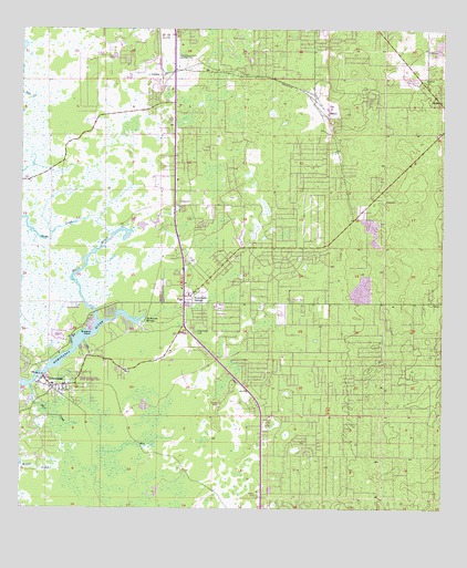
Homosassa, FL USGS Topographic Map
Click on map above to begin viewing in our Map Viewer.

This topographic map contains these locations and features:
Feature Name Type Latitude Longitude GNIS ID View Map
Buzzard PointCapeN28.7958°W82.6032°279768View Map
Christian Center ChurchChurchN28.7897°W82.5664°2374863View Map
Citrus Christian AcademySchoolN28.8150°W82.5759°299783View Map
Citrus CountyCivilN28.8476°W82.5201°295752View Map
Citrus County Fire Rescue Station 10BuildingN28.7816°W82.6155°2644104View Map
Citrus County Fire Rescue Station 17BuildingN28.8717°W82.6013°2644013View Map
Citrus County Fire Rescue Station 3BuildingN28.8061°W82.5733°2644327View Map
Citrus County Fire Rescue Station 7BuildingN28.8743°W82.5388°2644288View Map
Crystal River Airport TerminalBuildingN28.8711°W82.5778°2374856View Map
Crystal River Airport-Captain Tom Davis FieldAirportN28.8686°W82.5735°304700View Map
CutlersPopulated PlaceN28.8628°W82.5829°295232View Map
First United Methodist ChurchChurchN28.7917°W82.5803°2374857View Map
Florida National Guard 690th MP Company ArmoryMilitaryN28.8653°W82.5775°2374855View Map
Grace Bible ChurchChurchN28.7908°W82.5400°2374864View Map
Halls RiverStreamN28.7989°W82.6018°283634View Map
HomosassaPopulated PlaceN28.7814°W82.6151°284219View Map
Homosassa Census Designated PlaceCensusN28.7849°W82.6079°2402598View Map
Homosassa Church of GodChurchN28.7925°W82.5719°2374861View Map
Homosassa Elementary SchoolSchoolN28.7822°W82.6153°2374859View Map
Homosassa Elementary SchoolSchoolN28.7825°W82.6150°297275View Map
Homosassa Post OfficePost OfficeN28.7820°W82.6128°2767995View Map
Homosassa SpringsPopulated PlaceN28.8036°W82.5759°284223View Map
Homosassa SpringsSpringN28.7994°W82.5876°284224View Map
Homosassa Springs Census Designated PlaceCensusN28.8118°W82.5392°2402599View Map
Homosassa Springs Post OfficePost OfficeN28.7945°W82.5743°2767996View Map
Homosassa Springs Shopping CenterLocaleN28.8044°W82.5770°296011View Map
Homosassa Springs Wildlife State ParkParkN28.8003°W82.5873°1946104View Map
Homosassa SquareLocaleN28.7966°W82.5757°296010View Map
Homosassa Water TowerTowerN28.7900°W82.6053°2374858View Map
Otter CreekStreamN28.7819°W82.6215°288278View Map
Post Oak Ranch AirportAirportN28.8553°W82.5522°309355View Map
Rock Crusher Elementary SchoolSchoolN28.8487°W82.5367°2374853View Map
Rock Crusher Road First Church of GodChurchN28.8683°W82.5381°2374854View Map
Saint Michael the Archangel Greek Orthodox ChurchChurchN28.8692°W82.5100°2374851View Map
Saint Scholastica Roman Catholic ChurchChurchN28.8450°W82.5058°2374852View Map
Seven Rivers Christian SchoolSchoolN28.8589°W82.5033°2374850View Map
Seven Rivers Presbyterian ChurchChurchN28.8611°W82.5025°2374849View Map
Solid Rock Christian SchoolSchoolN28.7911°W82.5801°299782View Map
Stage Stand CemeteryCemeteryN28.7961°W82.5723°291605View Map
Sugar Mill Historic MemorialParkN28.7855°W82.6073°303671View Map
Suncoast Baptist ChurchChurchN28.7850°W82.5631°2374862View Map
The Church of Jesus ChristChurchN28.7822°W82.6161°2374860View Map
The Fountains Memorial ParkCemeteryN28.7913°W82.5283°298062View Map
Yulee Sugar Mill Ruins Historic State ParkParkN28.7844°W82.6065°1947526View Map

Note: Coordinates in the location and feature list above are referenced to NAD83 datum.


Copyright (C) 2008-2024 Ryan Niemi / Sunset Dynamics ... All Rights Reserved