TopoQuest Logo
Do you find TopoQuest useful?
Help keep TopoQuest running and adding new maps/features by donating!
Bitcoin:  19c7KJd3qBynnjoSw5npx9KScwjBe4ifkT
Litecoin:  LXs6TkuXGGXo1vDsWCkWVdjQX94eUKd6ui
Home View Maps Find Maps Find Places Resources & Links


Ozello, Florida Topographic Map

USGS Map Title: Ozello, FL
USGS Map MRC: 28082G6
DRG (GeoTIFF) Download: o28082g6.tif


Neighboring USGS Topographic Map Quads:


  Red Level, FL  
28082H6
 

  Crystal River, FL  
28082H5


  Ozello, FL  
28082G6
 

  Homosassa, FL  
28082G5


  Chassahowitzka Bay, FL  
28082F6
 

  Chassahowitzka, FL  
28082F5


Map MRC Location:

N29°
W83°
N29°
W82°
H8 H7 H6 H5 H4 H3 H2 H1
G8 G7 G6 G5 G4 G3 G2 G1
F8 F7 F6 F5 F4 F3 F2 F1
E8 E7 E6 E5 E4 E3 E2 E1
D8 D7 D6 D5 D4 D3 D2 D1
C8 C7 C6 C5 C4 C3 C2 C1
B8 B7 B6 B5 B4 B3 B2 B1
A8 A7 A6 A5 A4 A3 A2 A1
N28°
W83°
N28°
W82°

Ozello, FL USGS 1:24K Topographic Map Preview:
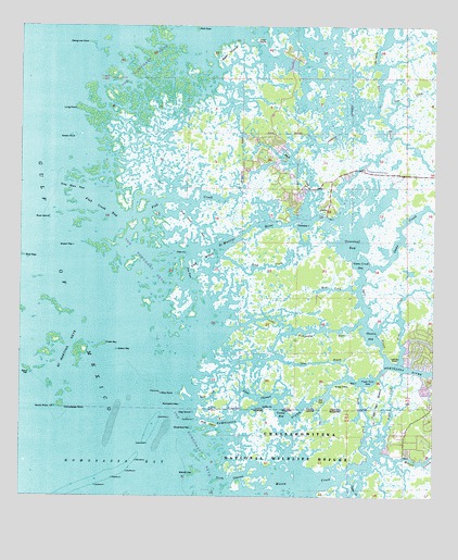
Ozello, FL USGS Topographic Map
Click on map above to begin viewing in our Map Viewer.

This topographic map contains these locations and features:
Feature Name Type Latitude Longitude GNIS ID View Map
Battle CreekBayN28.7690°W82.6380°278175View Map
Bear IslandIslandN28.8678°W82.6870°278327View Map
Beli IslandIslandN28.7808°W82.6476°278409View Map
Bird KeysIslandN28.8139°W82.7490°278822View Map
Black CreekBayN28.8392°W82.6679°278885View Map
Charr IslandIslandN28.8714°W82.6776°280332View Map
Citrus County Fire Rescue Station 11BuildingN28.8325°W82.6713°2644290View Map
Coffin PointCapeN28.7744°W82.6762°280631View Map
Crawl KeyIslandN28.7905°W82.7248°281021View Map
Crystal River DivisionCivilN28.8632°W82.6263°1935736View Map
Crystal River National Wildlife RefugeParkN28.7749°W82.6294°2765589View Map
Deep CreekBayN28.7757°W82.6931°281413View Map
Dog IslandIslandN28.7728°W82.6970°281651View Map
Dog IslandIslandN28.8122°W82.6940°281652View Map
False ChannelBayN28.7774°W82.6754°282373View Map
Fish CreekGutN28.8286°W82.6990°282475View Map
Fish Creek BayBayN28.8269°W82.7232°282480View Map
Fish Creek PassBayN28.8251°W82.7025°282481View Map
Game CreekStreamN28.8119°W82.6440°282894View Map
Game Creek BayBayN28.8122°W82.6468°282895View Map
Green KeyIslandN28.7891°W82.7204°283386View Map
Green PointCapeN28.8461°W82.7334°283394View Map
Greenleaf BayBayN28.8178°W82.6500°283419View Map
Greenleaf KeyIslandN28.7686°W82.6976°283420View Map
Grey Mare PassChannelN28.8325°W82.7354°283440View Map
Gustaf BayBayN28.7724°W82.6705°283570View Map
Head CreekBayN28.8116°W82.6725°283848View Map
Hell GateBayN28.7771°W82.6569°283874View Map
Homosassa PointCapeN28.7739°W82.7365°284221View Map
Homosassa RiverStreamN28.7705°W82.6970°284222View Map
Lashley PointCapeN28.7861°W82.6357°285356View Map
Little Homosassa RiverBayN28.7959°W82.6682°285711View Map
Long PointCapeN28.8528°W82.7329°286037View Map
Mangrove PointCapeN28.8705°W82.7293°286381View Map
Mason CreekStreamN28.7511°W82.6818°286503View Map
Mendit KeyIslandN28.7569°W82.6962°286714View Map
Mud CreekStreamN28.8050°W82.6484°287386View Map
North ChannelChannelN28.7550°W82.6857°287797View Map
OzelloPopulated PlaceN28.8258°W82.6570°294878View Map
Paradise IslandIslandN28.8230°W82.6659°288475View Map
Pea PassBayN28.8098°W82.6991°288601View Map
Petty CreekBayN28.7710°W82.6479°288753View Map
Pipe IslandIslandN28.8150°W82.6998°288984View Map
Pompano KeyIslandN28.7747°W82.7012°289168View Map
Port Richey Shopping VillageLocaleN28.7725°W82.7245°296523View Map
Price CreekStreamN28.7861°W82.6345°289310View Map
Roach KeyIslandN28.8166°W82.7337°289765View Map
Rock IslandIslandN28.8241°W82.7409°289827View Map
Saint Martins KeysIslandN28.7916°W82.7382°290298View Map
Saint Martins Marsh Aquatic PreserveParkN28.8336°W82.7082°304098View Map
Saint Martins RiverBayN28.8183°W82.6863°290299View Map
Salt CreekStreamN28.8594°W82.6404°290431View Map
Salt RiverBayN28.7932°W82.6446°290439View Map
Sams BayouBayN28.7856°W82.6607°290462View Map
Sand KeyIslandN28.7839°W82.7468°290531View Map
Shell IslandIslandN28.7697°W82.6923°290975View Map
Ship RockIslandN28.7775°W82.7068°291057View Map
Shivers BayBayN28.7938°W82.6437°291070View Map
South PointCapeN28.7739°W82.7401°291408View Map
The NarrowsBayN28.8681°W82.6421°292173View Map
The Suncoast KeysIslandN28.8289°W82.7179°297374View Map
Tiger Tail BayBayN28.7811°W82.6447°292289View Map
Tiger Tail IslandIslandN28.7761°W82.6412°292290View Map
Willey PointCapeN28.7803°W82.6545°293308View Map

Note: Coordinates in the location and feature list above are referenced to NAD83 datum.


Copyright (C) 2008-2025 Ryan Niemi / Sunset Dynamics ... All Rights Reserved