TopoQuest Logo
Do you find TopoQuest useful?
Help keep TopoQuest running and adding new maps/features by donating!
Bitcoin:  19c7KJd3qBynnjoSw5npx9KScwjBe4ifkT
Litecoin:  LXs6TkuXGGXo1vDsWCkWVdjQX94eUKd6ui
Home View Maps Find Maps Find Places Resources & Links


Crystal Spring, Oregon Topographic Map

USGS Map Title: Crystal Spring, OR
USGS Map MRC: 42122E1
DRG (GeoTIFF) Download: o42122e1.tif


Neighboring USGS Topographic Map Quads:


  Devils Peak, OR  
42122F2
 

  Mares Egg Spring, OR  
42122F1
 

  Fort Klamath, OR  
42121F8
 

  Pelican Butte, OR  
42122E2
 

  Crystal Spring, OR  
42122E1
 

  Agency Lake, OR  
42121E8
 

  Lake of the Woods North, OR  
42122D2
 

  Pelican Bay, OR  
42122D1
 

  Shoalwater Bay, OR  
42121D8


Map MRC Location:

N43°
W123°
N43°
W122°
H8 H7 H6 H5 H4 H3 H2 H1
G8 G7 G6 G5 G4 G3 G2 G1
F8 F7 F6 F5 F4 F3 F2 F1
E8 E7 E6 E5 E4 E3 E2 E1
D8 D7 D6 D5 D4 D3 D2 D1
C8 C7 C6 C5 C4 C3 C2 C1
B8 B7 B6 B5 B4 B3 B2 B1
A8 A7 A6 A5 A4 A3 A2 A1
N42°
W123°
N42°
W122°

Crystal Spring, OR USGS 1:24K Topographic Map Preview:
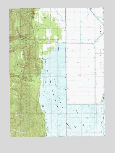
Crystal Spring, OR USGS Topographic Map
Click on map above to begin viewing in our Map Viewer.

This topographic map contains these locations and features:
Feature Name Type Latitude Longitude GNIS ID View Map
Agency StraitsChannelN42.5049°W122.0034°1135754View Map
Crystal (historical)Populated PlaceN42.5762°W122.0817°1154816View Map
Crystal Creek County ParkParkN42.5735°W122.0803°1162423View Map
Crystal Post Office (historical)Post OfficeN42.5762°W122.0817°1165119View Map
Crystal SpringSpringN42.5747°W122.0822°1140512View Map
Crystal Spring TrailheadLocaleN42.5768°W122.0822°1156250View Map
Crystal Springs Recreation SiteLocaleN42.5760°W122.0864°1156249View Map
Fourmile CanalCanalN42.6082°W122.0550°1167675View Map
Fourmile CreekStreamN42.5854°W122.0481°1142369View Map
Fourmile SloughStreamN42.5346°W122.0761°1154815View Map
Malone SpringSpringN42.5290°W122.0842°1145778View Map
Malone Springs Boat RampLocaleN42.5304°W122.0858°2700252View Map
Malone Springs Recreation SiteLocaleN42.5299°W122.0859°1156251View Map
Nannie CreekStreamN42.6237°W122.0911°1146726View Map
Pelican Butte TrailTrailN42.5026°W122.1225°1147569View Map
Penn CreekStreamN42.5585°W122.1114°1147581View Map
Penn PrairieSwampN42.5797°W122.1101°1147583View Map
Rock CreekStreamN42.5537°W122.1009°1148589View Map
Rocky Point TrailTrailN42.5121°W122.1097°1148672View Map
Sevenmile Canal LeveeLeveeN42.6182°W122.0131°1149256View Map
South Mound SpringSpringN42.6160°W122.0766°1154819View Map
Tiger Lily SpringSpringN42.6155°W122.0934°1154818View Map
Upper Klamath National Wildlife RefugeParkN42.5251°W122.0247°1151686View Map
West Fork Thomason CreekStreamN42.5029°W122.0378°1152119View Map

Note: Coordinates in the location and feature list above are referenced to NAD83 datum.


Copyright (C) 2008-2025 Ryan Niemi / Sunset Dynamics ... All Rights Reserved