TopoQuest Logo
Do you find TopoQuest useful?
Help keep TopoQuest running and adding new maps/features by donating!
Bitcoin:  19c7KJd3qBynnjoSw5npx9KScwjBe4ifkT
Litecoin:  LXs6TkuXGGXo1vDsWCkWVdjQX94eUKd6ui
Home View Maps Find Maps Find Places Resources & Links


Devils Peak, Oregon Topographic Map

USGS Map Title: Devils Peak, OR
USGS Map MRC: 42122F2
DRG (GeoTIFF) Download: o42122f2.tif


Neighboring USGS Topographic Map Quads:


  Red Blanket Mountain, OR  
42122G3
 

  Union Peak, OR  
42122G2
 

  Maklaks Crater, OR  
42122G1
 

  Imnaha Creek, OR  
42122F3
 

  Devils Peak, OR  
42122F2
 

  Mares Egg Spring, OR  
42122F1
 

  Rustler Peak, OR  
42122E3
 

  Pelican Butte, OR  
42122E2
 

  Crystal Spring, OR  
42122E1


Map MRC Location:

N43°
W123°
N43°
W122°
H8 H7 H6 H5 H4 H3 H2 H1
G8 G7 G6 G5 G4 G3 G2 G1
F8 F7 F6 F5 F4 F3 F2 F1
E8 E7 E6 E5 E4 E3 E2 E1
D8 D7 D6 D5 D4 D3 D2 D1
C8 C7 C6 C5 C4 C3 C2 C1
B8 B7 B6 B5 B4 B3 B2 B1
A8 A7 A6 A5 A4 A3 A2 A1
N42°
W123°
N42°
W122°

Devils Peak, OR USGS 1:24K Topographic Map Preview:
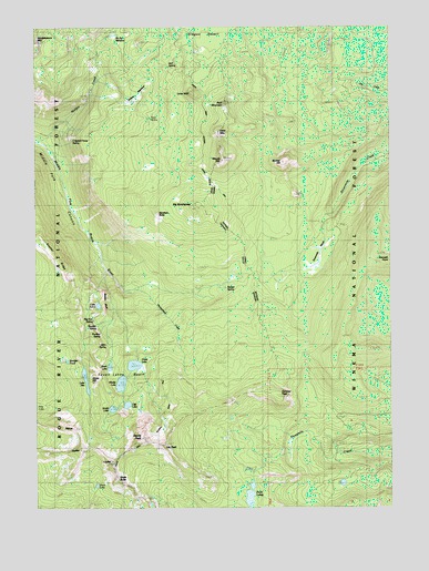
Devils Peak, OR USGS Topographic Map
Click on map above to begin viewing in our Map Viewer.

This topographic map contains these locations and features:
Feature Name Type Latitude Longitude GNIS ID View Map
Alta Campground (historical)ParkN42.6610°W122.2345°1162431View Map
Alta Lake TrailTrailN42.6757°W122.2439°1137176View Map
Bareface ButteSummitN42.7010°W122.2084°1137511View Map
Big BunchgrassSummitN42.7024°W122.1972°1137981View Map
Boston BluffCliffN42.6779°W122.2272°1138450View Map
Boulder PondLakeN42.6630°W122.2399°1138489View Map
Bunker HillSummitN42.7143°W122.1661°1138958View Map
Cliff LakeLakeN42.6517°W122.2188°1139827View Map
Cliff Lake Campground (historical)ParkN42.6526°W122.2178°1162428View Map
Crippled Horse SpringSpringN42.7203°W122.2379°1154825View Map
Devils PeakSummitN42.6432°W122.2142°1140966View Map
Dry Creek TrailTrailN42.7349°W122.1584°1141323View Map
Ethel MountainSummitN42.7221°W122.1872°1141904View Map
Finch LakeLakeN42.6308°W122.2298°1142093View Map
Gardner PeakSummitN42.6537°W122.1667°1142575View Map
Gopher RidgeRidgeN42.6954°W122.2497°1142861View Map
Grass LakeLakeN42.6620°W122.2165°1142954View Map
Grass Lake Campground (historical)ParkN42.6610°W122.2150°1162429View Map
Grass Lake Campground Number 2 (historical)ParkN42.6596°W122.2178°1162430View Map
Halifax TrailTrailN42.7246°W122.2278°1143219View Map
Honeymoon CreekStreamN42.6804°W122.2131°1143697View Map
JupiterSummitN42.6399°W122.2359°1144469View Map
Klamath PointSummitN42.6887°W122.1256°1144659View Map
Lake AltaLakeN42.6583°W122.2336°1137177View Map
Lake IvernLakeN42.6774°W122.2290°1144146View Map
Lee PeakSummitN42.6412°W122.2070°1144913View Map
Lone WolfSummitN42.7321°W122.1964°1145371View Map
LuciferSummitN42.6362°W122.2253°1145651View Map
Maude MountainSummitN42.7154°W122.1864°1145879View Map
McKie CampLocaleN42.7476°W122.2253°1146001View Map
Middle LakeLakeN42.6571°W122.2211°1146172View Map
Moude Mountain TrailTrailN42.7210°W122.2150°1146521View Map
North LakeLakeN42.6614°W122.2250°1147033View Map
Oregon DesertPlainN42.7460°W122.1906°1147262View Map
Puck LakesLakeN42.6281°W122.1758°1148024View Map
Ranger SpringSpringN42.6822°W122.1842°1148211View Map
Ruth MountainSummitN42.7296°W122.1856°1148869View Map
Seven Lakes BasinBasinN42.6604°W122.2209°1149249View Map
Sevenmile MarshSwampN42.6876°W122.1522°1149261View Map
Sevenmile Marsh CampgroundLocaleN42.6971°W122.1484°1154822View Map
Sevenmile Marsh TrailheadLocaleN42.6985°W122.1495°1155804View Map
Sevenmile TrailTrailN42.6890°W122.1584°1155805View Map
Shale ButteSummitN42.6326°W122.2225°1149277View Map
Snow LakesLakeN42.6280°W122.2105°1158491View Map
Solace CampLocaleN42.7271°W122.2214°1149861View Map
South LakeLakeN42.6506°W122.2241°1150053View Map
South Lake Campground (historical)ParkN42.6499°W122.2234°1162427View Map
VenusSummitN42.6460°W122.2381°1151749View Map
Violet HillSummitN42.6593°W122.2328°1151780View Map

Note: Coordinates in the location and feature list above are referenced to NAD83 datum.


Copyright (C) 2008-2024 Ryan Niemi / Sunset Dynamics ... All Rights Reserved