TopoQuest Logo
Do you find TopoQuest useful?
Help keep TopoQuest running and adding new maps/features by donating!
Bitcoin:  19c7KJd3qBynnjoSw5npx9KScwjBe4ifkT
Litecoin:  LXs6TkuXGGXo1vDsWCkWVdjQX94eUKd6ui
Home View Maps Find Maps Find Places Resources & Links


Steelhead Falls, Oregon Topographic Map

USGS Map Title: Steelhead Falls, OR
USGS Map MRC: 44121D3
DRG (GeoTIFF) Download: o44121d3.tif


Neighboring USGS Topographic Map Quads:


  Fly Creek, OR  
44121E4
 

  Round Butte Dam, OR  
44121E3
 

  Culver, OR  
44121E2
 

  Squaw Back Ridge, OR  
44121D4
 

  Steelhead Falls, OR  
44121D3
 

  Opal City, OR  
44121D2
 

  Henkle Butte, OR  
44121C4
 

  Cline Falls, OR  
44121C3
 

  Redmond, OR  
44121C2


Map MRC Location:

N45°
W122°
N45°
W121°
H8 H7 H6 H5 H4 H3 H2 H1
G8 G7 G6 G5 G4 G3 G2 G1
F8 F7 F6 F5 F4 F3 F2 F1
E8 E7 E6 E5 E4 E3 E2 E1
D8 D7 D6 D5 D4 D3 D2 D1
C8 C7 C6 C5 C4 C3 C2 C1
B8 B7 B6 B5 B4 B3 B2 B1
A8 A7 A6 A5 A4 A3 A2 A1
N44°
W122°
N44°
W121°

Steelhead Falls, OR USGS 1:24K Topographic Map Preview:
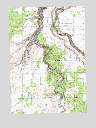
Steelhead Falls, OR USGS Topographic Map
Click on map above to begin viewing in our Map Viewer.

This topographic map contains these locations and features:
Feature Name Type Latitude Longitude GNIS ID View Map
Carcass CanyonValleyN44.4657°W121.3345°1153115View Map
Crooked River Ranch Census Designated PlaceCensusN44.4233°W121.2695°2787935View Map
Crooked River Ranch Fire DistrictBuildingN44.4360°W121.2697°2577113View Map
Gates RanchLocaleN44.4471°W121.2639°1156422View Map
Geneva OverlookLocaleN44.4793°W121.3295°1167613View Map
Grandview CemeteryCemeteryN44.4943°W121.3720°1161713View Map
Green MountainSummitN44.4746°W121.3673°1143047View Map
Holmes RanchLocaleN44.3815°W121.3603°1143679View Map
Lower Bridge School (historical)SchoolN44.3751°W121.3420°1145606View Map
Opal SpringsSpringN44.4907°W121.2973°1147251View Map
Potter CanyonValleyN44.4901°W121.3248°1153114View Map
Steelhead FallsFallsN44.4163°W121.2898°1150390View Map
Whychus CreekStreamN44.4598°W121.3353°1150253View Map
Whychus Creek CanyonValleyN44.4596°W121.3373°1153116View Map

Note: Coordinates in the location and feature list above are referenced to NAD83 datum.


Copyright (C) 2008-2025 Ryan Niemi / Sunset Dynamics ... All Rights Reserved