TopoQuest Logo
Do you find TopoQuest useful?
Help keep TopoQuest running and adding new maps/features by donating!
Bitcoin:  19c7KJd3qBynnjoSw5npx9KScwjBe4ifkT
Litecoin:  LXs6TkuXGGXo1vDsWCkWVdjQX94eUKd6ui
Home View Maps Find Maps Find Places Resources & Links


Cumberland Falls, Kentucky Topographic Map

USGS Map Title: Cumberland Falls, KY
USGS Map MRC: 36084G3
DRG (GeoTIFF) Download: o36084g3.tif


Neighboring USGS Topographic Map Quads:


  Hail, KY  
36084H4
 

  Sawyer, KY  
36084H3
 

  Vox, KY  
36084H2
 

  Wiborg, KY  
36084G4
 

  Cumberland Falls, KY  
36084G3
 

  Wofford, KY  
36084G2
 

  Whitley City, KY  
36084F4
 

  Hollyhill, KY  
36084F3
 

  Williamsburg, KY  
36084F2


Map MRC Location:

N37°
W85°
N37°
W84°
H8 H7 H6 H5 H4 H3 H2 H1
G8 G7 G6 G5 G4 G3 G2 G1
F8 F7 F6 F5 F4 F3 F2 F1
E8 E7 E6 E5 E4 E3 E2 E1
D8 D7 D6 D5 D4 D3 D2 D1
C8 C7 C6 C5 C4 C3 C2 C1
B8 B7 B6 B5 B4 B3 B2 B1
A8 A7 A6 A5 A4 A3 A2 A1
N36°
W85°
N36°
W84°

Cumberland Falls, KY USGS 1:24K Topographic Map Preview:
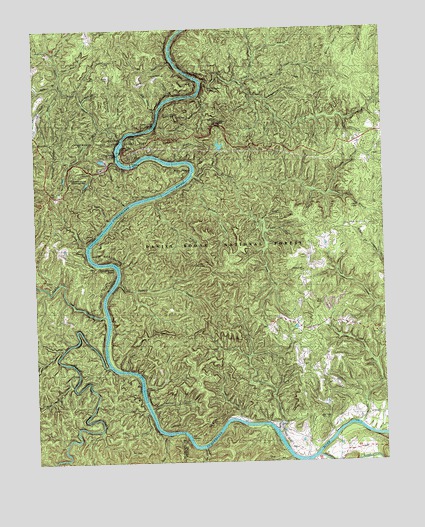
Cumberland Falls, KY USGS Topographic Map
Click on map above to begin viewing in our Map Viewer.

This topographic map contains these locations and features:
Feature Name Type Latitude Longitude GNIS ID View Map
Amos FallsFallsN36.8240°W84.2591°510259View Map
Amos Falls BranchStreamN36.8279°W84.2699°510260View Map
Archers CreekStreamN36.7598°W84.2891°510295View Map
Bear WallowLocaleN36.7536°W84.3420°2558380View Map
Bee ShoalsBarN36.7573°W84.3205°510507View Map
Bee Shoals CreekStreamN36.7540°W84.3155°510508View Map
Big BranchStreamN36.8665°W84.3258°510601View Map
Bill Perry BranchStreamN36.8517°W84.3305°510717View Map
Blue BendBendN36.8356°W84.3210°510798View Map
Bony BranchStreamN36.8598°W84.3655°510845View Map
Brummett BranchStreamN36.8456°W84.3466°510964View Map
Brushy CreekStreamN36.7826°W84.3655°510973View Map
Buck CreekStreamN36.8198°W84.2935°510999View Map
Buck Shoals CreekStreamN36.7579°W84.3283°511014View Map
Bunches CreekStreamN36.8329°W84.3177°511064View Map
Buzzard CreekStreamN36.8023°W84.3455°511108View Map
Calf Pen ForkStreamN36.8320°W84.3035°511128View Map
Cane CreekStreamN36.7626°W84.3030°511185View Map
Cantrel CreekStreamN36.7656°W84.3338°511211View Map
Catfish CreekStreamN36.8562°W84.3160°511249View Map
Center Rock RapidsRapidsN36.8479°W84.3316°511304View Map
Civilian Conservation Corps Historical MarkerParkN36.8402°W84.3394°2745300View Map
Coal Band BranchStreamN36.8548°W84.3572°511430View Map
Combling Falls Resort (historical)BuildingN36.7577°W84.3220°2710178View Map
Concord ChurchChurchN36.7623°W84.2835°511494View Map
Cow CreekStreamN36.8665°W84.2952°511590View Map
Crow CreekStreamN36.7720°W84.3363°511657View Map
Crow ShoalsBarN36.7709°W84.3369°511659View Map
Cumberland FallsFallsN36.8387°W84.3450°511676View Map
Cumberland Falls DivisionCivilN36.8481°W84.2534°1936964View Map
Cumberland Falls Fire StationBuildingN36.8279°W84.3687°2636554View Map
Cumberland Falls Moonbow Historical MarkerParkN36.8383°W84.3438°2745304View Map
Cumberland Falls Post Office (historical)Post OfficeN36.8404°W84.3327°1926486View Map
Cumberland Falls State ParkParkN36.8409°W84.3327°511677View Map
Cumberland Falls Trail Number TwoTrailN36.8531°W84.3266°516823View Map
Dog Slaughter CreekStreamN36.8604°W84.3144°511853View Map
Dog Slaughter FallsFallsN36.8581°W84.3113°516829View Map
Dog Slaughter RidgeRidgeN36.8606°W84.3322°511854View Map
Dry Bridge OverlookLocaleN36.8476°W84.3099°516828View Map
Dry Land BridgeBridgeN36.8470°W84.3108°511935View Map
Eagle CreekStreamN36.8437°W84.3433°511976View Map
Eagle Creek ChurchChurchN36.8684°W84.3691°511977View Map
Eagle FallsFallsN36.8429°W84.3441°511978View Map
Eagle Knob BranchStreamN36.8462°W84.3510°511979View Map
Falls BranchStreamN36.8370°W84.3452°512127View Map
Gulf BranchStreamN36.8667°W84.2955°512476View Map
Hatchell BranchStreamN36.8681°W84.3672°512583View Map
Hens Nest CreekStreamN36.7759°W84.3602°512663View Map
Hogbed BranchStreamN36.8545°W84.2913°512732View Map
Holden BranchStreamN36.8501°W84.3463°512741View Map
HoneybeePopulated PlaceN36.8415°W84.3722°512765View Map
Indian CreekStreamN36.7926°W84.3499°512901View Map
Jellico CreekStreamN36.7517°W84.2741°512987View Map
John Rose BranchStreamN36.8631°W84.3649°513033View Map
Kiwanis Trail Historical MarkerParkN36.8402°W84.3393°2745310View Map
Little Bunches CreekStreamN36.8320°W84.3163°513457View Map
Little Dog Slaughter CreekStreamN36.8617°W84.2963°513476View Map
Long BranchStreamN36.7770°W84.3416°513584View Map
Long Shoal CreekStreamN36.7645°W84.3349°513632View Map
Lovers Leap OverlookLocaleN36.8406°W84.3422°516824View Map
Lower Mulberry BranchStreamN36.8242°W84.3424°513707View Map
Mariar CemeteryCemeteryN36.8612°W84.3477°513787View Map
Marsh CreekStreamN36.7779°W84.3491°513798View Map
McKee BendBendN36.8095°W84.3519°513873View Map
Middle RidgeRidgeN36.8609°W84.2827°513947View Map
Midsprings SchoolSchoolN36.8137°W84.2769°513954View Map
Moonbow Inn (historical)BuildingN36.8439°W84.3409°2710203View Map
Morton SchoolSchoolN36.7879°W84.2777°514077View Map
New Liberty Lookout TowerTowerN36.7534°W84.3416°517250View Map
North Fork Dog Slaughter CreekStreamN36.8598°W84.3008°514288View Map
Oak Ridge ChurchChurchN36.7629°W84.2735°514301View Map
Peter BranchStreamN36.7504°W84.2816°514507View Map
Pine Grove ChurchChurchN36.7870°W84.2505°514579View Map
Pinnacle Lookout TowerTowerN36.8501°W84.3241°517267View Map
Pioneer Hero-Heroine Historical MarkerParkN36.8402°W84.3393°2745311View Map
Pitch BranchStreamN36.8126°W84.3566°514623View Map
Pitch RapidsBarN36.8162°W84.3519°514624View Map
Pleasant Hill ChurchChurchN36.8054°W84.2788°514645View Map
Polly HollowValleyN36.8167°W84.2923°514682View Map
Pond BranchStreamN36.8551°W84.2969°514690View Map
Pond RidgeRidgeN36.8495°W84.2908°514698View Map
Prop Cave BranchStreamN36.8581°W84.3588°514779View Map
Ridener CemeteryCemeteryN36.8742°W84.3033°514920View Map
Rock Branch ChurchChurchN36.8654°W84.3472°516822View Map
Rock Branch SchoolSchoolN36.8717°W84.3433°515018View Map
Ryan BranchStreamN36.8370°W84.3238°515153View Map
Sand Hill SchoolSchoolN36.7601°W84.2858°515219View Map
Seminary BranchStreamN36.8279°W84.2697°515322View Map
Shanty BranchStreamN36.8556°W84.3258°515336View Map
Shop BranchStreamN36.7515°W84.2844°515370View Map
Slick ShoalsBarN36.8267°W84.3330°515488View Map
Slick Shoals BranchStreamN36.8267°W84.3302°515489View Map
South Fork Dog Slaughter CreekStreamN36.8598°W84.3008°515543View Map
Summer ShoalsBarN36.7570°W84.2883°515814View Map
The StepsBenchN36.8073°W84.3158°516826View Map
Thunderstruck ShoalsBarN36.8070°W84.3460°515942View Map
Tombstone Junction Amusement ParkLocaleN36.8329°W84.3619°516827View Map
Upper Mulberry BranchStreamN36.8198°W84.3483°516144View Map
White Oak CreekStreamN36.7606°W84.2585°516315View Map
White Oak SchoolSchoolN36.7695°W84.2560°516327View Map
Worley BranchStreamN36.8576°W84.3641°516486View Map

Note: Coordinates in the location and feature list above are referenced to NAD83 datum.


Copyright (C) 2008-2024 Ryan Niemi / Sunset Dynamics ... All Rights Reserved