TopoQuest Logo
Do you find TopoQuest useful?
Help keep TopoQuest running and adding new maps/features by donating!
Bitcoin:  19c7KJd3qBynnjoSw5npx9KScwjBe4ifkT
Litecoin:  LXs6TkuXGGXo1vDsWCkWVdjQX94eUKd6ui
Home View Maps Find Maps Find Places Resources & Links


Wiborg, Kentucky Topographic Map

USGS Map Title: Wiborg, KY
USGS Map MRC: 36084G4
DRG (GeoTIFF) Download: o36084g4.tif


Neighboring USGS Topographic Map Quads:


  Burnside, KY  
36084H5
 

  Hail, KY  
36084H4
 

  Sawyer, KY  
36084H3
 

  Nevelsville, KY  
36084G5
 

  Wiborg, KY  
36084G4
 

  Cumberland Falls, KY  
36084G3
 

  Barthell, KY  
36084F5
 

  Whitley City, KY  
36084F4
 

  Hollyhill, KY  
36084F3


Map MRC Location:

N37°
W85°
N37°
W84°
H8 H7 H6 H5 H4 H3 H2 H1
G8 G7 G6 G5 G4 G3 G2 G1
F8 F7 F6 F5 F4 F3 F2 F1
E8 E7 E6 E5 E4 E3 E2 E1
D8 D7 D6 D5 D4 D3 D2 D1
C8 C7 C6 C5 C4 C3 C2 C1
B8 B7 B6 B5 B4 B3 B2 B1
A8 A7 A6 A5 A4 A3 A2 A1
N36°
W85°
N36°
W84°

Wiborg, KY USGS 1:24K Topographic Map Preview:
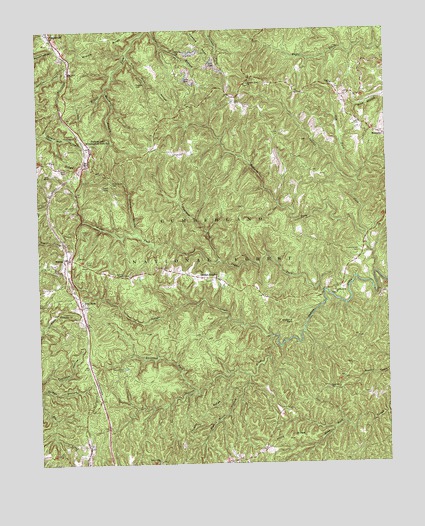
Wiborg, KY USGS Topographic Map
Click on map above to begin viewing in our Map Viewer.

This topographic map contains these locations and features:
Feature Name Type Latitude Longitude GNIS ID View Map
Barren ForkStreamN36.7865°W84.4166°510418View Map
Barren Fork CemeteryCemeteryN36.7773°W84.4691°510419View Map
Beulah HeightsPopulated PlaceN36.8042°W84.4394°510586View Map
Big Swag RidgeRidgeN36.8726°W84.4260°516582View Map
Chestnut FlatsSummitN36.7909°W84.4094°511331View Map
Coffey HollowValleyN36.7711°W84.4999°511450View Map
Cogur ForkStreamN36.8001°W84.3980°511453View Map
Daniel Boone National Forest Stearns Ranger DistrictBuildingN36.7695°W84.4782°2637449View Map
Dead Man HollowValleyN36.8457°W84.4974°511753View Map
Eagle - Sawyer Fire Protection District Station 2BuildingN36.8593°W84.4164°2637345View Map
Eagle SchoolSchoolN36.8595°W84.3938°511980View Map
Flat RockPopulated PlaceN36.7967°W84.4847°512195View Map
Four-H Camp (historical)LocaleN36.7655°W84.4135°2558388View Map
Franklin HollowValleyN36.7765°W84.4962°512240View Map
Freeman ForkStreamN36.8095°W84.4355°512249View Map
GreenwoodPopulated PlaceN36.8745°W84.4955°512450View Map
Hickenbottom CemeteryCemeteryN36.8115°W84.3847°512676View Map
Hughes CemeteryCemeteryN36.8598°W84.4641°512842View Map
Indian Creek ChurchChurchN36.7992°W84.3947°512908View Map
Kilburn ForkStreamN36.8051°W84.3797°513138View Map
Laurel ForkStreamN36.8154°W84.3830°513244View Map
Maxewell BranchStreamN36.8579°W84.4752°513832View Map
Parkers LakeLocaleN36.8420°W84.4808°514437View Map
Parkers Lake DivisionCivilN36.8603°W84.4363°1937191View Map
Pigeon Roost BranchStreamN36.7759°W84.4247°514547View Map
Piney Grove CemeteryCemeteryN36.8312°W84.4735°514607View Map
Pleasant Knob ChurchChurchN36.8598°W84.4244°514646View Map
Pole Road HollowValleyN36.8674°W84.4672°514672View Map
Pond RidgeRidgeN36.7570°W84.4110°514697View Map
Railroad ForkStreamN36.7715°W84.4447°514826View Map
Roberts ChapelChurchN36.8048°W84.4697°515003View Map
Sand Hill ChurchChurchN36.7715°W84.3966°515217View Map
Spruce HollowValleyN36.8461°W84.4970°515624View Map
Stearns District Ranger OfficeLocaleN36.7712°W84.4780°516580View Map
Strunk BranchStreamN36.8170°W84.4641°515764View Map
Taylor RidgeRidgeN36.7617°W84.4430°515883View Map
Taylor Ridge ChurchChurchN36.7509°W84.4574°515884View Map
Tom ForkStreamN36.8312°W84.3860°515969View Map
WiborgPopulated PlaceN36.8092°W84.4908°516351View Map
Wiborg Fire StationBuildingN36.8058°W84.4903°2636634View Map

Note: Coordinates in the location and feature list above are referenced to NAD83 datum.


Copyright (C) 2008-2024 Ryan Niemi / Sunset Dynamics ... All Rights Reserved