TopoQuest Logo
Do you find TopoQuest useful?
Help keep TopoQuest running and adding new maps/features by donating!
Bitcoin:  19c7KJd3qBynnjoSw5npx9KScwjBe4ifkT
Litecoin:  LXs6TkuXGGXo1vDsWCkWVdjQX94eUKd6ui
Home View Maps Find Maps Find Places Resources & Links


Wofford, Kentucky Topographic Map

USGS Map Title: Wofford, KY
USGS Map MRC: 36084G2
DRG (GeoTIFF) Download: o36084g2.tif


Neighboring USGS Topographic Map Quads:


  Sawyer, KY  
36084H3
 

  Vox, KY  
36084H2
 

  Corbin, KY  
36084H1
 

  Cumberland Falls, KY  
36084G3
 

  Wofford, KY  
36084G2
 

  Rockholds, KY  
36084G1
 

  Hollyhill, KY  
36084F3
 

  Williamsburg, KY  
36084F2
 

  Saxton, KY  
36084F1


Map MRC Location:

N37°
W85°
N37°
W84°
H8 H7 H6 H5 H4 H3 H2 H1
G8 G7 G6 G5 G4 G3 G2 G1
F8 F7 F6 F5 F4 F3 F2 F1
E8 E7 E6 E5 E4 E3 E2 E1
D8 D7 D6 D5 D4 D3 D2 D1
C8 C7 C6 C5 C4 C3 C2 C1
B8 B7 B6 B5 B4 B3 B2 B1
A8 A7 A6 A5 A4 A3 A2 A1
N36°
W85°
N36°
W84°

Wofford, KY USGS 1:24K Topographic Map Preview:
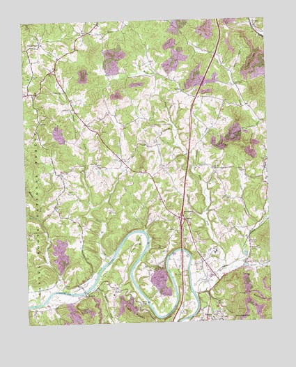
Wofford, KY USGS Topographic Map
Click on map above to begin viewing in our Map Viewer.

This topographic map contains these locations and features:
Feature Name Type Latitude Longitude GNIS ID View Map
Blake ForkStreamN36.7715°W84.1480°510776View Map
Browns CreekStreamN36.7748°W84.1385°510959View Map
Canada Town Holiness ChurchChurchN36.8042°W84.2278°511174View Map
Carr AirportAirportN36.7653°W84.1993°517504View Map
ClioPopulated PlaceN36.8179°W84.1994°511414View Map
Coalmont Railroad Station (historical)LocaleN36.7901°W84.1280°2710063View Map
Cripple CreekStreamN36.8143°W84.1633°511638View Map
Croley BendBendN36.7748°W84.1719°511647View Map
Doctor Thomas Walker Historical MarkerParkN36.7677°W84.1508°2745306View Map
FaberPopulated PlaceN36.8737°W84.1302°512106View Map
Faber Railroad Station (historical)LocaleN36.8730°W84.1303°2710075View Map
Freewill ChurchChurchN36.7579°W84.1908°512252View Map
Gatiffi State Fish HatcheryLocaleN36.7781°W84.1372°517160View Map
GoldbugPopulated PlaceN36.7926°W84.1680°512337View Map
Idiot BranchStreamN36.7887°W84.1302°512887View Map
King MountainSummitN36.7595°W84.1330°513153View Map
LibertyPopulated PlaceN36.7648°W84.2041°513369View Map
Log Cabin ChurchChurchN36.8334°W84.2416°513567View Map
Middle Fork Sanders CreekStreamN36.7948°W84.2435°513938View Map
New Mount Zion ChurchChurchN36.7534°W84.1705°514246View Map
New Zion ChurchChurchN36.8131°W84.1519°514253View Map
Piney Grove ChurchChurchN36.7879°W84.1727°514608View Map
Pocono Railroad Station (historical)LocaleN36.7505°W84.1668°2710204View Map
Prewitt BendBendN36.7837°W84.1935°514764View Map
RedbirdPopulated PlaceN36.7620°W84.2199°514874View Map
Rough Shoals CreekStreamN36.7654°W84.2155°515129View Map
Ryan CemeteryCemeteryN36.8251°W84.1809°515155View Map
Sanders CreekStreamN36.7637°W84.2322°515233View Map
Shiner ChurchChurchN36.8348°W84.2094°515357View Map
Steely CemeteryCemeteryN36.7651°W84.2308°515684View Map
Sutton CemeteryCemeteryN36.8176°W84.2013°515822View Map
Three Point Fire and Rescue DepartmentBuildingN36.7510°W84.1578°2636320View Map
Tidal Wave ChurchChurchN36.8484°W84.1405°515946View Map
Tuggle CemeteryCemeteryN36.8009°W84.1469°516033View Map
WaldenPopulated PlaceN36.8459°W84.1677°516203View Map
Watts CreekStreamN36.7623°W84.1638°516250View Map
Watts Creek Railroad Station (historical)LocaleN36.7692°W84.1538°2710096View Map
WEKC-AM (Williamsburg)TowerN36.7745°W84.1680°517673View Map
White Oak ChurchChurchN36.8459°W84.2299°516312View Map
Whitley CountyCivilN36.7581°W84.1452°516964View Map
Whitley County Emergency Medical ServicesBuildingN36.7990°W84.2014°2719143View Map
Whitley County High SchoolSchoolN36.7790°W84.1524°516541View Map
Whitley Memorial GardensCemeteryN36.7744°W84.1607°516341View Map
Williamsburg Post OfficePost OfficeN36.7565°W84.1561°2767806View Map
Williamsburg-Whitley County AirportAirportN36.8010°W84.1971°517505View Map
WoffordPopulated PlaceN36.7826°W84.1352°516427View Map
Wofford Railroad Station (historical)LocaleN36.7837°W84.1360°2710269View Map
Youngs CemeteryCemeteryN36.8526°W84.2447°516517View Map
Youngs CreekPopulated PlaceN36.8654°W84.2410°516518View Map
Youngs CreekStreamN36.7768°W84.2063°516519View Map
Youngs Creek ChurchChurchN36.8154°W84.2122°516521View Map

Note: Coordinates in the location and feature list above are referenced to NAD83 datum.


Copyright (C) 2008-2024 Ryan Niemi / Sunset Dynamics ... All Rights Reserved