TopoQuest Logo
Do you find TopoQuest useful?
Help keep TopoQuest running and adding new maps/features by donating!
Bitcoin:  19c7KJd3qBynnjoSw5npx9KScwjBe4ifkT
Litecoin:  LXs6TkuXGGXo1vDsWCkWVdjQX94eUKd6ui
Home View Maps Find Maps Find Places Resources & Links


Cunningham Creek, Texas Topographic Map

USGS Map Title: Cunningham Creek, TX
USGS Map MRC: 32094H4
DRG (GeoTIFF) Download: o32094h4.tif


Neighboring USGS Topographic Map Quads:


  Sardis, TX  
33094A5
 

  Carterville, TX  
33094A4
 

  Linden, TX  
33094A3
 

  Avinger, TX  
32094H5
 

  Cunningham Creek, TX  
32094H4
 

  Lanier, TX  
32094H3
 

  Lassater, TX  
32094G5
 

  Kellyville, TX  
32094G4
 

  Jefferson, TX  
32094G3


Map MRC Location:

N33°
W95°
N33°
W94°
H8 H7 H6 H5 H4 H3 H2 H1
G8 G7 G6 G5 G4 G3 G2 G1
F8 F7 F6 F5 F4 F3 F2 F1
E8 E7 E6 E5 E4 E3 E2 E1
D8 D7 D6 D5 D4 D3 D2 D1
C8 C7 C6 C5 C4 C3 C2 C1
B8 B7 B6 B5 B4 B3 B2 B1
A8 A7 A6 A5 A4 A3 A2 A1
N32°
W95°
N32°
W94°

Cunningham Creek, TX USGS 1:24K Topographic Map Preview:
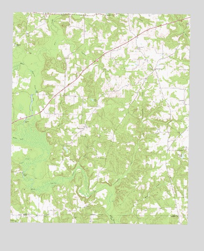
Cunningham Creek, TX USGS Topographic Map
Click on map above to begin viewing in our Map Viewer.

This topographic map contains these locations and features:
Feature Name Type Latitude Longitude GNIS ID View Map
Antioch ChurchChurchN32.9299°W94.3813°1329610View Map
Barnes LakeLakeN32.9030°W94.4916°1330061View Map
Bear CreekPopulated PlaceN32.9299°W94.4505°1380821View Map
Bear CreekStreamN32.9037°W94.4477°1330213View Map
Bear Creek CemeteryCemeteryN32.9140°W94.4352°1330230View Map
Bethlehem ChurchChurchN32.9190°W94.3821°1330534View Map
Black Cypress CreekStreamN32.8921°W94.4285°1372602View Map
Blue BranchStreamN32.9226°W94.4783°1330895View Map
Blue LakeLakeN32.9530°W94.4838°1330910View Map
Cannon CreekStreamN32.9104°W94.4846°1332099View Map
Caves SpringPopulated PlaceN32.9668°W94.3994°1378101View Map
Caves Spring ChurchChurchN32.9793°W94.4113°1332358View Map
Cunningham CreekStreamN32.8924°W94.4285°1333816View Map
Cypress BranchStreamN32.9818°W94.4688°1333846View Map
FairviewPopulated PlaceN32.9465°W94.3782°1378284View Map
Flag PondReservoirN32.9484°W94.4433°1335881View Map
Flat CreekStreamN32.9665°W94.4816°1373733View Map
Flat Creek BridgeBridgeN32.9993°W94.4660°1335903View Map
Henderson CemeteryCemeteryN32.9860°W94.4899°1337596View Map
Hughes CreekStreamN32.9237°W94.4896°1338243View Map
Hughes LakeLakeN32.9349°W94.4914°1338247View Map
Lacey BridgeBridgeN32.8937°W94.4416°1339439View Map
LibertyPopulated PlaceN32.8846°W94.4483°1378583View Map
Liberty ChurchChurchN32.8785°W94.4552°1339883View Map
Lockett CemeteryCemeteryN32.8762°W94.3805°1340308View Map
Pruitt LakeLakeN32.9391°W94.4860°1344611View Map
Simmons CemeteryCemeteryN32.8760°W94.4421°1347143View Map
Wallace LakeLakeN32.9802°W94.4980°1349395View Map
Wells ChurchChurchN32.9668°W94.4002°1349642View Map
Whipple PondReservoirN32.9156°W94.3789°1349915View Map

Note: Coordinates in the location and feature list above are referenced to NAD83 datum.


Copyright (C) 2008-2024 Ryan Niemi / Sunset Dynamics ... All Rights Reserved