TopoQuest Logo
Do you find TopoQuest useful?
Help keep TopoQuest running and adding new maps/features by donating!
Bitcoin:  19c7KJd3qBynnjoSw5npx9KScwjBe4ifkT
Litecoin:  LXs6TkuXGGXo1vDsWCkWVdjQX94eUKd6ui
Home View Maps Find Maps Find Places Resources & Links


Sardis, Texas Topographic Map

USGS Map Title: Sardis, TX
USGS Map MRC: 33094A5
DRG (GeoTIFF) Download: o33094a5.tif


Neighboring USGS Topographic Map Quads:


  Naples, TX  
33094B6
 

  Marietta, TX  
33094B5
 

  Bryans Mill, TX  
33094B4
 

  Daingerfield, TX  
33094A6
 

  Sardis, TX  
33094A5
 

  Carterville, TX  
33094A4
 

  Lone Star, TX  
32094H6
 

  Avinger, TX  
32094H5
 

  Cunningham Creek, TX  
32094H4


Map MRC Location:

N34°
W95°
N34°
W94°
H8 H7 H6 H5 H4 H3 H2 H1
G8 G7 G6 G5 G4 G3 G2 G1
F8 F7 F6 F5 F4 F3 F2 F1
E8 E7 E6 E5 E4 E3 E2 E1
D8 D7 D6 D5 D4 D3 D2 D1
C8 C7 C6 C5 C4 C3 C2 C1
B8 B7 B6 B5 B4 B3 B2 B1
A8 A7 A6 A5 A4 A3 A2 A1
N33°
W95°
N33°
W94°

Sardis, TX USGS 1:24K Topographic Map Preview:
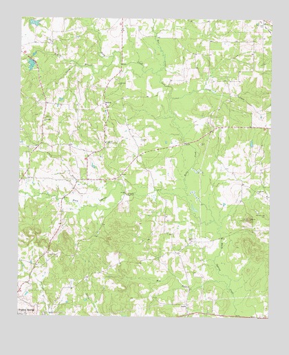
Sardis, TX USGS Topographic Map
Click on map above to begin viewing in our Map Viewer.

This topographic map contains these locations and features:
Feature Name Type Latitude Longitude GNIS ID View Map
Arbery BranchStreamN33.0562°W94.5755°1329655View Map
Bear CreekStreamN33.1029°W94.5563°1330227View Map
Caney CreekStreamN33.0921°W94.5496°1332095View Map
Coker LakeReservoirN33.1230°W94.6190°1854992View Map
Coker Lake DamDamN33.1235°W94.6202°1854991View Map
Crossroads - Cornett Volunteer Fire DepartmentBuildingN33.0693°W94.5850°2655566View Map
Crossroads Community CenteryPopulated PlaceN33.0729°W94.5819°1378186View Map
Dennis CemeteryCemeteryN33.0743°W94.5641°1334254View Map
Flat Creek CemeteryCemeteryN33.1237°W94.5046°1335904View Map
Friendship ChurchChurchN33.0818°W94.6130°1336243View Map
Kelly CreekStreamN33.0410°W94.5274°1339004View Map
MidwayPopulated PlaceN33.0893°W94.5821°1378678View Map
Mill BranchStreamN33.0118°W94.5196°1341613View Map
Mount Olive ChurchChurchN33.1151°W94.6094°1342082View Map
Old Union Hill CemeteryCemeteryN33.0429°W94.5019°1343240View Map
Pine Bluff ChurchChurchN33.0976°W94.5755°1344039View Map
Prairie BranchStreamN33.1093°W94.5785°1344484View Map
Rankin CemeteryCemeteryN33.0326°W94.5402°1344799View Map
SardisPopulated PlaceN33.0051°W94.5410°1379036View Map
Union Hill ChurchChurchN33.0532°W94.5060°1349079View Map
Union Hill Lookout TowerTowerN33.0415°W94.5105°1384502View Map

Note: Coordinates in the location and feature list above are referenced to NAD83 datum.


Copyright (C) 2008-2025 Ryan Niemi / Sunset Dynamics ... All Rights Reserved