TopoQuest Logo
Do you find TopoQuest useful?
Help keep TopoQuest running and adding new maps/features by donating!
Bitcoin:  19c7KJd3qBynnjoSw5npx9KScwjBe4ifkT
Litecoin:  LXs6TkuXGGXo1vDsWCkWVdjQX94eUKd6ui
Home View Maps Find Maps Find Places Resources & Links


Current Lake, Minnesota Topographic Map

USGS Map Title: Current Lake, MN
USGS Map MRC: 44095B8
DRG (GeoTIFF) Download: o44095b8.tif


Neighboring USGS Topographic Map Quads:


  Dead Coon Lake, MN  
44096C1
 

  Russell, MN  
44095C8
 

  Marshall SE, MN  
44095C7
 

  Ruthton, MN  
44096B1
 

  Current Lake, MN  
44095B8
 

  Balaton, MN  
44095B7
 

  Woodstock, MN  
44096A1
 

  Balaton SW, MN  
44095A8
 

  Hadley, MN  
44095A7


Map MRC Location:

N45°
W96°
N45°
W95°
H8 H7 H6 H5 H4 H3 H2 H1
G8 G7 G6 G5 G4 G3 G2 G1
F8 F7 F6 F5 F4 F3 F2 F1
E8 E7 E6 E5 E4 E3 E2 E1
D8 D7 D6 D5 D4 D3 D2 D1
C8 C7 C6 C5 C4 C3 C2 C1
B8 B7 B6 B5 B4 B3 B2 B1
A8 A7 A6 A5 A4 A3 A2 A1
N44°
W96°
N44°
W95°

Current Lake, MN USGS 1:24K Topographic Map Preview:
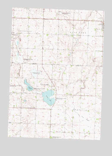
Current Lake, MN USGS Topographic Map
Click on map above to begin viewing in our Map Viewer.

This topographic map contains these locations and features:
Feature Name Type Latitude Longitude GNIS ID View Map
Bergman State Wildlife Management AreaParkN44.1766°W95.9456°639966View Map
County Ditch Number FortyeightCanalN44.2105°W95.8759°642136View Map
Current LakeLakeN44.1644°W95.9465°642555View Map
Current LakePopulated PlaceN44.1386°W95.9434°654660View Map
Current Lake Post Office (historical)Post OfficeN44.1386°W95.9434°2049985View Map
Current Lake State Wildlife Management AreaParkN44.1639°W95.9389°642556View Map
Gadwall State Wildlife Management AreaParkN44.2461°W95.9356°644003View Map
Hjermstad SloughLakeN44.1745°W95.9745°645041View Map
Nelson State Wildlife Management AreaParkN44.1875°W95.9659°648474View Map
Oscar LakebedFlatN44.1450°W95.8970°649015View Map
Reinhold State Wildlife Management AreaParkN44.1255°W95.9417°649923View Map
Saint Peter's Evangelical Lutheran SchoolSchoolN44.2328°W95.8778°2064348View Map
Saint Peters Lutheran CemeteryCemeteryN44.2431°W95.8772°651018View Map
Shelburne State Wildlife Management AreaParkN44.2002°W95.9870°651937View Map
Sillerud CemeteryCemeteryN44.1714°W95.9392°2050036View Map
Sillerud ChurchChurchN44.1716°W95.9392°652020View Map
Skandia CemeteryCemeteryN44.1671°W95.8983°652108View Map
Skandia ChurchChurchN44.1677°W95.9195°652109View Map
Township of Rock LakeCivilN44.2400°W95.8981°665437View Map
Township of SkandiaCivilN44.1528°W95.8833°665625View Map
Trinity CemeteryCemeteryN44.2436°W95.8773°653285View Map
Victory Christian ChurchChurchN44.2328°W95.8783°2064343View Map
Zion ChurchChurchN44.1594°W95.8842°654465View Map
Zion Lutheran CemeteryCemeteryN44.1598°W95.8842°2050035View Map

Note: Coordinates in the location and feature list above are referenced to NAD83 datum.


Copyright (C) 2008-2025 Ryan Niemi / Sunset Dynamics ... All Rights Reserved