TopoQuest Logo
Do you find TopoQuest useful?
Help keep TopoQuest running and adding new maps/features by donating!
Bitcoin:  19c7KJd3qBynnjoSw5npx9KScwjBe4ifkT
Litecoin:  LXs6TkuXGGXo1vDsWCkWVdjQX94eUKd6ui
Home View Maps Find Maps Find Places Resources & Links


Hadley, Minnesota Topographic Map

USGS Map Title: Hadley, MN
USGS Map MRC: 44095A7
DRG (GeoTIFF) Download: o44095a7.tif


Neighboring USGS Topographic Map Quads:


  Current Lake, MN  
44095B8
 

  Balaton, MN  
44095B7
 

  Tracy West, MN  
44095B6
 

  Balaton SW, MN  
44095A8
 

  Hadley, MN  
44095A7
 

  Currie, MN  
44095A6
 

  Chandler, MN  
43095H8
 

  Slayton, MN  
43095H7
 

  Avoca, MN  
43095H6


Map MRC Location:

N45°
W96°
N45°
W95°
H8 H7 H6 H5 H4 H3 H2 H1
G8 G7 G6 G5 G4 G3 G2 G1
F8 F7 F6 F5 F4 F3 F2 F1
E8 E7 E6 E5 E4 E3 E2 E1
D8 D7 D6 D5 D4 D3 D2 D1
C8 C7 C6 C5 C4 C3 C2 C1
B8 B7 B6 B5 B4 B3 B2 B1
A8 A7 A6 A5 A4 A3 A2 A1
N44°
W96°
N44°
W95°

Hadley, MN USGS 1:24K Topographic Map Preview:
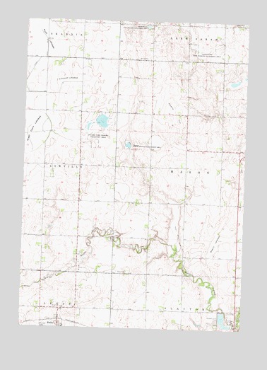
Hadley, MN USGS Topographic Map
Click on map above to begin viewing in our Map Viewer.

This topographic map contains these locations and features:
Feature Name Type Latitude Longitude GNIS ID View Map
Beauty LakebedFlatN44.0364°W95.7642°639811View Map
County Ditch Number EighteenCanalN44.0391°W95.7875°641739View Map
Crooked LakebedFlatN44.1000°W95.8525°642471View Map
HadleyPopulated PlaceN44.0011°W95.8539°644553View Map
Hadley (historical)LocaleN44.0027°W95.8531°2050011View Map
Hadley Area Community CenterBuildingN44.0011°W95.8539°2050014View Map
Hadley Lutheran ChurchChurchN44.0005°W95.8536°2050013View Map
Hadley Post OfficePost OfficeN44.0011°W95.8539°2050012View Map
Highland Home CemeteryCemeteryN44.0079°W95.8498°644949View Map
LowvillePopulated PlaceN44.0666°W95.8670°654530View Map
Lowville Post Office (historical)Post OfficeN44.0666°W95.8670°2049974View Map
Lowville State Wildlife Management AreasParkN44.0822°W95.8345°647276View Map
Mason State Wildlife Management AreaParkN44.0744°W95.8170°647605View Map
Modum CemeteryCemeteryN44.1241°W95.7517°648006View Map
Murray CountyCivilN44.0221°W95.7633°659496View Map
Poverty HillSummitN44.0886°W95.7922°649692View Map
Rush LakebedFlatN44.1177°W95.8639°650413View Map
Slayton CemeteryCemeteryN44.0025°W95.7528°652148View Map
Slayton Country ClubLocaleN44.0041°W95.7553°2049944View Map
Slayton Wastewater Treatment PlantLocaleN44.0039°W95.7611°2702861View Map
Stonegate OrchardLocaleN44.0142°W95.7644°2647727View Map
Township of MasonCivilN44.0657°W95.7634°664928View Map

Note: Coordinates in the location and feature list above are referenced to NAD83 datum.


Copyright (C) 2008-2025 Ryan Niemi / Sunset Dynamics ... All Rights Reserved