TopoQuest Logo
Do you find TopoQuest useful?
Help keep TopoQuest running and adding new maps/features by donating!
Bitcoin:  19c7KJd3qBynnjoSw5npx9KScwjBe4ifkT
Litecoin:  LXs6TkuXGGXo1vDsWCkWVdjQX94eUKd6ui
Home View Maps Find Maps Find Places Resources & Links


Balaton, Minnesota Topographic Map

USGS Map Title: Balaton, MN
USGS Map MRC: 44095B7
DRG (GeoTIFF) Download: o44095b7.tif


Neighboring USGS Topographic Map Quads:


  Russell, MN  
44095C8
 

  Marshall SE, MN  
44095C7
 

  Amiret, MN  
44095C6
 

  Current Lake, MN  
44095B8
 

  Balaton, MN  
44095B7
 

  Tracy West, MN  
44095B6
 

  Balaton SW, MN  
44095A8
 

  Hadley, MN  
44095A7
 

  Currie, MN  
44095A6


Map MRC Location:

N45°
W96°
N45°
W95°
H8 H7 H6 H5 H4 H3 H2 H1
G8 G7 G6 G5 G4 G3 G2 G1
F8 F7 F6 F5 F4 F3 F2 F1
E8 E7 E6 E5 E4 E3 E2 E1
D8 D7 D6 D5 D4 D3 D2 D1
C8 C7 C6 C5 C4 C3 C2 C1
B8 B7 B6 B5 B4 B3 B2 B1
A8 A7 A6 A5 A4 A3 A2 A1
N44°
W96°
N44°
W95°

Balaton, MN USGS 1:24K Topographic Map Preview:
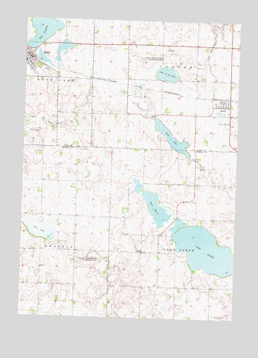
Balaton, MN USGS Topographic Map
Click on map above to begin viewing in our Map Viewer.

This topographic map contains these locations and features:
Feature Name Type Latitude Longitude GNIS ID View Map
BalatonLocaleN44.2361°W95.8717°2064356View Map
BalatonPopulated PlaceN44.2333°W95.8722°639591View Map
Balaton City HallBuildingN44.2342°W95.8717°2064355View Map
Balaton Elementary SchoolSchoolN44.2325°W95.8747°2064350View Map
Balaton Fire Department and Ambulance ServiceBuildingN44.2362°W95.8732°2064351View Map
Balaton LibraryBuildingN44.2342°W95.8717°2064354View Map
Balaton Police DepartmentBuildingN44.2328°W95.8723°2064352View Map
Balaton Post OfficePost OfficeN44.2342°W95.8717°2064353View Map
Balaton United Methodist ChurchChurchN44.2344°W95.8733°2064342View Map
City of BalatonCivilN44.2331°W95.8707°2394053View Map
City of GarvinCivilN44.2142°W95.7607°2394861View Map
County Ditch Number TwentynineCanalN44.2400°W95.7661°641911View Map
Dog Creek DamDamN44.2283°W95.8370°1776103View Map
Dog Creek ReservoirReservoirN44.2283°W95.8370°1776104View Map
East Bay Golf CourseLocaleN44.2365°W95.8616°2565004View Map
GarvinPopulated PlaceN44.2144°W95.7558°644051View Map
GarvinLocaleN44.2175°W95.7597°2064329View Map
Garvin City HallBuildingN44.2158°W95.7603°2064325View Map
Garvin Congregational ChurchChurchN44.2136°W95.7550°2064327View Map
Garvin Fire DepartmentBuildingN44.2148°W95.7608°2064326View Map
Garvin Post OfficePost OfficeN44.2167°W95.7597°2064328View Map
Garvin State Wildlife Management AreaParkN44.2344°W95.7900°644054View Map
Iron LakeLakeN44.1616°W95.8643°645457View Map
Kruger-Gregoire Farm Pond DamDamN44.2500°W95.7586°1777222View Map
Lake MariaLakeN44.1716°W95.7975°647527View Map
Lake of the HillLakeN44.2276°W95.7927°644983View Map
Lake SarahLakeN44.1540°W95.7670°651212View Map
Lake YanktonLakeN44.2461°W95.8659°654410View Map
Long LakeLakeN44.2010°W95.7888°647032View Map
Saint Peter's Evangelical Lutheran ChurchChurchN44.2328°W95.8736°2064344View Map
Sarah LakeReservoirN44.1316°W95.7653°1776098View Map
Sarah Lake DamDamN44.1316°W95.7653°1776097View Map
Skandia State Wildlife Management AreaParkN44.1511°W95.8320°652110View Map
Spink LakeLakeN44.2375°W95.8551°2628406View Map
Township of CusterCivilN44.2398°W95.7754°663909View Map
Township of Lake SarahCivilN44.1525°W95.7627°664698View Map
Trinity Lutheran ChurchChurchN44.2306°W95.8711°2064345View Map
Yankton Country SchoolSchoolN44.2333°W95.8719°2064349View Map
Yankton LakeReservoirN44.2283°W95.8586°1776294View Map
Yankton Lake DamDamN44.2283°W95.8586°1776293View Map

Note: Coordinates in the location and feature list above are referenced to NAD83 datum.


Copyright (C) 2008-2025 Ryan Niemi / Sunset Dynamics ... All Rights Reserved