TopoQuest Logo
Do you find TopoQuest useful?
Help keep TopoQuest running and adding new maps/features by donating!
Bitcoin:  19c7KJd3qBynnjoSw5npx9KScwjBe4ifkT
Litecoin:  LXs6TkuXGGXo1vDsWCkWVdjQX94eUKd6ui
Home View Maps Find Maps Find Places Resources & Links


Curryville, Missouri Topographic Map

USGS Map Title: Curryville, MO
USGS Map MRC: 39091C3
DRG (GeoTIFF) Download: o39091c3.tif


Neighboring USGS Topographic Map Quads:


  Spencerburg, MO  
39091D4
 

  Frankford, MO  
39091D3
 

  Vera, MO  
39091D2
 

  Vandalia, MO  
39091C4
 

  Curryville, MO  
39091C3
 

  Bowling Green, MO  
39091C2
 

  Middletown, MO  
39091B4
 

  New Hartford, MO  
39091B3
 

  Louisville, MO  
39091B2


Map MRC Location:

N40°
W92°
N40°
W91°
H8 H7 H6 H5 H4 H3 H2 H1
G8 G7 G6 G5 G4 G3 G2 G1
F8 F7 F6 F5 F4 F3 F2 F1
E8 E7 E6 E5 E4 E3 E2 E1
D8 D7 D6 D5 D4 D3 D2 D1
C8 C7 C6 C5 C4 C3 C2 C1
B8 B7 B6 B5 B4 B3 B2 B1
A8 A7 A6 A5 A4 A3 A2 A1
N39°
W92°
N39°
W91°

Curryville, MO USGS 1:24K Topographic Map Preview:
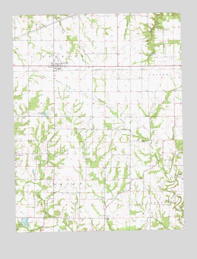
Curryville, MO USGS Topographic Map
Click on map above to begin viewing in our Map Viewer.

This topographic map contains these locations and features:
Feature Name Type Latitude Longitude GNIS ID View Map
Allison School (historical)SchoolN39.2503°W91.2749°742252View Map
City of CurryvilleCivilN39.3457°W91.3413°2393699View Map
Concord ChurchChurchN39.3006°W91.2785°716177View Map
Concord School (historical)SchoolN39.3017°W91.2746°742248View Map
Cuivre CreekStreamN39.2784°W91.2563°716582View Map
CurryvillePopulated PlaceN39.3456°W91.3449°716603View Map
Curryville Elementary School (historical)SchoolN39.3468°W91.3391°2651161View Map
Curryville Police DepartmentBuildingN39.3462°W91.3419°2752464View Map
Curryville Post OfficePost OfficeN39.3452°W91.3415°2783048View Map
Curryville Volunteer Fire DepartmentBuildingN39.3465°W91.3415°2621098View Map
Deigel DamDamN39.3167°W91.3518°761084View Map
Dougherty LakeReservoirN39.3180°W91.3523°761085View Map
Dry Straw BranchStreamN39.2795°W91.2563°717133View Map
Excelsior School (historical)SchoolN39.3448°W91.2554°742247View Map
FarmerPopulated PlaceN39.2573°W91.3093°729484View Map
Irvine BranchStreamN39.2784°W91.2563°720169View Map
Jasper Spring BranchStreamN39.2995°W91.2746°720269View Map
Kilby ChurchChurchN39.2545°W91.3707°720578View Map
MarzolfLocaleN39.2645°W91.2613°740345View Map
Marzolf Post Office (historical)Post OfficeN39.2645°W91.2613°759555View Map
Murray Hill School (historical)SchoolN39.2945°W91.3515°742250View Map
New HarmonyPopulated PlaceN39.2942°W91.3749°741099View Map
Sandy CreekStreamN39.2762°W91.3563°726036View Map
Shady CreekStreamN39.2537°W91.3443°726231View Map
Township of IndianCivilN39.2733°W91.3617°767191View Map
Vannoy School (historical)SchoolN39.2503°W91.3193°742251View Map
Woodlawn School (historical)SchoolN39.2942°W91.3176°742249View Map

Note: Coordinates in the location and feature list above are referenced to NAD83 datum.


Copyright (C) 2008-2025 Ryan Niemi / Sunset Dynamics ... All Rights Reserved