TopoQuest Logo
Do you find TopoQuest useful?
Help keep TopoQuest running and adding new maps/features by donating!
Bitcoin:  19c7KJd3qBynnjoSw5npx9KScwjBe4ifkT
Litecoin:  LXs6TkuXGGXo1vDsWCkWVdjQX94eUKd6ui
Home View Maps Find Maps Find Places Resources & Links


Frankford, Missouri Topographic Map

USGS Map Title: Frankford, MO
USGS Map MRC: 39091D3
DRG (GeoTIFF) Download: o39091d3.tif


Neighboring USGS Topographic Map Quads:


  New London, MO  
39091E4
 

  Hannibal SE, MO  
39091E3
 

  Ashburn, MO  
39091E2
 

  Spencerburg, MO  
39091D4
 

  Frankford, MO  
39091D3
 

  Vera, MO  
39091D2
 

  Vandalia, MO  
39091C4
 

  Curryville, MO  
39091C3
 

  Bowling Green, MO  
39091C2


Map MRC Location:

N40°
W92°
N40°
W91°
H8 H7 H6 H5 H4 H3 H2 H1
G8 G7 G6 G5 G4 G3 G2 G1
F8 F7 F6 F5 F4 F3 F2 F1
E8 E7 E6 E5 E4 E3 E2 E1
D8 D7 D6 D5 D4 D3 D2 D1
C8 C7 C6 C5 C4 C3 C2 C1
B8 B7 B6 B5 B4 B3 B2 B1
A8 A7 A6 A5 A4 A3 A2 A1
N39°
W92°
N39°
W91°

Frankford, MO USGS 1:24K Topographic Map Preview:
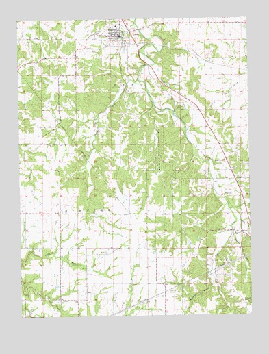
Frankford, MO USGS Topographic Map
Click on map above to begin viewing in our Map Viewer.

This topographic map contains these locations and features:
Feature Name Type Latitude Longitude GNIS ID View Map
Biggs CemeteryCemeteryN39.4256°W91.2638°714233View Map
City of FrankfordCivilN39.4934°W91.3209°2394804View Map
Donovan School (historical)SchoolN39.4689°W91.3160°742254View Map
DuChien Cave Natural BridgeArchN39.4414°W91.3008°738882View Map
Fairview CemeteryCemeteryN39.4928°W91.3324°717766View Map
FrankfordPopulated PlaceN39.4900°W91.3201°729699View Map
Frankford Elementary SchoolSchoolN39.4971°W91.3213°2651160View Map
Frankford Fire DepartmentBuildingN39.4926°W91.3196°2621585View Map
Frankford Post OfficePost OfficeN39.4926°W91.3192°2783177View Map
Gailey BranchStreamN39.4150°W91.2576°718304View Map
Gentle School (historical)SchoolN39.3889°W91.3540°742262View Map
Hickory Grove School (historical)SchoolN39.3812°W91.2926°742261View Map
Little Peno CreekStreamN39.4737°W91.3091°721200View Map
Martin School (historical)SchoolN39.4723°W91.2585°742255View Map
McCune Post Office (historical)Post OfficeN39.4095°W91.2551°759564View Map
McCune Railroad Station (historical)BuildingN39.4095°W91.2551°744307View Map
McCunes CemeteryCemeteryN39.4095°W91.2588°722080View Map
Mount Air ChurchChurchN39.3817°W91.3535°722706View Map
Mount Pisgah CemeteryCemeteryN39.3803°W91.2532°722840View Map
Mount Pisgah Church (historical)ChurchN39.3803°W91.2524°742260View Map
Mount Pleasant CemeteryCemeteryN39.4564°W91.3340°722854View Map
Oakdale School (historical)SchoolN39.4217°W91.3113°742257View Map
Peno (historical)LocaleN39.4359°W91.2690°744276View Map
Peno Church (historical)ChurchN39.4081°W91.2532°742259View Map
Peno School (historical)SchoolN39.4248°W91.2640°742258View Map
Railroad BranchStreamN39.4142°W91.2554°725073View Map
Ranacker State Wildlife AreaParkN39.4453°W91.2988°725095View Map
Steele School (historical)SchoolN39.4700°W91.3696°742253View Map
Sunny Slope School (historical)SchoolN39.4364°W91.3538°742256View Map
Township of PenoCivilN39.4877°W91.2780°767192View Map
Weatherly BranchStreamN39.3887°W91.2707°728439View Map
Wright CemeteryCemeteryN39.4395°W91.2690°729160View Map

Note: Coordinates in the location and feature list above are referenced to NAD83 datum.


Copyright (C) 2008-2025 Ryan Niemi / Sunset Dynamics ... All Rights Reserved