TopoQuest Logo
Do you find TopoQuest useful?
Help keep TopoQuest running and adding new maps/features by donating!
Bitcoin:  19c7KJd3qBynnjoSw5npx9KScwjBe4ifkT
Litecoin:  LXs6TkuXGGXo1vDsWCkWVdjQX94eUKd6ui
Home View Maps Find Maps Find Places Resources & Links


Curtis Ridge, Utah Topographic Map

USGS Map Title: Curtis Ridge, UT
USGS Map MRC: 41111E4
DRG (GeoTIFF) Download: o41111e4.tif


Neighboring USGS Topographic Map Quads:


  Boulder Mountain, UT  
41111F5
 

  Red Spur Mountain, UT  
41111F4
 

  Old Canyon, UT  
41111F3
 

  Hardware Ranch, UT  
41111E5
 

  Curtis Ridge, UT  
41111E4
 

  Birch Creek Reservoirs, UT  
41111E3
 

  Monte Cristo Peak, UT  
41111D5
 

  Dairy Ridge, UT  
41111D4
 

  Meachum Ridge, UT  
41111D3


Map MRC Location:

N42°
W112°
N42°
W111°
H8 H7 H6 H5 H4 H3 H2 H1
G8 G7 G6 G5 G4 G3 G2 G1
F8 F7 F6 F5 F4 F3 F2 F1
E8 E7 E6 E5 E4 E3 E2 E1
D8 D7 D6 D5 D4 D3 D2 D1
C8 C7 C6 C5 C4 C3 C2 C1
B8 B7 B6 B5 B4 B3 B2 B1
A8 A7 A6 A5 A4 A3 A2 A1
N41°
W112°
N41°
W111°

Curtis Ridge, UT USGS 1:24K Topographic Map Preview:
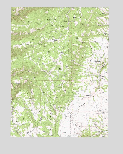
Curtis Ridge, UT USGS Topographic Map
Click on map above to begin viewing in our Map Viewer.

This topographic map contains these locations and features:
Feature Name Type Latitude Longitude GNIS ID View Map
Arbs BasinBasinN41.5236°W111.4724°1438261View Map
Beaver SpringSpringN41.5890°W111.4814°1438545View Map
Big Crawford CreekStreamN41.5691°W111.3821°1438650View Map
Big Crawford SpringSpringN41.5738°W111.3869°1438651View Map
Blacksmith SpringSpringN41.5329°W111.4533°1438895View Map
Blind SpringSpringN41.5658°W111.4385°1438914View Map
Bob Kiddys HoleBasinN41.5599°W111.3877°1438981View Map
Chicken CreekStreamN41.5019°W111.4135°1439664View Map
Chuckhole SpringSpringN41.6117°W111.4335°1439734View Map
Curtis RidgeRidgeN41.6074°W111.4924°1440209View Map
Davenport HollowValleyN41.5510°W111.4974°1440277View Map
Deer Sink SpringSpringN41.5698°W111.4909°1440394View Map
Deer SpringSpringN41.5530°W111.4694°1440399View Map
Dry Fork SpringSpringN41.5991°W111.3817°1440632View Map
Elk Sink SpringSpringN41.6078°W111.4465°1440909View Map
Elmo PondLakeN41.5709°W111.4590°1440920View Map
Frazier HollowValleyN41.5511°W111.4760°1441216View Map
Frazier SpringSpringN41.5433°W111.4594°1441217View Map
Hardware Ranch TrailTrailN41.5902°W111.4849°1441589View Map
Joann SpringSpringN41.6074°W111.4354°1442150View Map
Kearl SpringSpringN41.6135°W111.4459°1442289View Map
Lamb CanyonValleyN41.5402°W111.4041°1442427View Map
Lamb Canyon SpringSpringN41.5477°W111.4412°1442428View Map
Lewis SpringSpringN41.5006°W111.4282°1442572View Map
Little Crawford SpringSpringN41.5286°W111.4324°1442687View Map
Middle Davenport ReservoirReservoirN41.5132°W111.4969°1443331View Map
Monte Cristo RangeRangeN41.5499°W111.4841°1455149View Map
Mud SpringSpringN41.6103°W111.4681°1443707View Map
Pine SpringSpringN41.5705°W111.4991°1454860View Map
Red WellsSpringN41.5822°W111.4531°1444840View Map
Roundup SpringSpringN41.5938°W111.4444°1445188View Map
Running Water SpringSpringN41.5808°W111.4328°1445207View Map
Six Bit HollowValleyN41.5711°W111.3860°1445621View Map
Six Bit SpringSpringN41.5957°W111.4187°1445622View Map
Spence Basin SinkBasinN41.6119°W111.4216°1445954View Map
Spencer BasinBasinN41.6133°W111.4158°1445955View Map
Stove SpringSpringN41.5772°W111.3866°1446167View Map
The ValleyBasinN41.5911°W111.3849°1446513View Map
Thorsen SpringSpringN41.5777°W111.4771°1446552View Map
Valley SinkBasinN41.5916°W111.3938°1446908View Map
Valley SpringSpringN41.5544°W111.3941°1446909View Map
Walton GulchValleyN41.5088°W111.4141°1446974View Map
Willow Sink SpringSpringN41.6009°W111.4562°1447428View Map
Woodruff ParkFlatN41.5316°W111.4038°1447517View Map
Zion SpringSpringN41.5750°W111.4638°1447586View Map

Note: Coordinates in the location and feature list above are referenced to NAD83 datum.


Copyright (C) 2008-2025 Ryan Niemi / Sunset Dynamics ... All Rights Reserved