TopoQuest Logo
Do you find TopoQuest useful?
Help keep TopoQuest running and adding new maps/features by donating!
Bitcoin:  19c7KJd3qBynnjoSw5npx9KScwjBe4ifkT
Litecoin:  LXs6TkuXGGXo1vDsWCkWVdjQX94eUKd6ui
Home View Maps Find Maps Find Places Resources & Links


Birch Creek Reservoirs, Utah Topographic Map

USGS Map Title: Birch Creek Reservoirs, UT
USGS Map MRC: 41111E3
DRG (GeoTIFF) Download: o41111e3.tif


Neighboring USGS Topographic Map Quads:


  Red Spur Mountain, UT  
41111F4
 

  Old Canyon, UT  
41111F3
 

  Randolph, UT  
41111F2
 

  Curtis Ridge, UT  
41111E4
 

  Birch Creek Reservoirs, UT  
41111E3
 

  Woodruff, UT  
41111E2
 

  Dairy Ridge, UT  
41111D4
 

  Meachum Ridge, UT  
41111D3
 

  Neponset Reservoir NW, UT  
41111D2


Map MRC Location:

N42°
W112°
N42°
W111°
H8 H7 H6 H5 H4 H3 H2 H1
G8 G7 G6 G5 G4 G3 G2 G1
F8 F7 F6 F5 F4 F3 F2 F1
E8 E7 E6 E5 E4 E3 E2 E1
D8 D7 D6 D5 D4 D3 D2 D1
C8 C7 C6 C5 C4 C3 C2 C1
B8 B7 B6 B5 B4 B3 B2 B1
A8 A7 A6 A5 A4 A3 A2 A1
N41°
W112°
N41°
W111°

Birch Creek Reservoirs, UT USGS 1:24K Topographic Map Preview:
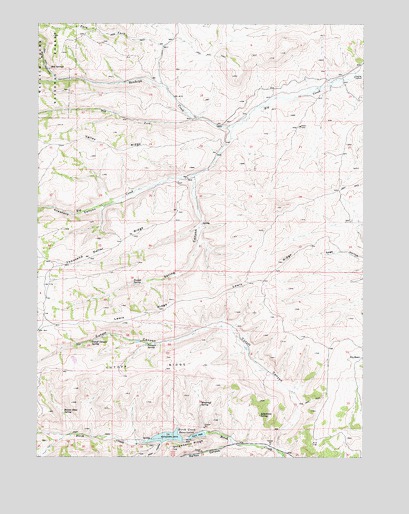
Birch Creek Reservoirs, UT USGS Topographic Map
Click on map above to begin viewing in our Map Viewer.

This topographic map contains these locations and features:
Feature Name Type Latitude Longitude GNIS ID View Map
Allan HollowValleyN41.5041°W111.3274°1438158View Map
Beaver Pond SpringSpringN41.5127°W111.3658°1425386View Map
Birch Creek CampgroundLocaleN41.5083°W111.3127°1435146View Map
Birch Creek ReservoirsReservoirN41.5055°W111.3199°1425607View Map
Crawford CanyonValleyN41.5949°W111.3033°1440136View Map
Cutoff CanyonValleyN41.5027°W111.2830°1440217View Map
Cutoff Canyon SpringSpringN41.5334°W111.3549°1427170View Map
Cutoff RidgeRidgeN41.5247°W111.3591°1440218View Map
Dry ForkStreamN41.5972°W111.3152°1440626View Map
Lewis RidgeRidgeN41.5455°W111.3155°1429600View Map
Limestone SpringSpringN41.5121°W111.2903°1429639View Map
Pole ForkStreamN41.6186°W111.3283°1431385View Map
Pole HollowValleyN41.6088°W111.3691°1444556View Map
Putman SpringSpringN41.5329°W111.3339°1431505View Map
Randolph CreekStreamN41.5955°W111.3013°1444721View Map
Red SpringsSpringN41.6119°W111.3719°1431704View Map
Spring CanyonValleyN41.5805°W111.3158°1432824View Map
Thousand Dollar RidgeRidgeN41.5574°W111.3549°1433480View Map
Trough SpringSpringN41.5499°W111.3390°1433680View Map
Valley RidgeRidgeN41.5894°W111.3474°1433867View Map
Walton CanyonValleyN41.5038°W111.3010°1446972View Map
Woodruff PasturesFlatN41.5677°W111.2580°1436666View Map
Woodruff SpringSpringN41.5152°W111.3132°1434467View Map

Note: Coordinates in the location and feature list above are referenced to NAD83 datum.


Copyright (C) 2008-2025 Ryan Niemi / Sunset Dynamics ... All Rights Reserved