TopoQuest Logo
Do you find TopoQuest useful?
Help keep TopoQuest running and adding new maps/features by donating!
Bitcoin:  19c7KJd3qBynnjoSw5npx9KScwjBe4ifkT
Litecoin:  LXs6TkuXGGXo1vDsWCkWVdjQX94eUKd6ui
Home View Maps Find Maps Find Places Resources & Links


Dairy Ridge, Utah Topographic Map

USGS Map Title: Dairy Ridge, UT
USGS Map MRC: 41111D4
DRG (GeoTIFF) Download: o41111d4.tif


Neighboring USGS Topographic Map Quads:


  Hardware Ranch, UT  
41111E5
 

  Curtis Ridge, UT  
41111E4
 

  Birch Creek Reservoirs, UT  
41111E3
 

  Monte Cristo Peak, UT  
41111D5
 

  Dairy Ridge, UT  
41111D4
 

  Meachum Ridge, UT  
41111D3
 

  Causey Dam, UT  
41111C5
 

  Horse Ridge, UT  
41111C4
 

  Peck Canyon, UT  
41111C3


Map MRC Location:

N42°
W112°
N42°
W111°
H8 H7 H6 H5 H4 H3 H2 H1
G8 G7 G6 G5 G4 G3 G2 G1
F8 F7 F6 F5 F4 F3 F2 F1
E8 E7 E6 E5 E4 E3 E2 E1
D8 D7 D6 D5 D4 D3 D2 D1
C8 C7 C6 C5 C4 C3 C2 C1
B8 B7 B6 B5 B4 B3 B2 B1
A8 A7 A6 A5 A4 A3 A2 A1
N41°
W112°
N41°
W111°

Dairy Ridge, UT USGS 1:24K Topographic Map Preview:
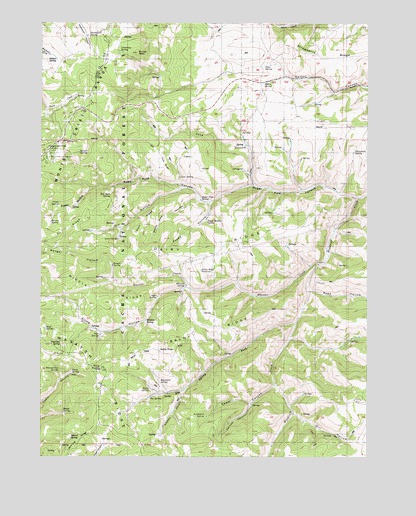
Dairy Ridge, UT USGS Topographic Map
Click on map above to begin viewing in our Map Viewer.

This topographic map contains these locations and features:
Feature Name Type Latitude Longitude GNIS ID View Map
Baldy PeakSummitN41.4055°W111.4519°1438366View Map
Baldy RidgeRidgeN41.4122°W111.4363°1438367View Map
Banks SpringSpringN41.3877°W111.4919°1438390View Map
Big SpringSpringN41.3922°W111.4587°1438737View Map
Big Spring ForkStreamN41.4138°W111.4027°1438742View Map
Bluff SpringSpringN41.4120°W111.4992°1438972View Map
Bountiful SpringSpringN41.3964°W111.4550°1439042View Map
Byram SpringSpringN41.4425°W111.4972°1439403View Map
Cave RidgeRidgeN41.4594°W111.4538°1439549View Map
Cave SpringSpringN41.4557°W111.4477°1439551View Map
Choke SpringSpringN41.3990°W111.4890°1439703View Map
Dairy RidgeRidgeN41.4338°W111.4391°1440236View Map
Dairy Ridge ReservoirReservoirN41.4287°W111.4397°1440237View Map
Davenport SpringSpringN41.4964°W111.4830°1440278View Map
Desert SpringSpringN41.3807°W111.4889°1440414View Map
Dip HollowValleyN41.4522°W111.4466°1440464View Map
Eccles PeakSummitN41.4916°W111.4644°1440859View Map
Eli RidgeRidgeN41.4405°W111.4910°1440892View Map
Freds HollowValleyN41.4522°W111.4808°1441221View Map
Freds SpringSpringN41.4479°W111.4939°1441222View Map
Front Hollow SpringSpringN41.3810°W111.4780°1454748View Map
Girl HollowValleyN41.3872°W111.4033°1441328View Map
Hansen CanyonValleyN41.3899°W111.4202°1441579View Map
Hatch SpringSpringN41.3956°W111.4598°1441629View Map
Indian SpringSpringN41.4894°W111.4951°1442028View Map
Limestone SpringSpringN41.4920°W111.4707°1442621View Map
Middle RidgeRidgeN41.4202°W111.4752°1443375View Map
Millie SpringSpringN41.4827°W111.4152°1443495View Map
Monte Cristo CampgroundLocaleN41.4613°W111.4977°1443563View Map
Monte Cristo Guard StationLocaleN41.4638°W111.4983°1443564View Map
Neponset SpringSpringN41.4069°W111.4927°1443801View Map
Open SpringSpringN41.4213°W111.4562°1444100View Map
Peggy HollowValleyN41.4483°W111.4358°1444268View Map
Peggy Hollow SpringSpringN41.4434°W111.4371°1444269View Map
Petes SpringSpringN41.4878°W111.4153°1444320View Map
Phosphate SpringSpringN41.4628°W111.3808°1444334View Map
Pipe SpringSpringN41.4098°W111.4783°1444455View Map
Ranger HollowValleyN41.4269°W111.4733°1444722View Map
Ranger SpringSpringN41.4304°W111.4732°1444723View Map
Red Rock SpringSpringN41.4504°W111.4741°1444837View Map
Road HollowValleyN41.4230°W111.3974°1445009View Map
Sawmill CanyonValleyN41.3955°W111.4110°1445346View Map
Silvia HollowValleyN41.4236°W111.4455°1445603View Map
Sleepy GulchValleyN41.3938°W111.4458°1445671View Map
Southwick SpringSpringN41.3869°W111.4376°1445941View Map
Sprout SpringSpringN41.4625°W111.4862°1446061View Map
Sugar Pine CanyonValleyN41.4494°W111.3802°1446211View Map
Sugar Pine SpringSpringN41.4487°W111.4395°1446212View Map
Swan RidgeRidgeN41.4416°W111.4610°1446275View Map
Swan SpringSpringN41.4376°W111.4710°1446276View Map
Wheatgrass SpringSpringN41.3999°W111.4936°1447210View Map
Wheeler CreekStreamN41.4302°W111.3941°1447211View Map
Wheeler SpringSpringN41.4244°W111.4454°1447216View Map
White Pine HollowValleyN41.4497°W111.4410°1447274View Map
William SpringSpringN41.4142°W111.4603°1454953View Map
Zeke HollowValleyN41.4533°W111.4194°1447583View Map
Zeke Hollow CorralLocaleN41.4663°W111.4221°1454960View Map

Note: Coordinates in the location and feature list above are referenced to NAD83 datum.


Copyright (C) 2008-2025 Ryan Niemi / Sunset Dynamics ... All Rights Reserved