TopoQuest Logo
Do you find TopoQuest useful?
Help keep TopoQuest running and adding new maps/features by donating!
Bitcoin:  19c7KJd3qBynnjoSw5npx9KScwjBe4ifkT
Litecoin:  LXs6TkuXGGXo1vDsWCkWVdjQX94eUKd6ui
Home View Maps Find Maps Find Places Resources & Links


Cut And Shoot, Texas Topographic Map

USGS Map Title: Cut And Shoot, TX
USGS Map MRC: 30095C3
DRG (GeoTIFF) Download: o30095c3.tif


Neighboring USGS Topographic Map Quads:


  Willis, TX  
30095D4
 

  Conroe NE, TX  
30095D3
 

  Bear Creek, TX  
30095D2
 

  Conroe, TX  
30095C4
 

  Cut And Shoot, TX  
30095C3
 

  Fostoria, TX  
30095C2
 

  Tamina, TX  
30095B4
 

  Outlaw Pond, TX  
30095B3
 

  Splendora, TX  
30095B2


Map MRC Location:

N31°
W96°
N31°
W95°
H8 H7 H6 H5 H4 H3 H2 H1
G8 G7 G6 G5 G4 G3 G2 G1
F8 F7 F6 F5 F4 F3 F2 F1
E8 E7 E6 E5 E4 E3 E2 E1
D8 D7 D6 D5 D4 D3 D2 D1
C8 C7 C6 C5 C4 C3 C2 C1
B8 B7 B6 B5 B4 B3 B2 B1
A8 A7 A6 A5 A4 A3 A2 A1
N30°
W96°
N30°
W95°

Cut And Shoot, TX USGS 1:24K Topographic Map Preview:
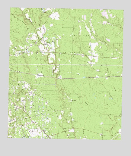
Cut And Shoot, TX USGS Topographic Map
Click on map above to begin viewing in our Map Viewer.

This topographic map contains these locations and features:
Feature Name Type Latitude Longitude GNIS ID View Map
Austin Elementary SchoolSchoolN30.3322°W95.3431°2007465View Map
Austin SchoolSchoolN30.3324°W95.3433°1381183View Map
Bart LakeReservoirN30.3721°W95.3382°1383023View Map
Bart Lake DamDamN30.3719°W95.3385°1854472View Map
Ben Milam SchoolSchoolN30.2602°W95.3135°1381186View Map
Black DiamondLocaleN30.2877°W95.3060°1381189View Map
Cagle BranchStreamN30.3213°W95.3233°1381194View Map
Caney Creek High SchoolSchoolN30.2558°W95.3125°2007473View Map
City of Cut and ShootCivilN30.3377°W95.3451°2412399View Map
Coney Creek High School Football StadiumParkN30.2524°W95.3122°2027922View Map
Crater HillSummitN30.2816°W95.3577°1333632View Map
Crater LakeLakeN30.2804°W95.3573°1381202View Map
Creighton Intermediate SchoolSchoolN30.2524°W95.3088°2007476View Map
Cut - N - Shoot Volunteer Fire Department Station 21 MCESD 12BuildingN30.3336°W95.3490°2655504View Map
Cut and ShootPopulated PlaceN30.3333°W95.3580°1381207View Map
Cut and Shoot AirportAirportN30.3107°W95.3271°1386416View Map
Cut and Shoot City HallBuildingN30.3335°W95.3502°2753779View Map
Cut and Shoot Police DepartmentBuildingN30.3335°W95.3502°2751292View Map
Cut N Shoot Volunteer Fire Department Station 22BuildingN30.3295°W95.2786°2655529View Map
East Fork Crystal CreekStreamN30.2747°W95.3588°1383086View Map
GrangerlandPopulated PlaceN30.2527°W95.3294°1381214View Map
Grangerland Volunteer Fire Department Station 41BuildingN30.2565°W95.3155°2334611View Map
GrocevillePopulated PlaceN30.3410°W95.3341°1381216View Map
KJZS-FM (Conroe)TowerN30.2633°W95.3222°1385820View Map
Lake WildwoodReservoirN30.3035°W95.3669°1862949View Map
Lake Wildwood DamDamN30.3035°W95.3669°1862948View Map
McRae CreekStreamN30.3527°W95.3447°1383135View Map
Milam BranchStreamN30.2772°W95.2797°1381229View Map
Montgomery County Hospital District Emergency Medical Services Station 41BuildingN30.2566°W95.3153°2720905View Map
Montgomery County Hospital District Emergency Medical Services Station 42BuildingN30.3336°W95.3494°2720864View Map
Moorhead Junior High SchoolSchoolN30.2547°W95.3127°2007444View Map
New Bethlehem ChurchChurchN30.3416°W95.3452°1381232View Map
Saddle Blanket PondLakeN30.2508°W95.3502°1383171View Map
Shady Grove ChurchChurchN30.3419°W95.3341°1381257View Map
TimberLocaleN30.3099°W95.2766°1381266View Map
WaukeganPopulated PlaceN30.3099°W95.3394°1381272View Map
West Fork Crystal CreekStreamN30.2747°W95.3588°1381274View Map
West Fork Spring BranchStreamN30.2694°W95.2574°1383209View Map
WigginsvillePopulated PlaceN30.2583°W95.3372°1381275View Map
YouensPopulated PlaceN30.3155°W95.3747°1383217View Map

Note: Coordinates in the location and feature list above are referenced to NAD83 datum.


Copyright (C) 2008-2025 Ryan Niemi / Sunset Dynamics ... All Rights Reserved