TopoQuest Logo
Do you find TopoQuest useful?
Help keep TopoQuest running and adding new maps/features by donating!
Bitcoin:  19c7KJd3qBynnjoSw5npx9KScwjBe4ifkT
Litecoin:  LXs6TkuXGGXo1vDsWCkWVdjQX94eUKd6ui
Home View Maps Find Maps Find Places Resources & Links


Cut Bank SE, Montana Topographic Map

USGS Map Title: Cut Bank SE, MT
USGS Map MRC: 48112E3
DRG (GeoTIFF) Download: o48112e3.tif


Neighboring USGS Topographic Map Quads:


  Gunsight, MT  
48112F4
 

  Cut Bank, MT  
48112F3
 

  Ethridge NW, MT  
48112F2
 

  Squaw Buttes, MT  
48112E4
 

  Cut Bank SE, MT  
48112E3
 

  Boru Spring, MT  
48112E2
 

  Flag Butte, MT  
48112D4
 

  Rock City, MT  
48112D3
 

  Abbott Lake, MT  
48112D2


Map MRC Location:

N49°
W113°
N49°
W112°
H8 H7 H6 H5 H4 H3 H2 H1
G8 G7 G6 G5 G4 G3 G2 G1
F8 F7 F6 F5 F4 F3 F2 F1
E8 E7 E6 E5 E4 E3 E2 E1
D8 D7 D6 D5 D4 D3 D2 D1
C8 C7 C6 C5 C4 C3 C2 C1
B8 B7 B6 B5 B4 B3 B2 B1
A8 A7 A6 A5 A4 A3 A2 A1
N48°
W113°
N48°
W112°

Cut Bank SE, MT USGS 1:24K Topographic Map Preview:
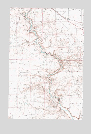
Cut Bank SE, MT USGS Topographic Map
Click on map above to begin viewing in our Map Viewer.

This topographic map contains these locations and features:
Feature Name Type Latitude Longitude GNIS ID View Map
32N05W16AACC01 WellWellN48.5350°W112.2587°1635823View Map
32N05W16BC__01 WellWellN48.5350°W112.2698°1635824View Map
32N05W30BB__01 WellWellN48.5108°W112.3131°1635773View Map
32N05W30BD__02 WellWellN48.5075°W112.3078°1635759View Map
32N05W30BDDA01 WellWellN48.5075°W112.3078°1635758View Map
32N05W30DC__01 WellWellN48.5005°W112.3023°1635735View Map
32N06W01AC__01 WellWellN48.5639°W112.3264°1635899View Map
32N06W24DA__01 WellWellN48.5172°W112.3209°1635784View Map
32N06W25AD__01 WellWellN48.5064°W112.3209°1635753View Map
33N05W17AD__01 WellWellN48.6192°W112.2792°1636044View Map
33N05W17DA__01 WellWellN48.6155°W112.2792°1636036View Map
33N05W17DA__02 WellWellN48.6155°W112.2792°1636037View Map
33N05W19AB__01 WellWellN48.6086°W112.3067°1636023View Map
33N05W20DA__01 WellWellN48.6014°W112.2792°1635996View Map
33N05W21BB__01 WellWellN48.6086°W112.2739°1636021View Map
33N05W21BBBD02 WellWellN48.6086°W112.2739°1636022View Map
33N05W21BC__01 WellWellN48.6050°W112.2739°1636005View Map
33N05W21DA__01 WellWellN48.6014°W112.2575°1635995View Map
33N05W22BC__01 WellWellN48.6050°W112.2520°1636004View Map
33N05W29CA__01 WellWellN48.5869°W112.2903°1635953View Map
33N05W30AA__01 WellWellN48.5941°W112.3012°1635977View Map
33N05W32AD__01 WellWellN48.5761°W112.2792°1635926View Map
33N06W14CA__01 WellWellN48.6141°W112.3570°1636034View Map
33N06W24BB__01 WellWellN48.6066°W112.3406°1636011View Map
Baltic (historical)LocaleN48.6111°W112.2759°1750430View Map
Cut Bank Golf and Country ClubLocaleN48.6222°W112.3481°1750558View Map
Cut Bank International AirportAirportN48.6075°W112.3661°806398View Map
Spring CouleeValleyN48.5869°W112.3453°1750581View Map
Spring CreekStreamN48.5878°W112.3300°777059View Map

Note: Coordinates in the location and feature list above are referenced to NAD83 datum.


Copyright (C) 2008-2025 Ryan Niemi / Sunset Dynamics ... All Rights Reserved