TopoQuest Logo
Do you find TopoQuest useful?
Help keep TopoQuest running and adding new maps/features by donating!
Bitcoin:  19c7KJd3qBynnjoSw5npx9KScwjBe4ifkT
Litecoin:  LXs6TkuXGGXo1vDsWCkWVdjQX94eUKd6ui
Home View Maps Find Maps Find Places Resources & Links


Cut Off, Louisiana Topographic Map

USGS Map Title: Cut Off, LA
USGS Map MRC: 29090E3
DRG (GeoTIFF) Download: o29090e3.tif


Neighboring USGS Topographic Map Quads:


  Gheens, LA  
29090F4
 

  Catahoula Bay, LA  
29090F3


  Larose, LA  
29090E4
 

  Cut Off, LA  
29090E3
 

  Bay L'Ours, LA  
29090E2
 

  Lake Bully Camp, LA  
29090D4
 

  Golden Meadow, LA  
29090D3
 

  Golden Meadow Farms, LA  
29090D2


Map MRC Location:

N30°
W91°
N30°
W90°
H8 H7 H6 H5 H4 H3 H2 H1
G8 G7 G6 G5 G4 G3 G2 G1
F8 F7 F6 F5 F4 F3 F2 F1
E8 E7 E6 E5 E4 E3 E2 E1
D8 D7 D6 D5 D4 D3 D2 D1
C8 C7 C6 C5 C4 C3 C2 C1
B8 B7 B6 B5 B4 B3 B2 B1
A8 A7 A6 A5 A4 A3 A2 A1
N29°
W91°
N29°
W90°

Cut Off, LA USGS 1:24K Topographic Map Preview:
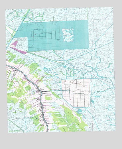
Cut Off, LA USGS Topographic Map
Click on map above to begin viewing in our Map Viewer.

This topographic map contains these locations and features:
Feature Name Type Latitude Longitude GNIS ID View Map
Bayou de la GaucheGutN29.5402°W90.2642°532399View Map
Bayou Des AmoreuxGutN29.5747°W90.2681°532566View Map
Bayou PierceGutN29.5594°W90.2829°532717View Map
Bayou PoignardGutN29.5699°W90.2829°532731View Map
Bayou Poignard Gas FieldOilfieldN29.5760°W90.3162°532732View Map
Bon Service Shopping CenterLocaleN29.5508°W90.3495°557799View Map
Christian Fellowship ChurchChurchN29.5595°W90.3540°2601489View Map
Clovelly AirportAirportN29.5411°W90.3070°557807View Map
Clovelly FarmsPopulated PlaceN29.5405°W90.2931°541072View Map
Clovelly Farms Seaplane BaseAirportN29.5510°W90.3062°1632682View Map
Cote Blanche BridgeBridgeN29.5149°W90.3334°557808View Map
Cut OffPopulated PlaceN29.5427°W90.3381°554153View Map
Cut Off Census Designated PlaceCensusN29.5164°W90.3291°2402391View Map
Cut Off Church of ChristChurchN29.5654°W90.3636°2601558View Map
Cut Off Community Bible ChurchChurchN29.5311°W90.3350°2601559View Map
Cut Off Elementary SchoolSchoolN29.5340°W90.3395°1629613View Map
Cut Off Oil and Gas FieldOilfieldN29.5488°W90.2981°534313View Map
Delta FarmsLocaleN29.5999°W90.3301°534494View Map
Dixie Delta CanalCanalN29.6119°W90.3162°534539View Map
First Baptist ChurchChurchN29.5672°W90.3732°2601743View Map
KBAU-FM (Galliano)TowerN29.5505°W90.3512°1632446View Map
Lady of the Sea Hospital HeliportAirportN29.5002°W90.3334°1632711View Map
Lafourche Parish Fire District 3 East Cut Off StationBuildingN29.5288°W90.3350°2691654View Map
Lafourche Parish Fire District 3 West Cut Off StationBuildingN29.5261°W90.3360°2691653View Map
Lafourche Parish Fire District 3 West Larose Volunteer Fire StationBuildingN29.5620°W90.3640°2691650View Map
Larose Cut Off Middle SchoolSchoolN29.5637°W90.3647°557837View Map
Larose Oil and Gas FieldOilfieldN29.6113°W90.3465°536340View Map
Ledet Airfield (historical)AirportN29.5555°W90.3295°1632681View Map
Lions ParkParkN29.5091°W90.3151°536468View Map
Mount Zion Baptist ChurchChurchN29.5577°W90.3524°2602396View Map
Mount Zion SchoolSchoolN29.5577°W90.3526°537460View Map
New Mount Zion Baptist CemeteryCemeteryN29.5593°W90.3500°537421View Map
Opportunity Place Adult Education Center South CampusSchoolN29.5348°W90.3350°2493523View Map
Parish Governing Authority District 12 (historical)CivilN29.6085°W90.2587°1929828View Map
Parish Governing Authority District 8CivilN29.5955°W90.2764°1930238View Map
Raccoon BayouGutN29.5147°W90.3451°538467View Map
Sacred Heart Cemetery / MausoleumCemeteryN29.5138°W90.3343°536329View Map
Sacred Heart ChurchChurchN29.5145°W90.3343°2602358View Map
Scully CanalCanalN29.5419°W90.3237°539235View Map
South Lafourche Nursing CenterBuildingN29.5527°W90.3351°2601129View Map
South Larose Elementary SchoolSchoolN29.5623°W90.3641°2493422View Map

Note: Coordinates in the location and feature list above are referenced to NAD83 datum.


Copyright (C) 2008-2025 Ryan Niemi / Sunset Dynamics ... All Rights Reserved