TopoQuest Logo
Do you find TopoQuest useful?
Help keep TopoQuest running and adding new maps/features by donating!
Bitcoin:  19c7KJd3qBynnjoSw5npx9KScwjBe4ifkT
Litecoin:  LXs6TkuXGGXo1vDsWCkWVdjQX94eUKd6ui
Home View Maps Find Maps Find Places Resources & Links


Golden Meadow, Louisiana Topographic Map

USGS Map Title: Golden Meadow, LA
USGS Map MRC: 29090D3
DRG (GeoTIFF) Download: o29090d3.tif


Neighboring USGS Topographic Map Quads:


  Larose, LA  
29090E4
 

  Cut Off, LA  
29090E3
 

  Bay L'Ours, LA  
29090E2
 

  Lake Bully Camp, LA  
29090D4
 

  Golden Meadow, LA  
29090D3
 

  Golden Meadow Farms, LA  
29090D2
 

  Lake Felicity, LA  
29090C4
 

  Bay Courant, LA  
29090C3
 

  Mink Bayou, LA  
29090C2


Map MRC Location:

N30°
W91°
N30°
W90°
H8 H7 H6 H5 H4 H3 H2 H1
G8 G7 G6 G5 G4 G3 G2 G1
F8 F7 F6 F5 F4 F3 F2 F1
E8 E7 E6 E5 E4 E3 E2 E1
D8 D7 D6 D5 D4 D3 D2 D1
C8 C7 C6 C5 C4 C3 C2 C1
B8 B7 B6 B5 B4 B3 B2 B1
A8 A7 A6 A5 A4 A3 A2 A1
N29°
W91°
N29°
W90°

Golden Meadow, LA USGS 1:24K Topographic Map Preview:
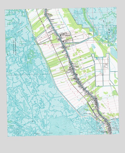
Golden Meadow, LA USGS Topographic Map
Click on map above to begin viewing in our Map Viewer.

This topographic map contains these locations and features:
Feature Name Type Latitude Longitude GNIS ID View Map
Bayou BlueBayN29.4399°W90.3567°532456View Map
Bayou BouillonBayN29.4346°W90.3745°532470View Map
Bayou FaleauBayN29.3759°W90.3679°532589View Map
Bayou MonnaieBayN29.3995°W90.3249°532696View Map
Bayou RaphaelGutN29.4708°W90.2751°532750View Map
Belle AmiePopulated PlaceN29.4941°W90.3279°542974View Map
Breton CanalCanalN29.4680°W90.2870°553772View Map
Catfish LakeBayN29.3785°W90.3118°553928View Map
Cheramie CemeteryCemeteryN29.4449°W90.3004°533902View Map
Christian Family CenterChurchN29.4309°W90.2947°2601487View Map
Clovelly Oil and Gas FieldOilfieldN29.4772°W90.2587°534006View Map
Cut Off Post OfficePost OfficeN29.4863°W90.3251°1632182View Map
Faleau (historical)Populated PlaceN29.3922°W90.3473°557814View Map
First Baptist ChurchChurchN29.3932°W90.2737°2601731View Map
Freedom Worship CenterChurchN29.4446°W90.3022°2602012View Map
GallianoPopulated PlaceN29.4422°W90.2992°543225View Map
Galliano BridgeBridgeN29.4341°W90.2976°557816View Map
Galliano Census Designated PlaceCensusN29.4471°W90.3096°2402512View Map
Galliano Elementary SchoolSchoolN29.4419°W90.3035°557817View Map
Galliano Junior High SchoolSchoolN29.4416°W90.3037°557818View Map
Galliano Post OfficePost OfficeN29.4450°W90.3116°1632186View Map
Golden MeadowPopulated PlaceN29.3791°W90.2601°535261View Map
Golden Meadow BridgeBridgeN29.3894°W90.2645°557820View Map
Golden Meadow Lower Elementary SchoolSchoolN29.4090°W90.2773°557821View Map
Golden Meadow Middle SchoolSchoolN29.3885°W90.2647°557822View Map
Golden Meadow Police DepartmentBuildingN29.3936°W90.2698°2334152View Map
Golden Meadow Upper Elementary SchoolSchoolN29.4054°W90.2763°557823View Map
Hebert CemeteryCemeteryN29.4137°W90.2814°535596View Map
J and K Mobile ParkPopulated PlaceN29.4351°W90.2942°2600430View Map
KLEB-AM (Golden Meadow)TowerN29.3955°W90.2670°1633177View Map
Lady of the Sea General HospitalHospitalN29.4569°W90.3114°557831View Map
Lafourche Parish Fire District 3 Central Fire StationBuildingN29.4506°W90.3047°2332373View Map
Lafourche Parish Fire District 3 South Golden Meadow StationBuildingN29.3863°W90.2623°2691741View Map
Lafourche Parish Fire District 3 West Galliano StationBuildingN29.4419°W90.3023°2691660View Map
Lafourche Parish Health Unit Cut Off OfficeBuildingN29.4781°W90.3219°2601200View Map
Lafourche Parish Library Golden Meadow BranchBuildingN29.4007°W90.2740°2603100View Map
Lafourche Parish Library South Lafourche BranchBuildingN29.4734°W90.3133°2603106View Map
Lafourche Parish Sheriff's Office South Lafourche Sub StationBuildingN29.4991°W90.3299°2334236View Map
Lake CheniereBayN29.3983°W90.3631°553969View Map
Lighthouse Worship CenterChurchN29.4402°W90.3089°2602189View Map
Louisiana Technical College Galliano CampusSchoolN29.4737°W90.3073°1958395View Map
Oak Ridge Community ParkParkN29.3919°W90.2823°1958393View Map
Our Lady of Prompt Succor CemeteryCemeteryN29.3952°W90.2727°538223View Map
Our Lady of Prompt Succor ChurchChurchN29.3956°W90.2721°2602547View Map
Parish Governing Authority District 13 (historical)CivilN29.4952°W90.3381°1929843View Map
Parish Governing Authority District 14 (historical)CivilN29.4305°W90.3320°1929853View Map
Saint Joseph ChurchChurchN29.4344°W90.2981°555902View Map
South Lafourche BridgeBridgeN29.4722°W90.3145°557884View Map
South Lafourche ChurchChurchN29.4599°W90.3073°1958394View Map
South Lafourche High SchoolSchoolN29.4675°W90.3108°557885View Map
South Lafourche Leonard Miller Junior AirportAirportN29.4436°W90.2630°1632712View Map
Tidelands Country ClubLocaleN29.4741°W90.2826°558833View Map
Town of Golden MeadowCivilN29.3876°W90.2739°2406584View Map
Valere Guidry School (historical)SchoolN29.4972°W90.3284°557897View Map
Ward TenCivilN29.4772°W90.3065°545102View Map
West Fork Bayou L'OursGutN29.4763°W90.2740°540312View Map
William Petre School (historical)SchoolN29.4619°W90.3092°557900View Map
Williams CemeteryCemeteryN29.4029°W90.2751°540426View Map

Note: Coordinates in the location and feature list above are referenced to NAD83 datum.


Copyright (C) 2008-2024 Ryan Niemi / Sunset Dynamics ... All Rights Reserved