TopoQuest Logo
Do you find TopoQuest useful?
Help keep TopoQuest running and adding new maps/features by donating!
Bitcoin:  19c7KJd3qBynnjoSw5npx9KScwjBe4ifkT
Litecoin:  LXs6TkuXGGXo1vDsWCkWVdjQX94eUKd6ui
Home View Maps Find Maps Find Places Resources & Links


Dalbo, Minnesota Topographic Map

USGS Map Title: Dalbo, MN
USGS Map MRC: 45093F4
DRG (GeoTIFF) Download: o45093f4.tif


Neighboring USGS Topographic Map Quads:


  Bock, MN  
45093G5
 

  Ogilvie, MN  
45093G4
 

  Mora South, MN  
45093G3
 

  Princeton NE, MN  
45093F5
 

  Dalbo, MN  
45093F4
 

  Springvale, MN  
45093F3
 

  Princeton, MN  
45093E5
 

  Wyanett, MN  
45093E4
 

  Bradford, MN  
45093E3


Map MRC Location:

N46°
W94°
N46°
W93°
H8 H7 H6 H5 H4 H3 H2 H1
G8 G7 G6 G5 G4 G3 G2 G1
F8 F7 F6 F5 F4 F3 F2 F1
E8 E7 E6 E5 E4 E3 E2 E1
D8 D7 D6 D5 D4 D3 D2 D1
C8 C7 C6 C5 C4 C3 C2 C1
B8 B7 B6 B5 B4 B3 B2 B1
A8 A7 A6 A5 A4 A3 A2 A1
N45°
W94°
N45°
W93°

Dalbo, MN USGS 1:24K Topographic Map Preview:
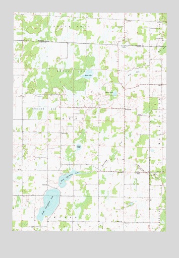
Dalbo, MN USGS Topographic Map
Click on map above to begin viewing in our Map Viewer.

This topographic map contains these locations and features:
Feature Name Type Latitude Longitude GNIS ID View Map
CarmodyPopulated PlaceN45.6516°W93.4713°654630View Map
Carmody Post Office (historical)Post OfficeN45.6517°W93.4711°2069221View Map
DalboPopulated PlaceN45.6589°W93.3988°642601View Map
Dalbo Baptist ChurchChurchN45.6586°W93.4083°2069331View Map
Dalbo Fire DepartmentBuildingN45.6547°W93.3903°2666539View Map
Dalbo Memorial ParkParkN45.6486°W93.4083°2069332View Map
Dalbo Post OfficePost OfficeN45.6586°W93.3988°2069330View Map
Dalbo Wildlife Management AreaParkN45.7111°W93.4583°2069232View Map
DayPopulated PlaceN45.7091°W93.3794°642660View Map
Day Post Office (historical)Post OfficeN45.7092°W93.3792°2069215View Map
Dobe Wildlife Management AreaParkN45.6722°W93.4472°2069233View Map
Grass LakeLakeN45.6729°W93.4466°644373View Map
Hawthorne SchoolSchoolN45.7414°W93.3883°644750View Map
Karmel ChurchChurchN45.6302°W93.4147°646042View Map
Karmel Covenant CemeteryCemeteryN45.6305°W93.4161°2069281View Map
Karmel SchoolSchoolN45.6302°W93.4086°646043View Map
Krone BogSwampN45.7141°W93.4533°646261View Map
Krone LakeLakeN45.7146°W93.4396°646262View Map
Lewis Lake ChurchChurchN45.7350°W93.3786°646621View Map
Lincoln SchoolSchoolN45.6589°W93.4097°646698View Map
Lindgren LakeLakeN45.7308°W93.4097°646717View Map
Matson LakeLakeN45.7036°W93.4173°647615View Map
Moss LakeSwampN45.7294°W93.3766°648133View Map
North Stanchfield LakeLakeN45.6552°W93.4561°648694View Map
North Star SchoolSchoolN45.6808°W93.4608°648700View Map
Odegard BogSwampN45.6930°W93.4738°648896View Map
PFAU AirstripAirportN45.6565°W93.4846°2770417View Map
Salem CemeteryCemeteryN45.6586°W93.3791°651096View Map
Salem ChurchChurchN45.6575°W93.3847°651104View Map
South Stanchfield LakeLakeN45.6405°W93.4703°652347View Map
South Stanchfield Lake DamDamN45.6483°W93.4652°1776713View Map
Stanchfield LakeReservoirN45.6483°W93.4652°1776714View Map
Township of DalboCivilN45.6888°W93.4511°663916View Map
West LakeLakeN45.7155°W93.4025°653976View Map
Whittier SchoolSchoolN45.6944°W93.4088°654122View Map

Note: Coordinates in the location and feature list above are referenced to NAD83 datum.


Copyright (C) 2008-2024 Ryan Niemi / Sunset Dynamics ... All Rights Reserved