TopoQuest Logo
Do you find TopoQuest useful?
Help keep TopoQuest running and adding new maps/features by donating!
Bitcoin:  19c7KJd3qBynnjoSw5npx9KScwjBe4ifkT
Litecoin:  LXs6TkuXGGXo1vDsWCkWVdjQX94eUKd6ui
Home View Maps Find Maps Find Places Resources & Links


Dallas, Wisconsin Topographic Map

USGS Map Title: Dallas, WI
USGS Map MRC: 45091C7
DRG (GeoTIFF) Download: o45091c7.tif


Neighboring USGS Topographic Map Quads:


  Poskin, WI  
45091D8
 

  Barron, WI  
45091D7
 

  Rice Lake South, WI  
45091D6
 

  Dorrity Creek, WI  
45091C8
 

  Dallas, WI  
45091C7
 

  Chetek, WI  
45091C6
 

  Ridgeland, WI  
45091B8
 

  Ridgeland NE, WI  
45091B7
 

  Sand Creek, WI  
45091B6


Map MRC Location:

N46°
W92°
N46°
W91°
H8 H7 H6 H5 H4 H3 H2 H1
G8 G7 G6 G5 G4 G3 G2 G1
F8 F7 F6 F5 F4 F3 F2 F1
E8 E7 E6 E5 E4 E3 E2 E1
D8 D7 D6 D5 D4 D3 D2 D1
C8 C7 C6 C5 C4 C3 C2 C1
B8 B7 B6 B5 B4 B3 B2 B1
A8 A7 A6 A5 A4 A3 A2 A1
N45°
W92°
N45°
W91°

Dallas, WI USGS 1:24K Topographic Map Preview:
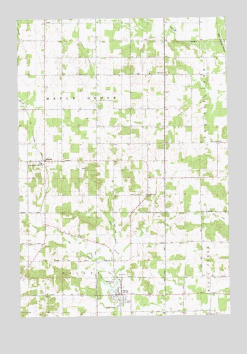
Dallas, WI USGS Topographic Map
Click on map above to begin viewing in our Map Viewer.

This topographic map contains these locations and features:
Feature Name Type Latitude Longitude GNIS ID View Map
Anderson DamDamN45.2583°W91.8185°1792114View Map
DallasPopulated PlaceN45.2591°W91.8149°1563676View Map
Dallas - Sioux Creek Joint Fire DepartmentBuildingN45.2594°W91.8172°2696880View Map
Dallas CemeteryCemeteryN45.2727°W91.8227°1563677View Map
Dallas Elementary SchoolSchoolN45.2588°W91.8143°1837910View Map
Dallas FlowageReservoirN45.2610°W91.8206°1792115View Map
East Branch Upper Pine CreekStreamN45.2611°W91.8208°2547938View Map
Gilbertson School (historical)SchoolN45.2811°W91.8310°1837933View Map
HillsdalePopulated PlaceN45.3158°W91.8596°1566450View Map
Howard School (historical)SchoolN45.2808°W91.7510°1837948View Map
Irving School (historical)SchoolN45.3080°W91.7921°1837953View Map
Langlade School (historical)SchoolN45.3691°W91.8277°1837960View Map
Last Chance DairyLocaleN45.3336°W91.7889°2611494View Map
Maple Grove Center School (historical)SchoolN45.3552°W91.8585°1837966View Map
New Scandinavia CemeteryCemeteryN45.3011°W91.7991°1988536View Map
North Branch Upper Pine CreekStreamN45.2750°W91.8163°1577235View Map
Old Hillsdale CemeteryCemeteryN45.3141°W91.8696°1570777View Map
Pershing School (historical)SchoolN45.2808°W91.8030°1837979View Map
Pine Crest Golf CourseLocaleN45.2675°W91.8143°1988877View Map
Prairie Lake Evangelical Covenant ChurchChurchN45.3227°W91.7554°1571882View Map
Prairie Lake Heights School (historical)SchoolN45.3363°W91.7871°1837990View Map
Scandinavia ChurchChurchN45.3005°W91.7982°1573769View Map
Severson Number 2 Landing Strip (historical)AirportN45.2636°W91.8188°1838014View Map
Sioux Creek CemeteryCemeteryN45.2505°W91.7579°1574200View Map
Sioux Creek School (historical)SchoolN45.2522°W91.7627°1838015View Map
Town of DallasCivilN45.2507°W91.8518°1583046View Map
Town of Maple GroveCivilN45.3367°W91.8489°1583642View Map
Village of DallasCivilN45.2590°W91.8143°1583045View Map
WickwarePopulated PlaceN45.3513°W91.7863°1576713View Map
Woodside School (historical)SchoolN45.3441°W91.8285°1838037View Map
Yellow RiverStreamN45.3641°W91.7524°1577089View Map

Note: Coordinates in the location and feature list above are referenced to NAD83 datum.


Copyright (C) 2008-2025 Ryan Niemi / Sunset Dynamics ... All Rights Reserved