TopoQuest Logo
Do you find TopoQuest useful?
Help keep TopoQuest running and adding new maps/features by donating!
Bitcoin:  19c7KJd3qBynnjoSw5npx9KScwjBe4ifkT
Litecoin:  LXs6TkuXGGXo1vDsWCkWVdjQX94eUKd6ui
Home View Maps Find Maps Find Places Resources & Links


Ridgeland, Wisconsin Topographic Map

USGS Map Title: Ridgeland, WI
USGS Map MRC: 45091B8
DRG (GeoTIFF) Download: o45091b8.tif


Neighboring USGS Topographic Map Quads:


  Arland, WI  
45092C1
 

  Dorrity Creek, WI  
45091C8
 

  Dallas, WI  
45091C7
 

  Connorsville, WI  
45092B1
 

  Ridgeland, WI  
45091B8
 

  Ridgeland NE, WI  
45091B7
 

  Boyceville, WI  
45092A1
 

  Wheeler, WI  
45091A8
 

  Norton, WI  
45091A7


Map MRC Location:

N46°
W92°
N46°
W91°
H8 H7 H6 H5 H4 H3 H2 H1
G8 G7 G6 G5 G4 G3 G2 G1
F8 F7 F6 F5 F4 F3 F2 F1
E8 E7 E6 E5 E4 E3 E2 E1
D8 D7 D6 D5 D4 D3 D2 D1
C8 C7 C6 C5 C4 C3 C2 C1
B8 B7 B6 B5 B4 B3 B2 B1
A8 A7 A6 A5 A4 A3 A2 A1
N45°
W92°
N45°
W91°

Ridgeland, WI USGS 1:24K Topographic Map Preview:
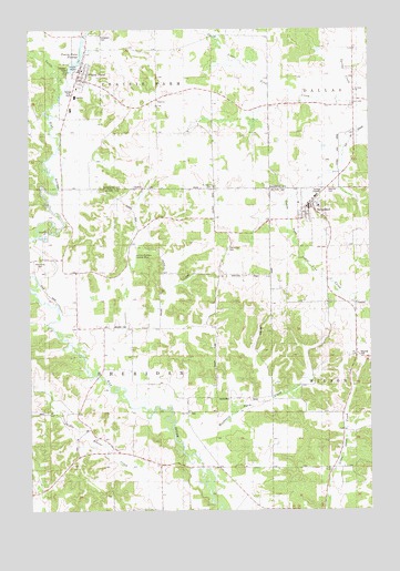
Ridgeland, WI USGS Topographic Map
Click on map above to begin viewing in our Map Viewer.

This topographic map contains these locations and features:
Feature Name Type Latitude Longitude GNIS ID View Map
Bilse School (historical)SchoolN45.1936°W91.9260°1578511View Map
Blairmoor School (historical)SchoolN45.1358°W91.8899°1578512View Map
Cub Acres AirportAirportN45.1799°W91.9882°1582162View Map
Dammon Ridge School (historical)SchoolN45.1789°W91.8802°1578514View Map
Evergreen CemeteryCemeteryN45.2477°W91.9738°1564760View Map
Faith ChurchChurchN45.2316°W91.9527°1564832View Map
Harmon Brothers Landing Strip (historical)AirportN45.1908°W91.9616°1831715View Map
Key School (historical)SchoolN45.2447°W91.8805°1578460View Map
Little Beaver School (historical)SchoolN45.1502°W91.9832°1578520View Map
Oak Grove CemeteryCemeteryN45.1930°W91.9268°1570617View Map
Parkman School (historical)SchoolN45.2302°W91.9527°1578463View Map
Pioneer ParkParkN45.2408°W91.9855°1571545View Map
Prairie FarmPopulated PlaceN45.2372°W91.9816°1571876View Map
Prairie Farm - Sheridan Fire DepartmentBuildingN45.2480°W91.9805°2696932View Map
Prairie Farm DamDamN45.2389°W91.9849°1791858View Map
Prairie Farm Elementary SchoolSchoolN45.2326°W91.9830°1837987View Map
Prairie Farm FlowageReservoirN45.2418°W91.9815°1571877View Map
Prairie Farm High SchoolSchoolN45.2326°W91.9830°1837989View Map
Prairie Farm Middle SchoolSchoolN45.2327°W91.9830°2713335View Map
RidgelandPopulated PlaceN45.2036°W91.8955°1572302View Map
Ridgeland - Dallas Elementary SchoolSchoolN45.2040°W91.8937°1831726View Map
Ridgeland - Wilson Fire DepartmentBuildingN45.2037°W91.8988°2696903View Map
Saint Pauls ChurchChurchN45.2091°W91.9321°1573490View Map
Saint Pauls ChurchChurchN45.2339°W91.8802°1573491View Map
Saint Pauls Evangelical Lutheran CemeteryCemeteryN45.2088°W91.9327°1988541View Map
Saint Pauls Evangelical Lutheran CemeteryCemeteryN45.2338°W91.8810°1988542View Map
Spring CreekStreamN45.2305°W91.8813°1574637View Map
Town of SheridanCivilN45.1650°W91.9730°1584144View Map
Turtle CreekStreamN45.2322°W91.9891°1575733View Map
Vanceburg CemeteryCemeteryN45.1900°W91.9960°1576046View Map
Vanceburg School (historical)SchoolN45.1908°W91.9968°1578535View Map
Village of Prairie FarmCivilN45.2368°W91.9805°1583975View Map
Village of RidgelandCivilN45.2022°W91.8975°1584032View Map
Washburn Farm CreekStreamN45.1400°W91.9405°1576231View Map
Washburn Farm School (historical)SchoolN45.1469°W91.9418°1578536View Map
Wilson TownhallBuildingN45.1789°W91.8802°1831729View Map
Zion ChurchChurchN45.1502°W91.9421°1577168View Map

Note: Coordinates in the location and feature list above are referenced to NAD83 datum.


Copyright (C) 2008-2024 Ryan Niemi / Sunset Dynamics ... All Rights Reserved