TopoQuest Logo
Do you find TopoQuest useful?
Help keep TopoQuest running and adding new maps/features by donating!
Bitcoin:  19c7KJd3qBynnjoSw5npx9KScwjBe4ifkT
Litecoin:  LXs6TkuXGGXo1vDsWCkWVdjQX94eUKd6ui
Home View Maps Find Maps Find Places Resources & Links


Chetek, Wisconsin Topographic Map

USGS Map Title: Chetek, WI
USGS Map MRC: 45091C6
DRG (GeoTIFF) Download: o45091c6.tif


Neighboring USGS Topographic Map Quads:


  Barron, WI  
45091D7
 

  Rice Lake South, WI  
45091D6
 

  Strickland, WI  
45091D5
 

  Dallas, WI  
45091C7
 

  Chetek, WI  
45091C6
 

  Moose Ear Lake, WI  
45091C5
 

  Ridgeland NE, WI  
45091B7
 

  Sand Creek, WI  
45091B6
 

  New Auburn, WI  
45091B5


Map MRC Location:

N46°
W92°
N46°
W91°
H8 H7 H6 H5 H4 H3 H2 H1
G8 G7 G6 G5 G4 G3 G2 G1
F8 F7 F6 F5 F4 F3 F2 F1
E8 E7 E6 E5 E4 E3 E2 E1
D8 D7 D6 D5 D4 D3 D2 D1
C8 C7 C6 C5 C4 C3 C2 C1
B8 B7 B6 B5 B4 B3 B2 B1
A8 A7 A6 A5 A4 A3 A2 A1
N45°
W92°
N45°
W91°

Chetek, WI USGS 1:24K Topographic Map Preview:
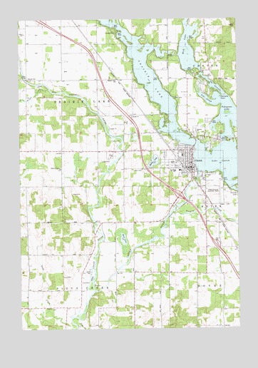
Chetek, WI USGS Topographic Map
Click on map above to begin viewing in our Map Viewer.

This topographic map contains these locations and features:
Feature Name Type Latitude Longitude GNIS ID View Map
Advent Christian ChurchChurchN45.3202°W91.6510°1988868View Map
Bailey LakeLakeN45.3175°W91.6732°1561089View Map
Brown CreekStreamN45.3469°W91.7327°1562259View Map
ChetekPopulated PlaceN45.3141°W91.6510°1562995View Map
Chetek Flowage 135ReservoirN45.3160°W91.6291°1791853View Map
Chetek Full Gospel TabernacleChurchN45.3211°W91.6585°1988869View Map
Chetek High SchoolSchoolN45.3137°W91.6617°1837891View Map
Chetek Lutheran ChurchChurchN45.3222°W91.6518°1988870View Map
Chetek Middle SchoolSchoolN45.3137°W91.6617°2713275View Map
Chetek Municipal-Southworth AirportAirportN45.3083°W91.6339°1581017View Map
Chetek Police DepartmentBuildingN45.3151°W91.6502°2759663View Map
Chetek RiverStreamN45.2652°W91.7077°1562996View Map
Chetek United Methodist ChurchChurchN45.3166°W91.6532°1988871View Map
Chetek Volunteer Fire DistrictBuildingN45.3207°W91.6631°2696791View Map
Chetek Wastewater Treatment PlantLocaleN45.3108°W91.6486°2358193View Map
Chetek WP277 DamDamN45.3133°W91.6485°1791852View Map
City of ChetekCivilN45.3159°W91.6533°1582951View Map
City View School (historical)SchoolN45.3041°W91.6910°1837894View Map
Dovre TownhallBuildingN45.2505°W91.6349°1837913View Map
Gregarson School (historical)SchoolN45.3583°W91.6646°1837941View Map
Hunt School (historical)SchoolN45.2819°W91.6366°1837949View Map
Lake ChetekLakeN45.3160°W91.6291°1562997View Map
Lakeview CemeteryCemeteryN45.3291°W91.6490°1567797View Map
Lakewood ParkParkN45.3700°W91.6943°1567810View Map
Mud LakeLakeN45.2863°W91.6910°1569944View Map
Mud LakeLakeN45.3640°W91.6533°1569997View Map
Oak Grove School (historical)SchoolN45.2730°W91.6743°1837975View Map
Otterholt CemeteryCemeteryN45.3155°W91.7263°1570920View Map
Otterholt School (historical)SchoolN45.3222°W91.7254°1837977View Map
Pike SloughGutN45.3425°W91.6429°1571392View Map
Pittmans PointCapeN45.3433°W91.6352°1571565View Map
Pleasant Hill School (historical)SchoolN45.2802°W91.7099°1837982View Map
Pleasant Plain CemeteryCemeteryN45.3513°W91.6938°1571618View Map
Pleasant Plain School (historical)SchoolN45.3511°W91.7057°1837984View Map
Pokegama LakeLakeN45.3355°W91.6293°1571729View Map
Prairie LakeLakeN45.3585°W91.6829°1571881View Map
Prairie Lake TownhallBuildingN45.3216°W91.7257°1837991View Map
Riverview School (historical)SchoolN45.3586°W91.7454°1838002View Map
Roselawn Elementary SchoolSchoolN45.3198°W91.6569°1838004View Map
Saint Boniface Catholic ChurchChurchN45.3133°W91.6529°1988872View Map
Sioux Creek TownhallBuildingN45.2583°W91.7324°1838016View Map
Stardust Drive-In TheatreLocaleN45.3478°W91.7033°2634412View Map
Sunset View Country ClubLocaleN45.3522°W91.6410°1988873View Map
Tenmile CreekStreamN45.2969°W91.6624°1575307View Map
The NarrowsLakeN45.3270°W91.6338°1575331View Map
Tiller CreekStreamN45.2522°W91.7191°1575454View Map
Town of Prairie LakeCivilN45.3366°W91.7272°1583977View Map
Town of Sioux CreekCivilN45.2507°W91.7270°1584163View Map

Note: Coordinates in the location and feature list above are referenced to NAD83 datum.


Copyright (C) 2008-2024 Ryan Niemi / Sunset Dynamics ... All Rights Reserved