TopoQuest Logo
Do you find TopoQuest useful?
Help keep TopoQuest running and adding new maps/features by donating!
Bitcoin:  19c7KJd3qBynnjoSw5npx9KScwjBe4ifkT
Litecoin:  LXs6TkuXGGXo1vDsWCkWVdjQX94eUKd6ui
Home View Maps Find Maps Find Places Resources & Links


Dalys, Montana Topographic Map

USGS Map Title: Dalys, MT
USGS Map MRC: 45112A7
DRG (GeoTIFF) Download: o45112a7.tif


Neighboring USGS Topographic Map Quads:


  Bannack, MT  
45112B8
 

  Burns Mountain, MT  
45112B7
 

  Dillon West, MT  
45112B6
 

  Eli Spring, MT  
45112A8
 

  Dalys, MT  
45112A7
 

  Gallagher Mountain, MT  
45112A6
 

  Garfield Canyon, MT  
44112H8
 

  Red Rock, MT  
44112H7
 

  Monument Hill, MT  
44112H6


Map MRC Location:

N46°
W113°
N46°
W112°
H8 H7 H6 H5 H4 H3 H2 H1
G8 G7 G6 G5 G4 G3 G2 G1
F8 F7 F6 F5 F4 F3 F2 F1
E8 E7 E6 E5 E4 E3 E2 E1
D8 D7 D6 D5 D4 D3 D2 D1
C8 C7 C6 C5 C4 C3 C2 C1
B8 B7 B6 B5 B4 B3 B2 B1
A8 A7 A6 A5 A4 A3 A2 A1
N45°
W113°
N45°
W112°

Dalys, MT USGS 1:24K Topographic Map Preview:
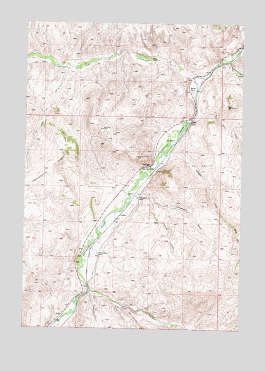
Dalys, MT USGS Topographic Map
Click on map above to begin viewing in our Map Viewer.

This topographic map contains these locations and features:
Feature Name Type Latitude Longitude GNIS ID View Map
Ashbaugh CreekStreamN45.0530°W112.8114°768376View Map
Beaver Head (historical)LocaleN45.0158°W112.8370°1797315View Map
Bill Hill CreekStreamN45.0869°W112.7764°779911View Map
Clark CanyonValleyN45.0152°W112.8372°769891View Map
Clark Canyon (historical)LocaleN45.0166°W112.8370°1797318View Map
Clark Canyon DamDamN45.0016°W112.8575°795607View Map
Corrals Fishing Access SiteLocaleN45.1127°W112.7559°1744551View Map
DalysPopulated PlaceN45.0852°W112.7800°770432View Map
Gallagher CreekStreamN45.0733°W112.7928°771683View Map
Gallagher Creek Station (historical)LocaleN45.0721°W112.7925°1797327View Map
Grasshopper CreekStreamN45.1027°W112.7792°784206View Map
GraylingPopulated PlaceN45.0466°W112.8209°771951View Map
Grayling (historical)LocaleN45.0466°W112.8209°1797348View Map
Grayling School (historical)SchoolN45.0466°W112.8209°1797349View Map
Henneberry BridgeBridgeN45.0552°W112.8153°1797062View Map
Henneberry Fishing Access SiteLocaleN45.0505°W112.8170°1744555View Map
Henneberry GulchValleyN45.0544°W112.8081°772340View Map
Henneberry RanchLocaleN45.0538°W112.8103°772341View Map
High Bridge Fishing Access SiteLocaleN45.0199°W112.8375°1744556View Map
Juniper Spring GulchValleyN45.1066°W112.8495°767959View Map
Long GulchValleyN45.1094°W112.7584°773644View Map
McMenomey RanchLocaleN45.0305°W112.8328°774041View Map
Middle Fork Gallagher CreekStreamN45.0427°W112.7550°774164View Map
Mooney MountainSummitN45.0911°W112.7569°2582470View Map
Mooney RanchLocaleN45.0971°W112.7806°774358View Map
Pipe Organ LodgeLocaleN45.0663°W112.8039°775267View Map
Pipe Organ RockPillarN45.0671°W112.8039°775268View Map
RockLocaleN45.0680°W112.7978°775841View Map

Note: Coordinates in the location and feature list above are referenced to NAD83 datum.


Copyright (C) 2008-2025 Ryan Niemi / Sunset Dynamics ... All Rights Reserved