TopoQuest Logo
Do you find TopoQuest useful?
Help keep TopoQuest running and adding new maps/features by donating!
Bitcoin:  19c7KJd3qBynnjoSw5npx9KScwjBe4ifkT
Litecoin:  LXs6TkuXGGXo1vDsWCkWVdjQX94eUKd6ui
Home View Maps Find Maps Find Places Resources & Links


Burns Mountain, Montana Topographic Map

USGS Map Title: Burns Mountain, MT
USGS Map MRC: 45112B7
DRG (GeoTIFF) Download: o45112b7.tif


Neighboring USGS Topographic Map Quads:


  Ermont, MT  
45112C8
 

  Argenta, MT  
45112C7
 

  Bond, MT  
45112C6
 

  Bannack, MT  
45112B8
 

  Burns Mountain, MT  
45112B7
 

  Dillon West, MT  
45112B6
 

  Eli Spring, MT  
45112A8
 

  Dalys, MT  
45112A7
 

  Gallagher Mountain, MT  
45112A6


Map MRC Location:

N46°
W113°
N46°
W112°
H8 H7 H6 H5 H4 H3 H2 H1
G8 G7 G6 G5 G4 G3 G2 G1
F8 F7 F6 F5 F4 F3 F2 F1
E8 E7 E6 E5 E4 E3 E2 E1
D8 D7 D6 D5 D4 D3 D2 D1
C8 C7 C6 C5 C4 C3 C2 C1
B8 B7 B6 B5 B4 B3 B2 B1
A8 A7 A6 A5 A4 A3 A2 A1
N45°
W113°
N45°
W112°

Burns Mountain, MT USGS 1:24K Topographic Map Preview:
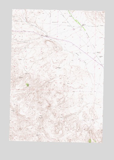
Burns Mountain, MT USGS Topographic Map
Click on map above to begin viewing in our Map Viewer.

This topographic map contains these locations and features:
Feature Name Type Latitude Longitude GNIS ID View Map
07S10W15CBCC01 WellWellN45.2221°W112.8239°808490View Map
07S10W22AAD_01 WellWellN45.2152°W112.7847°808457View Map
07S10W24BCCA01 WellWellN45.2110°W112.7814°808432View Map
07S10W24BCCA02 WellWellN45.2110°W112.7814°808433View Map
07S10W24BDB_01 WellWellN45.2133°W112.7784°808447View Map
Albers SpringsSpringN45.2191°W112.8598°768151View Map
Bunton and Parish Stage Station (historical)LocaleN45.2430°W112.7898°1797098View Map
Burns MountainSummitN45.1485°W112.8342°769418View Map
Christensen RanchLocaleN45.2358°W112.7814°769866View Map
Dillon ReservoirReservoirN45.2445°W112.7955°770656View Map
G B Shaffner RanchLocaleN45.2069°W112.7584°771662View Map
Hans Dons RanchLocaleN45.2105°W112.7614°772123View Map
John Shaffner RanchLocaleN45.1952°W112.8089°772848View Map
Magpie SpringSpringN45.1892°W112.8563°773813View Map
Morrison Post Office (historical)Post OfficeN45.2249°W112.8273°1797249View Map
O'Neils Station (historical)LocaleN45.2421°W112.7898°1797383View Map
Red SpringSpringN45.1532°W112.8695°775663View Map
School Section SpringSpringN45.1311°W112.8394°776276View Map
Tenmile HouseLocaleN45.2249°W112.8273°777466View Map
The PuddlesSpringN45.2022°W112.8609°777533View Map
Timber ButteSummitN45.1780°W112.8531°777650View Map
Upper Magpie SpringSpringN45.1855°W112.8644°777931View Map

Note: Coordinates in the location and feature list above are referenced to NAD83 datum.


Copyright (C) 2008-2025 Ryan Niemi / Sunset Dynamics ... All Rights Reserved