TopoQuest Logo
Do you find TopoQuest useful?
Help keep TopoQuest running and adding new maps/features by donating!
Bitcoin:  19c7KJd3qBynnjoSw5npx9KScwjBe4ifkT
Litecoin:  LXs6TkuXGGXo1vDsWCkWVdjQX94eUKd6ui
Home View Maps Find Maps Find Places Resources & Links


Bannack, Montana Topographic Map

USGS Map Title: Bannack, MT
USGS Map MRC: 45112B8
DRG (GeoTIFF) Download: o45112b8.tif


Neighboring USGS Topographic Map Quads:


  Polaris, MT  
45113C1
 

  Ermont, MT  
45112C8
 

  Argenta, MT  
45112C7
 

  Mill Point, MT  
45113B1
 

  Bannack, MT  
45112B8
 

  Burns Mountain, MT  
45112B7
 

  Grant, MT  
45113A1
 

  Eli Spring, MT  
45112A8
 

  Dalys, MT  
45112A7


Map MRC Location:

N46°
W113°
N46°
W112°
H8 H7 H6 H5 H4 H3 H2 H1
G8 G7 G6 G5 G4 G3 G2 G1
F8 F7 F6 F5 F4 F3 F2 F1
E8 E7 E6 E5 E4 E3 E2 E1
D8 D7 D6 D5 D4 D3 D2 D1
C8 C7 C6 C5 C4 C3 C2 C1
B8 B7 B6 B5 B4 B3 B2 B1
A8 A7 A6 A5 A4 A3 A2 A1
N45°
W113°
N45°
W112°

Bannack, MT USGS 1:24K Topographic Map Preview:
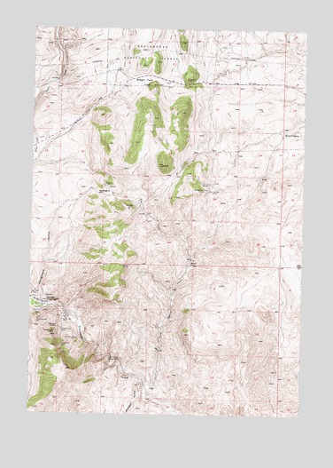
Bannack, MT USGS Topographic Map
Click on map above to begin viewing in our Map Viewer.

This topographic map contains these locations and features:
Feature Name Type Latitude Longitude GNIS ID View Map
07S10W19BBBB01 SpringSpringN45.2171°W112.8856°808467View Map
07S11W30DADD01 WellWellN45.1921°W112.9889°808376View Map
08S11W11AAAA01 WellWellN45.1588°W112.9059°808223View Map
Arctic MineMineN45.1999°W112.9675°802325View Map
Badger PassGapN45.2338°W112.9503°779246View Map
Badger Pass MineMineN45.2166°W112.9509°802334View Map
Badger RidgeRidgeN45.1666°W112.9703°793918View Map
BannackPopulated PlaceN45.1610°W112.9956°802010View Map
Bannack Post Office (historical)Post OfficeN45.1610°W112.9956°1797223View Map
Bannack School (historical)SchoolN45.1610°W112.9956°1797312View Map
Bannack State ParkParkN45.1591°W112.9986°806886View Map
Beaverhead CountyCivilN45.1327°W112.8988°1719627View Map
Beaverhead MineMineN45.1666°W112.9842°802277View Map
Blue Dot MineMineN45.1971°W112.9195°780143View Map
Blue Wing MineMineN45.1666°W112.9509°802327View Map
Bob Ingersoll MineMineN45.1730°W112.9553°780179View Map
Bob Ingersoll MineMineN45.1666°W112.9509°802288View Map
Bon Accord MineMineN45.1499°W112.9592°802318View Map
Bon Accord Placer MineMineN45.1430°W112.9620°780202View Map
Bonaccord Post Office (historical)Post OfficeN45.1424°W112.9592°1797108View Map
Box X MineMineN45.1499°W112.9592°802308View Map
Cavendish (historical)LocaleN45.1555°W112.9786°1797092View Map
Cavendish Post Office (historical)Post OfficeN45.1555°W112.9786°1797093View Map
Centerville (historical)Populated PlaceN45.1552°W112.9786°1797091View Map
Cold Spring CreekStreamN45.1333°W112.9467°781495View Map
Contact MineMineN45.1666°W112.9675°802331View Map
Cottontail MineMineN45.1999°W112.9509°802321View Map
Del Monte MineMineN45.1988°W112.9675°782278View Map
Erie MineMineN45.1952°W112.9470°802408View Map
Excelsior Lode MineMineN45.1494°W112.9795°783263View Map
Excelsior MineMineN45.1499°W112.9842°802312View Map
Francis H MineMineN45.1999°W112.9675°802324View Map
French Lode MineMineN45.1474°W112.9861°783742View Map
French MineMineN45.1499°W112.9842°802313View Map
Golden Leaf MineMineN45.1555°W112.9856°784078View Map
Golden Leaf MineMineN45.1499°W112.9842°802316View Map
Golden Ledge MineMineN45.1499°W112.9675°802311View Map
Hangmans GulchValleyN45.1624°W112.9970°784517View Map
Hangmans Gulch MineMineN45.1833°W112.9675°802290View Map
Hendricks Lode MineMineN45.1555°W112.9970°784775View Map
Hillside Placer MineMineN45.1519°W112.9861°784895View Map
Hope Placer MineMineN45.1649°W112.9984°785002View Map
Huron MineMineN45.1999°W112.9509°802335View Map
Iron Mask MineMineN45.1999°W112.9509°802320View Map
Iron Mask MineMineN45.1916°W112.9561°785325View Map
Kent MineMineN45.1833°W112.9509°802319View Map
Log Cabin MineMineN45.1833°W112.9509°802330View Map
Madigan GulchValleyN45.1369°W112.9511°786762View Map
Maltby S MineMineN45.1971°W112.9592°802407View Map
McDowell SpringSpringN45.2168°W112.8840°787040View Map
Nelson MineMineN45.2416°W112.8967°802409View Map
Nettie MineMineN45.1833°W112.9509°802332View Map
New Departure MineMineN45.1974°W112.9220°787962View Map
New Departure MineMineN45.1977°W112.9203°802428View Map
NW Section 28 MineMineN45.1999°W112.9675°802326View Map
Old Charter Oak MineMineN45.1666°W112.9509°802329View Map
Opy MineMineN45.2499°W112.9175°802361View Map
Priscilla MineMineN45.1571°W112.9845°789197View Map
Road Agents RockPillarN45.1966°W112.9700°789617View Map
Senator/Arcata MineMineN45.1594°W112.9892°802437View Map
South Ermont MineMineN45.2499°W112.9175°802444View Map
South Oak MineMineN45.1666°W112.9509°802328View Map
Southmont MineMineN45.1499°W112.9675°802310View Map
SW Section 5 MineMineN45.1666°W112.9842°802309View Map
Taylor MineMineN45.2333°W112.9895°791922View Map
Taylor MineMineN45.2333°W112.9842°802322View Map
Wadam MineMineN45.1499°W112.9842°802314View Map
Wadams Lode MineMineN45.1516°W112.9892°792737View Map
Wallace Lode MineMineN45.1535°W112.9884°792780View Map
Wallace MineMineN45.1499°W112.9842°802315View Map
Wheal Rose MineMineN45.1999°W112.9342°802323View Map
Yankee Flat (historical)Populated PlaceN45.1588°W112.9953°1797265View Map

Note: Coordinates in the location and feature list above are referenced to NAD83 datum.


Copyright (C) 2008-2024 Ryan Niemi / Sunset Dynamics ... All Rights Reserved