TopoQuest Logo
Do you find TopoQuest useful?
Help keep TopoQuest running and adding new maps/features by donating!
Bitcoin:  19c7KJd3qBynnjoSw5npx9KScwjBe4ifkT
Litecoin:  LXs6TkuXGGXo1vDsWCkWVdjQX94eUKd6ui
Home View Maps Find Maps Find Places Resources & Links


Damascus, Ohio Topographic Map

USGS Map Title: Damascus, OH
USGS Map MRC: 40080H8
DRG (GeoTIFF) Download: o40080h8.tif


Neighboring USGS Topographic Map Quads:


  Deerfield, OH  
41081A1
 

  Lake Milton, OH  
41080A8
 

  Canfield, OH  
41080A7
 

  Alliance, OH  
40081H1
 

  Damascus, OH  
40080H8
 

  Salem, OH  
40080H7
 

  Homeworth, OH  
40081G1
 

  Hanoverton, OH  
40080G8
 

  Lisbon, OH  
40080G7


Map MRC Location:

N41°
W81°
N41°
W80°
H8 H7 H6 H5 H4 H3 H2 H1
G8 G7 G6 G5 G4 G3 G2 G1
F8 F7 F6 F5 F4 F3 F2 F1
E8 E7 E6 E5 E4 E3 E2 E1
D8 D7 D6 D5 D4 D3 D2 D1
C8 C7 C6 C5 C4 C3 C2 C1
B8 B7 B6 B5 B4 B3 B2 B1
A8 A7 A6 A5 A4 A3 A2 A1
N40°
W81°
N40°
W80°

Damascus, OH USGS 1:24K Topographic Map Preview:
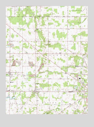
Damascus, OH USGS Topographic Map
Click on map above to begin viewing in our Map Viewer.

This topographic map contains these locations and features:
Feature Name Type Latitude Longitude GNIS ID View Map
Beech Ridge ChurchChurchN40.9406°W80.9937°1037797View Map
BeloitPopulated PlaceN40.9231°W80.9937°1064412View Map
Beloit Elementary SchoolSchoolN40.9237°W80.9920°1051796View Map
Beloit Fire Department Station 1BuildingN40.9229°W80.9914°2549759View Map
Beloit Post OfficePost OfficeN40.9237°W80.9943°2035946View Map
Blackburn HillSummitN40.8998°W80.8884°1048526View Map
Boswell (historical)Populated PlaceN40.9506°W80.9548°1051794View Map
Boswell Post Office (historical)Post OfficeN40.9501°W80.9554°2035690View Map
Boyds CornersLocaleN40.9739°W80.9545°1038241View Map
Bunker HillPopulated PlaceN40.9592°W80.9356°1048566View Map
Bunker Hill CemeteryCemeteryN40.9592°W80.9359°1963254View Map
Bunker Hill United Methodist ChurchChurchN40.9595°W80.9365°1077419View Map
Butler Mobile CityPopulated PlaceN40.8981°W80.9422°2513675View Map
C And C Mobile Home CommunityPopulated PlaceN40.9028°W80.8822°2513683View Map
Camp MerrydaleLocaleN40.9556°W80.9359°1038723View Map
ChristytownPopulated PlaceN40.9998°W80.9859°1056802View Map
DamascusPopulated PlaceN40.9020°W80.9551°1064504View Map
Damascus CemeteryCemeteryN40.8992°W80.9509°1807413View Map
Damascus Census Designated PlaceCensusN40.9042°W80.9523°2628881View Map
Damascus Post OfficePost OfficeN40.9014°W80.9554°2035642View Map
Damascus Volunteer Fire DepartmentBuildingN40.9032°W80.9554°2550426View Map
Damascus Wastewater Treatment PlantLocaleN40.9028°W80.9569°2633290View Map
East GoshenPopulated PlaceN40.9451°W80.9704°1048680View Map
East Goshen Friends CemeteryCemeteryN40.9462°W80.9706°1963260View Map
GarfieldPopulated PlaceN40.9184°W80.9551°1064702View Map
Garfield BogSwampN40.9172°W80.9661°1960385View Map
Garfield DitchCanalN40.9381°W80.9495°1040767View Map
Garfield Post Office (historical)Post OfficeN40.9181°W80.9554°2035696View Map
Goshen CenterLocaleN40.9445°W80.9179°1040977View Map
Goshen Center Elementary SchoolSchoolN40.9445°W80.9162°1051793View Map
Koons AirportAirportN40.8823°W80.8801°1085502View Map
Lumberton CemeteryCemeteryN40.9876°W80.9454°1963271View Map
NaylorPopulated PlaceN40.9184°W80.9729°1065095View Map
Naylor DitchCanalN40.9098°W80.9723°1043786View Map
New Buffalo Post Office (historical)Post OfficeN40.9876°W80.8790°2035706View Map
O K Dies AirportAirportN40.9007°W80.9293°1082995View Map
PatmosPopulated PlaceN40.9737°W80.9059°1044315View Map
Patmos Post Office (historical)Post OfficeN40.9737°W80.9054°2035711View Map
Peru School (historical)SchoolN40.9737°W80.9940°1051795View Map
PointviewPopulated PlaceN40.9445°W80.8973°1044660View Map
Ponderosa HeliportAirportN40.9823°W80.9579°1082992View Map
Salem Country ClubLocaleN40.9076°W80.8943°1080184View Map
Salem HeightsPopulated PlaceN40.9009°W80.8909°1049146View Map
Smith Hog FarmsLocaleN40.9583°W80.8803°2711028View Map
SnodesPopulated PlaceN40.9592°W80.9937°1046402View Map
Snodes Post Office (historical)Post OfficeN40.9598°W80.9943°2035721View Map
Township of GoshenCivilN40.9481°W80.9203°1086563View Map
Tri-City AirportAirportN40.9034°W80.9987°1083003View Map
Village of BeloitCivilN40.9195°W80.9963°2398089View Map
West Branch High SchoolSchoolN40.9117°W80.9923°1047737View Map
West Branch Junior High SchoolSchoolN40.9098°W80.9545°1056958View Map
WestvillePopulated PlaceN40.9014°W80.9940°1049320View Map
Westville LakeReservoirN40.8951°W80.9959°1070990View Map
Westville Lake Golf CourseLocaleN40.8889°W80.9804°1052108View Map
Wilbur ChurchChurchN40.9001°W80.9509°1047900View Map
Willow GrovePopulated PlaceN40.8859°W80.9004°1047956View Map
Willow Spring LakesLakeN40.8809°W80.9168°1047964View Map
WNEO-TV (Alliance)TowerN40.9064°W80.9109°1085427View Map
Yankee CrossingPopulated PlaceN40.9228°W80.9073°1063104View Map

Note: Coordinates in the location and feature list above are referenced to NAD83 datum.


Copyright (C) 2008-2024 Ryan Niemi / Sunset Dynamics ... All Rights Reserved