TopoQuest Logo
Do you find TopoQuest useful?
Help keep TopoQuest running and adding new maps/features by donating!
Bitcoin:  19c7KJd3qBynnjoSw5npx9KScwjBe4ifkT
Litecoin:  LXs6TkuXGGXo1vDsWCkWVdjQX94eUKd6ui
Home View Maps Find Maps Find Places Resources & Links


Dana, California Topographic Map

USGS Map Title: Dana, CA
USGS Map MRC: 41121A5
DRG (GeoTIFF) Download: o41121a5.tif


Neighboring USGS Topographic Map Quads:


  Pondosa, CA  
41121B6
 

  East of Pondosa, CA  
41121B5
 

  Timbered Crater, CA  
41121B4
 

  Burney Falls, CA  
41121A6
 

  Dana, CA  
41121A5
 

  Fall River Mills, CA  
41121A4
 

  Burney, CA  
40121H6
 

  Cassel, CA  
40121H5
 

  Hogback Ridge, CA  
40121H4


Map MRC Location:

N42°
W122°
N42°
W121°
H8 H7 H6 H5 H4 H3 H2 H1
G8 G7 G6 G5 G4 G3 G2 G1
F8 F7 F6 F5 F4 F3 F2 F1
E8 E7 E6 E5 E4 E3 E2 E1
D8 D7 D6 D5 D4 D3 D2 D1
C8 C7 C6 C5 C4 C3 C2 C1
B8 B7 B6 B5 B4 B3 B2 B1
A8 A7 A6 A5 A4 A3 A2 A1
N41°
W122°
N41°
W121°

Dana, CA USGS 1:24K Topographic Map Preview:
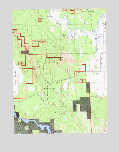
Dana, CA USGS Topographic Map
Click on map above to begin viewing in our Map Viewer.

This topographic map contains these locations and features:
Feature Name Type Latitude Longitude GNIS ID View Map
Bear CreekStreamN41.1143°W121.5533°256648View Map
Burney PitMineN41.0022°W121.5839°2675078View Map
Coyote Flat ReservoirReservoirN41.0397°W121.5905°258833View Map
DanaPopulated PlaceN41.1116°W121.5647°259035View Map
Dana CemeteryCemeteryN41.1235°W121.5789°253127View Map
Dusty CampgroundLocaleN41.0157°W121.6114°253134View Map
Fort MountainSummitN41.0671°W121.5930°260280View Map
GomezPopulated PlaceN41.0360°W121.5164°1652958View Map
Horrs Four CornersLocaleN41.1213°W121.5225°276468View Map
Jamo PointSummitN41.0193°W121.6228°1661721View Map
Rainbow SpringSpringN41.1110°W121.5511°265149View Map
Ricks Fishing LodgeLocaleN41.0954°W121.5544°274917View Map
Soldier MountainSummitN41.0741°W121.5636°267385View Map
Soldier Mountain ReservoirReservoirN41.0417°W121.5656°267386View Map
Soldier Mountain Volunteer Fire Company Station 13BuildingN41.0940°W121.5146°2622169View Map
Spring CreekStreamN41.1010°W121.5155°267591View Map
Thousand SpringsSpringN41.1179°W121.5547°268248View Map
Warner Grade ReservoirReservoirN41.0157°W121.5592°268782View Map

Note: Coordinates in the location and feature list above are referenced to NAD83 datum.


Copyright (C) 2008-2024 Ryan Niemi / Sunset Dynamics ... All Rights Reserved