TopoQuest Logo
Do you find TopoQuest useful?
Help keep TopoQuest running and adding new maps/features by donating!
Bitcoin:  19c7KJd3qBynnjoSw5npx9KScwjBe4ifkT
Litecoin:  LXs6TkuXGGXo1vDsWCkWVdjQX94eUKd6ui
Home View Maps Find Maps Find Places Resources & Links


Antelope Hill, New Mexico Topographic Map

USGS Map Title: Antelope Hill, NM
USGS Map MRC: 32108D1
DRG (GeoTIFF) Download: o32108d1.tif


Neighboring USGS Topographic Map Quads:


  Whitewater, NM  
32108E2
 

  Faywood Station, NM  
32108E1
 

  Taylor Mountain, NM  
32107E8
 

  Cow Springs Mountain, NM  
32108D2
 

  Antelope Hill, NM  
32108D1
 

  Spalding, NM  
32107D8
 

  Grandmother Mountain West, NM  
32108C2
 

  Grandmother Mountain East, NM  
32108C1
 

  Williams Ranch, NM  
32107C8


Map MRC Location:

N33°
W109°
N33°
W108°
H8 H7 H6 H5 H4 H3 H2 H1
G8 G7 G6 G5 G4 G3 G2 G1
F8 F7 F6 F5 F4 F3 F2 F1
E8 E7 E6 E5 E4 E3 E2 E1
D8 D7 D6 D5 D4 D3 D2 D1
C8 C7 C6 C5 C4 C3 C2 C1
B8 B7 B6 B5 B4 B3 B2 B1
A8 A7 A6 A5 A4 A3 A2 A1
N32°
W109°
N32°
W108°

Antelope Hill, NM USGS 1:24K Topographic Map Preview:
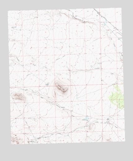
Antelope Hill, NM USGS Topographic Map
Click on map above to begin viewing in our Map Viewer.

This topographic map contains these locations and features:
Feature Name Type Latitude Longitude GNIS ID View Map
01250 Water WellWellN32.3958°W108.0179°927688View Map
01257 Water WellWellN32.4251°W108.1087°922206View Map
01258 Water WellWellN32.4084°W108.0684°922205View Map
01259 Water WellWellN32.3974°W108.0398°922204View Map
01267 Water WellWellN32.3776°W108.1020°922202View Map
01301 Water WellWellN32.4815°W108.0128°927632View Map
01302 Water WellWellN32.4709°W108.0039°922211View Map
01307 Water WellWellN32.4326°W108.0245°922207View Map
01319 Water WellWellN32.4929°W108.0937°922217View Map
01320 Water WellWellN32.4965°W108.0428°922220View Map
01321 Water WellWellN32.4934°W108.0470°922219View Map
01323 Water WellWellN32.4934°W108.0470°922218View Map
01324 Water WellWellN32.4934°W108.0306°927689View Map
01325 Water WellWellN32.4912°W108.0292°927634View Map
01326 Water WellWellN32.4890°W108.0275°927633View Map
01327 Water WellWellN32.4859°W108.0403°922216View Map
01328 Water WellWellN32.4823°W108.0359°922215View Map
01329 Water WellWellN32.4787°W108.0298°922214View Map
01330 Water WellWellN32.4770°W108.0253°922213View Map
01331 Water WellWellN32.4709°W108.0959°922212View Map
01333 Water WellWellN32.4570°W108.0267°922210View Map
01334 Water WellWellN32.4531°W108.0278°922209View Map
01335 Water WellWellN32.4506°W108.0295°927630View Map
01336 Water WellWellN32.4090°W108.0273°922208View Map
01471 Water WellWellN32.4754°W108.1189°927631View Map
06038 Water WellWellN32.4276°W108.1103°927629View Map
1260 Water WellWellN32.3959°W108.1020°922203View Map
Antelope HillSummitN32.4265°W108.0700°899505View Map
Antelope WindmillLocaleN32.4084°W108.0684°885807View Map
Bar O RanchLocaleN32.3962°W108.0178°886049View Map
Butterfield WindmillLocaleN32.4251°W108.1084°886992View Map
Chicken WindmillLocaleN32.4729°W108.1184°887506View Map
Criswell TankReservoirN32.4846°W108.1216°888074View Map
Criswell WindmillLocaleN32.4929°W108.0934°888075View Map
Homestead WindmillLocaleN32.4487°W108.0270°890104View Map
Jones Spring RanchLocaleN32.3773°W108.1014°890550View Map
Munson WindmillLocaleN32.4298°W108.0086°892345View Map
Upton TankReservoirN32.3976°W108.0422°896050View Map
West Antelope DrawValleyN32.3926°W108.0378°896328View Map
Whitewater CreekStreamN32.4601°W108.0042°912353View Map
Yates WindmillLocaleN32.4326°W108.0245°896806View Map

Note: Coordinates in the location and feature list above are referenced to NAD83 datum.


Copyright (C) 2008-2025 Ryan Niemi / Sunset Dynamics ... All Rights Reserved