TopoQuest Logo
Do you find TopoQuest useful?
Help keep TopoQuest running and adding new maps/features by donating!
Bitcoin:  19c7KJd3qBynnjoSw5npx9KScwjBe4ifkT
Litecoin:  LXs6TkuXGGXo1vDsWCkWVdjQX94eUKd6ui
Home View Maps Find Maps Find Places Resources & Links


Davenport, Nebraska Topographic Map

USGS Map Title: Davenport, NE
USGS Map MRC: 40097C7
DRG (GeoTIFF) Download: o40097c7.tif


Neighboring USGS Topographic Map Quads:


  Edgar NW, NE  
40097D8
 

  Ong, NE  
40097D7
 

  Shickley, NE  
40097D6
 

  Edgar, NE  
40097C8
 

  Davenport, NE  
40097C7
 

  Carleton, NE  
40097C6
 

  Oak, NE  
40097B8
 

  Ruskin, NE  
40097B7
 

  Deshler, NE  
40097B6


Map MRC Location:

N41°
W98°
N41°
W97°
H8 H7 H6 H5 H4 H3 H2 H1
G8 G7 G6 G5 G4 G3 G2 G1
F8 F7 F6 F5 F4 F3 F2 F1
E8 E7 E6 E5 E4 E3 E2 E1
D8 D7 D6 D5 D4 D3 D2 D1
C8 C7 C6 C5 C4 C3 C2 C1
B8 B7 B6 B5 B4 B3 B2 B1
A8 A7 A6 A5 A4 A3 A2 A1
N40°
W98°
N40°
W97°

Davenport, NE USGS 1:24K Topographic Map Preview:
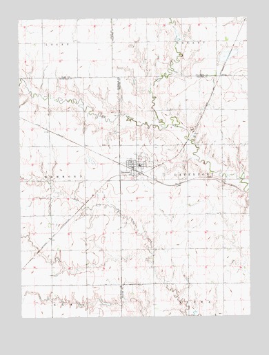
Davenport, NE USGS Topographic Map
Click on map above to begin viewing in our Map Viewer.

This topographic map contains these locations and features:
Feature Name Type Latitude Longitude GNIS ID View Map
CarlislePopulated PlaceN40.3506°W97.7650°835268View Map
Carlisle (historical)LocaleN40.3506°W97.7650°1882249View Map
Carlisle Post Office (historical)Post OfficeN40.3506°W97.7650°1882248View Map
Christs Lutheran ChurchChurchN40.3128°W97.8120°1883035View Map
DavenportLocaleN40.3114°W97.8128°1883053View Map
DavenportPopulated PlaceN40.3128°W97.8120°828584View Map
Davenport Community SchoolsSchoolN40.3133°W97.8100°1882964View Map
Davenport Medical ClinicHospitalN40.3128°W97.8120°1883033View Map
Davenport Post OfficePost OfficeN40.3128°W97.8134°1883054View Map
Davenport Public LibraryBuildingN40.3128°W97.8120°1883036View Map
Davenport Volunteer Fire and RescueBuildingN40.3136°W97.8142°2553443View Map
Grone Airport (historical)AirportN40.2970°W97.7984°837537View Map
Hammond Election Precinct (historical)CivilN40.3075°W97.8734°1928931View Map
Happy Hollow School (historical)SchoolN40.2653°W97.7975°1882886View Map
Jagels DamDamN40.2550°W97.8270°1767206View Map
Jagels ReservoirReservoirN40.2550°W97.8270°1767207View Map
Jennings DamDamN40.3283°W97.8237°1767428View Map
Jennings ReservoirReservoirN40.3291°W97.8228°1767429View Map
Little Sandy CreekStreamN40.3289°W97.7964°830796View Map
Pleasant Hill School (historical)SchoolN40.2995°W97.7642°1882884View Map
R and R Farms Airport (historical)AirportN40.2817°W97.8545°837538View Map
Saint Peters Lutheran ChurchChurchN40.3128°W97.8120°1883032View Map
Saint Peters Lutheran Elementary SchoolSchoolN40.3128°W97.8120°1882969View Map
Schroeder DamDamN40.2552°W97.8413°1767200View Map
Schroeder ReservoirReservoirN40.2551°W97.8436°1767201View Map
Township of DavenportCivilN40.3000°W97.7920°1882942View Map
Township of HammondCivilN40.3056°W97.8748°1882658View Map
United Methodist ChurchChurchN40.3128°W97.8120°1883034View Map
Valley View School (historical)SchoolN40.3372°W97.7934°1882885View Map
Village of DavenportCivilN40.3123°W97.8115°2398685View Map

Note: Coordinates in the location and feature list above are referenced to NAD83 datum.


Copyright (C) 2008-2024 Ryan Niemi / Sunset Dynamics ... All Rights Reserved