TopoQuest Logo
Do you find TopoQuest useful?
Help keep TopoQuest running and adding new maps/features by donating!
Bitcoin:  19c7KJd3qBynnjoSw5npx9KScwjBe4ifkT
Litecoin:  LXs6TkuXGGXo1vDsWCkWVdjQX94eUKd6ui
Home View Maps Find Maps Find Places Resources & Links


Davis Hill, Texas Topographic Map

USGS Map Title: Davis Hill, TX
USGS Map MRC: 30094C7
DRG (GeoTIFF) Download: o30094c7.tif


Neighboring USGS Topographic Map Quads:


  Rayburn, TX  
30094D8
 

  Romayor, TX  
30094D7
 

  Votaw, TX  
30094D6
 

  Tarkington Prairie, TX  
30094C8
 

  Davis Hill, TX  
30094C7
 

  Arizona Creek, TX  
30094C6
 

  Simmons Bottom, TX  
30094B8
 

  Capers Ridge, TX  
30094B7
 

  Hardin, TX  
30094B6


Map MRC Location:

N31°
W95°
N31°
W94°
H8 H7 H6 H5 H4 H3 H2 H1
G8 G7 G6 G5 G4 G3 G2 G1
F8 F7 F6 F5 F4 F3 F2 F1
E8 E7 E6 E5 E4 E3 E2 E1
D8 D7 D6 D5 D4 D3 D2 D1
C8 C7 C6 C5 C4 C3 C2 C1
B8 B7 B6 B5 B4 B3 B2 B1
A8 A7 A6 A5 A4 A3 A2 A1
N30°
W95°
N30°
W94°

Davis Hill, TX USGS 1:24K Topographic Map Preview:
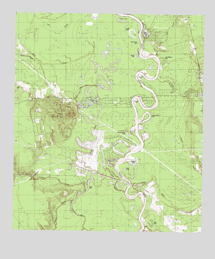
Davis Hill, TX USGS Topographic Map
Click on map above to begin viewing in our Map Viewer.

This topographic map contains these locations and features:
Feature Name Type Latitude Longitude GNIS ID View Map
Beef Head CreekStreamN30.3508°W94.7810°1372481View Map
Bledsoe Creek (historical)StreamN30.3394°W94.7738°1377744View Map
Board SloughStreamN30.3494°W94.8624°1372651View Map
Buzzard Roost LakeLakeN30.3061°W94.7992°1331777View Map
Cade LakeLakeN30.2555°W94.7821°1331834View Map
Coushatta VillagePopulated PlaceN30.2752°W94.7960°1377118View Map
Cypress LakeReservoirN30.2952°W94.8002°1862935View Map
Cypress Lake DamDamN30.2952°W94.8002°1862934View Map
Davis BayouStreamN30.2733°W94.8010°1383075View Map
Davis HillSummitN30.3160°W94.8408°1334094View Map
Davis Hill State ParkParkN30.3172°W94.8227°2028473View Map
Deer GullyValleyN30.3340°W94.8636°1334212View Map
Double LakesLakeN30.3624°W94.7977°1334532View Map
Fields LakeLakeN30.3712°W94.8052°1335781View Map
FranklinPopulated PlaceN30.2752°W94.7960°1377120View Map
Gaylor CreekStreamN30.2722°W94.8308°1336458View Map
Gaylor LakeLakeN30.2720°W94.8282°1336459View Map
Grand CanePopulated PlaceN30.3210°W94.7505°1377119View Map
Hanners BendBendN30.3247°W94.7946°1337312View Map
Hanners Bend LakeLakeN30.3141°W94.7886°1337313View Map
Hardin-Rye DivisionCivilN30.3172°W94.7582°1938822View Map
Hollins LakeLakeN30.2501°W94.8016°1377098View Map
Horseshoe LakeLakeN30.2951°W94.8044°1338132View Map
Jack Williams LakeLakeN30.3484°W94.7758°1338559View Map
Jacob SettlementPopulated PlaceN30.2585°W94.7752°1377121View Map
Lake BowieLakeN30.3218°W94.8272°1377100View Map
Lake SamLakeN30.3235°W94.8199°1377101View Map
Little Brushy LakeLakeN30.3586°W94.7942°1340033View Map
Mud LakeLakeN30.2911°W94.8096°1342205View Map
Old River LakeLakeN30.3637°W94.7890°1343213View Map
Rayburn LakeLakeN30.2906°W94.7962°1344855View Map
Round LakeLakeN30.3510°W94.7952°1345666View Map
Sam HoustonPopulated PlaceN30.3252°W94.8085°1384192View Map
Sevenmile BendBendN30.3413°W94.7913°1346915View Map
Tanners BluffCliffN30.2697°W94.7849°1377105View Map
Trinity River Lake EstatesPopulated PlaceN30.3377°W94.7877°1384193View Map
Trinity River National Wildlife RefugeParkN30.3422°W94.8326°2765535View Map
Willis LakeLakeN30.2861°W94.8013°1350165View Map

Note: Coordinates in the location and feature list above are referenced to NAD83 datum.


Copyright (C) 2008-2025 Ryan Niemi / Sunset Dynamics ... All Rights Reserved