TopoQuest Logo
Do you find TopoQuest useful?
Help keep TopoQuest running and adding new maps/features by donating!
Bitcoin:  19c7KJd3qBynnjoSw5npx9KScwjBe4ifkT
Litecoin:  LXs6TkuXGGXo1vDsWCkWVdjQX94eUKd6ui
Home View Maps Find Maps Find Places Resources & Links


Dawson, West Virginia Topographic Map

USGS Map Title: Dawson, WV
USGS Map MRC: 37080G6
DRG (GeoTIFF) Download: o37080g6.tif


Neighboring USGS Topographic Map Quads:


  Rainelle, WV  
37080H7
 

  Rupert, WV  
37080H6
 

  Cornstalk, WV  
37080H5
 

  Meadow Bridge, WV  
37080G7
 

  Dawson, WV  
37080G6
 

  Asbury, WV  
37080G5
 

  Talcott, WV  
37080F7
 

  Alderson, WV  
37080F6
 

  Fort Spring, WV  
37080F5


Map MRC Location:

N38°
W81°
N38°
W80°
H8 H7 H6 H5 H4 H3 H2 H1
G8 G7 G6 G5 G4 G3 G2 G1
F8 F7 F6 F5 F4 F3 F2 F1
E8 E7 E6 E5 E4 E3 E2 E1
D8 D7 D6 D5 D4 D3 D2 D1
C8 C7 C6 C5 C4 C3 C2 C1
B8 B7 B6 B5 B4 B3 B2 B1
A8 A7 A6 A5 A4 A3 A2 A1
N37°
W81°
N37°
W80°

Dawson, WV USGS 1:24K Topographic Map Preview:
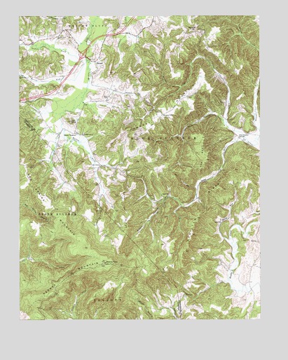
Dawson, WV USGS Topographic Map
Click on map above to begin viewing in our Map Viewer.

This topographic map contains these locations and features:
Feature Name Type Latitude Longitude GNIS ID View Map
Beech RunStreamN37.7832°W80.6404°1535548View Map
Bennett MountainSummitN37.8260°W80.6912°1535635View Map
Blue Sulphur SpringSpringN37.8285°W80.6392°1557478View Map
Blue Sulphur SpringsPopulated PlaceN37.8251°W80.6362°1549600View Map
Blue Sulphur Springs Junior High School (historical)SchoolN37.8293°W80.6351°1558000View Map
Bryant HollowValleyN37.7987°W80.6754°1536535View Map
Buffalo CreekStreamN37.8571°W80.7148°1536627View Map
Chapel Hill ChurchChurchN37.8010°W80.6734°1537198View Map
Cleveland School (historical)SchoolN37.8007°W80.6737°1556267View Map
DawsonPopulated PlaceN37.8562°W80.7109°1558356View Map
Dougher KnobSummitN37.8693°W80.6604°1554323View Map
Dougher School (historical)SchoolN37.8668°W80.6640°1556275View Map
Grassy MeadowsPopulated PlaceN37.8268°W80.7209°1549713View Map
Grassy Meadows Post OfficePost OfficeN37.8271°W80.7215°1559389View Map
Green ChurchChurchN37.7901°W80.6456°1539670View Map
Hamilton RidgeRidgeN37.7982°W80.6526°1539878View Map
Harrison School (historical)SchoolN37.7940°W80.7234°1556924View Map
Hickory GrovePopulated PlaceN37.8340°W80.6759°1554694View Map
Interchange 150CrossingN37.8596°W80.7165°1556438View Map
Keeney KnobSummitN37.7735°W80.7054°1541105View Map
Keeney MountainRidgeN37.7735°W80.7052°1541106View Map
Keeney Mountain Lookout TowerLocaleN37.7735°W80.7054°1556938View Map
Knapp School (historical)SchoolN37.7912°W80.6456°1556308View Map
Leef KnobSummitN37.8315°W80.7231°1541612View Map
Lewis School (historical)SchoolN37.8126°W80.7115°1556311View Map
Maude ChapelChurchN37.8418°W80.7034°1542880View Map
McClung School (historical)SchoolN37.8693°W80.6834°1556321View Map
McElhenney ChurchChurchN37.8271°W80.7168°1542994View Map
Meadow Grove Baptist ChurchChurchN37.8662°W80.7304°1543068View Map
Morris ForkStreamN37.8568°W80.7143°1543574View Map
Morris Fork ChurchChurchN37.8501°W80.7490°1543575View Map
Mount Vernon School (historical)SchoolN37.7815°W80.6751°1556332View Map
Mount Zion ChurchChurchN37.7598°W80.6637°1543810View Map
Patterson CreekStreamN37.8287°W80.7273°1544622View Map
Patterson Creek School (historical)SchoolN37.8121°W80.7309°1556958View Map
Pentecostal ChurchChurchN37.8437°W80.6412°1556344View Map
Red Spring MountainSummitN37.7796°W80.7162°1545466View Map
Richardson CemeteryCemeteryN37.8656°W80.6507°2574010View Map
Robert Bennett SpringSpringN37.8515°W80.6484°1557593View Map
Sassafras KnobSummitN37.7529°W80.7484°1555574View Map
Sawmill HollowValleyN37.8323°W80.6448°1546458View Map
Sawmill Hollow School (historical)SchoolN37.8254°W80.6654°1556364View Map
Smoot Volunteer Fire DepartmentBuildingN37.8690°W80.6857°2577964View Map
Snake RunStreamN37.8223°W80.6309°1547023View Map
The SwellSummitN37.8157°W80.6531°1548011View Map
Thompson School (historical)SchoolN37.8446°W80.6998°1556375View Map
Tincher RidgeRidgeN37.7979°W80.6973°1548102View Map
Willard School (historical)SchoolN37.8440°W80.7295°1556388View Map

Note: Coordinates in the location and feature list above are referenced to NAD83 datum.


Copyright (C) 2008-2024 Ryan Niemi / Sunset Dynamics ... All Rights Reserved