TopoQuest Logo
Do you find TopoQuest useful?
Help keep TopoQuest running and adding new maps/features by donating!
Bitcoin:  19c7KJd3qBynnjoSw5npx9KScwjBe4ifkT
Litecoin:  LXs6TkuXGGXo1vDsWCkWVdjQX94eUKd6ui
Home View Maps Find Maps Find Places Resources & Links


Rupert, West Virginia Topographic Map

USGS Map Title: Rupert, WV
USGS Map MRC: 37080H6
DRG (GeoTIFF) Download: o37080h6.tif


Neighboring USGS Topographic Map Quads:


  Corliss, WV  
38080A7
 

  Quinwood, WV  
38080A6
 

  Duo, WV  
38080A5
 

  Rainelle, WV  
37080H7
 

  Rupert, WV  
37080H6
 

  Cornstalk, WV  
37080H5
 

  Meadow Bridge, WV  
37080G7
 

  Dawson, WV  
37080G6
 

  Asbury, WV  
37080G5


Map MRC Location:

N38°
W81°
N38°
W80°
H8 H7 H6 H5 H4 H3 H2 H1
G8 G7 G6 G5 G4 G3 G2 G1
F8 F7 F6 F5 F4 F3 F2 F1
E8 E7 E6 E5 E4 E3 E2 E1
D8 D7 D6 D5 D4 D3 D2 D1
C8 C7 C6 C5 C4 C3 C2 C1
B8 B7 B6 B5 B4 B3 B2 B1
A8 A7 A6 A5 A4 A3 A2 A1
N37°
W81°
N37°
W80°

Rupert, WV USGS 1:24K Topographic Map Preview:
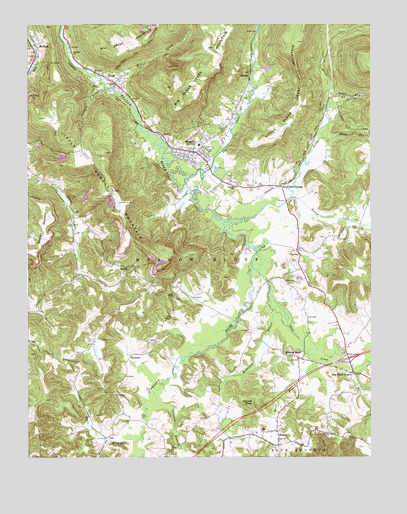
Rupert, WV USGS Topographic Map
Click on map above to begin viewing in our Map Viewer.

This topographic map contains these locations and features:
Feature Name Type Latitude Longitude GNIS ID View Map
Amwell Baptist ChurchChurchN37.9529°W80.6745°1534930View Map
Beaver CreekStreamN37.9498°W80.6526°1535448View Map
Big Clear CreekStreamN37.9537°W80.6923°1550288View Map
Big Clear Creek School (historical)SchoolN37.9887°W80.6801°1556246View Map
Bivens School (historical)SchoolN37.9229°W80.6437°1556247View Map
Brown School (historical)SchoolN37.9035°W80.7354°1556251View Map
Callahan BranchStreamN37.8946°W80.7045°1536865View Map
Charmco ChurchChurchN37.9921°W80.7340°1537223View Map
Collison BranchStreamN37.9818°W80.7215°1537536View Map
CragPopulated PlaceN37.9085°W80.7498°1560588View Map
CrawleyPopulated PlaceN37.9348°W80.6520°1537808View Map
Crawley Post OfficePost OfficeN37.9230°W80.6422°1559386View Map
Crawley School (historical)SchoolN37.9243°W80.6465°1556271View Map
DennisPopulated PlaceN37.9307°W80.7115°1554290View Map
Eagle BranchStreamN37.8807°W80.7087°1538486View Map
Fairview (historical)Populated PlaceN37.9979°W80.7490°1556278View Map
FarmdalePopulated PlaceN37.9048°W80.7109°1554445View Map
Frame School (historical)SchoolN37.9532°W80.6806°1556285View Map
Goddard MountainSummitN37.9343°W80.7476°1539487View Map
Greenbrier County Sheriff's OfficeBuildingN37.9632°W80.6906°2775761View Map
HinesPopulated PlaceN37.9835°W80.7181°1540311View Map
Hines Post OfficePost OfficeN37.9815°W80.7165°1559390View Map
Interchange 156CrossingN37.9035°W80.6331°1556439View Map
KesslerPopulated PlaceN37.9851°W80.6690°1541170View Map
Kessler Post OfficePost OfficeN37.9854°W80.6693°1559391View Map
Liberty School (historical)SchoolN37.8826°W80.7026°1556313View Map
Little Clear CreekStreamN37.9432°W80.6773°1551844View Map
Little Sewell MountainSummitN37.9521°W80.7187°1542217View Map
McRossPopulated PlaceN37.9887°W80.7484°1555090View Map
Meadow BluffPopulated PlaceN37.9037°W80.6515°1543049View Map
Meadow Bluff Post OfficePost OfficeN37.9035°W80.6518°1559646View Map
Meadow River Wildlife Management AreaParkN37.9343°W80.6809°2043538View Map
Meadowdale School (historical)SchoolN37.9257°W80.7362°1556324View Map
Methodist BranchStreamN37.9298°W80.6681°1543144View Map
Mill CreekStreamN37.9826°W80.7220°1552102View Map
Mount Lookout School (historical)SchoolN37.9418°W80.6940°1556329View Map
Nichols KnobSummitN37.8910°W80.6681°1555220View Map
Old Amwell CemeteryCemeteryN37.9248°W80.6634°2586149View Map
Opossum HollowValleyN37.8798°W80.7201°1544428View Map
Otter CreekStreamN37.9229°W80.6618°1544462View Map
Rader RunStreamN37.9807°W80.6404°1545378View Map
Rainelle AirportAirportN37.9487°W80.7165°1558840View Map
Relihan School (historical)SchoolN37.8871°W80.6865°1556354View Map
RupertPopulated PlaceN37.9632°W80.6895°1546153View Map
Rupert Elementary SchoolSchoolN37.9654°W80.6874°2088339View Map
Rupert Elementary-Junior High School (historical)SchoolN37.9651°W80.6876°1556460View Map
Rupert Post OfficePost OfficeN37.9629°W80.6890°1559667View Map
Rupert Public LibraryBuildingN37.9637°W80.6905°2727212View Map
Rupert Volunteer Fire DepartmentBuildingN37.9644°W80.6872°2577707View Map
Saint Johns Church (historical)ChurchN37.8918°W80.6515°1556362View Map
Sam Black BridgeBridgeN37.9037°W80.6333°2646948View Map
Sam Black ChurchChurchN37.8990°W80.6312°1546318View Map
Sharp School (historical)SchoolN37.9090°W80.6679°1556365View Map
Shawvers CrossingPopulated PlaceN37.9535°W80.6581°1555603View Map
SmootPopulated PlaceN37.8787°W80.6590°1547015View Map
Smoot BranchStreamN37.9029°W80.6462°1547016View Map
Smoot Elementary SchoolSchoolN37.8831°W80.6642°2088353View Map
Smoot Elementary-Junior High School (historical)SchoolN37.8829°W80.6643°1556462View Map
Smoot Post OfficePost OfficeN37.8804°W80.6644°1559397View Map
Soule ChapelChurchN37.9215°W80.6968°1547058View Map
State Flower School (historical)SchoolN37.9232°W80.6862°1556372View Map
Stony RunStreamN37.9668°W80.6434°1547501View Map
Sugar Grove School (historical)SchoolN37.9473°W80.7343°1556374View Map
Tincher Post Office (historical)Post OfficeN37.9087°W80.7495°1559398View Map
Town of RupertCivilN37.9649°W80.6869°2391398View Map
ValePopulated PlaceN37.8804°W80.7218°1549966View Map
Western Greenbrier Middle SchoolSchoolN37.9557°W80.6680°2088405View Map
WYKM-AM (Rupert)TowerN37.9932°W80.6840°1559743View Map

Note: Coordinates in the location and feature list above are referenced to NAD83 datum.


Copyright (C) 2008-2024 Ryan Niemi / Sunset Dynamics ... All Rights Reserved