TopoQuest Logo
Do you find TopoQuest useful?
Help keep TopoQuest running and adding new maps/features by donating!
Bitcoin:  19c7KJd3qBynnjoSw5npx9KScwjBe4ifkT
Litecoin:  LXs6TkuXGGXo1vDsWCkWVdjQX94eUKd6ui
Home View Maps Find Maps Find Places Resources & Links


DeLong, Illinois Topographic Map

USGS Map Title: DeLong, IL
USGS Map MRC: 40090G3
DRG (GeoTIFF) Download: o40090g3.tif


Neighboring USGS Topographic Map Quads:


  Galesburg West, IL  
40090H4
 

  Galesburg East, IL  
40090H3
 

  Appleton, IL  
40090H2
 

  Abingdon, IL  
40090G4
 

  DeLong, IL  
40090G3
 

  Maquon, IL  
40090G2
 

  Avon, IL  
40090F4
 

  London Mills, IL  
40090F3
 

  Fairview, IL  
40090F2


Map MRC Location:

N41°
W91°
N41°
W90°
H8 H7 H6 H5 H4 H3 H2 H1
G8 G7 G6 G5 G4 G3 G2 G1
F8 F7 F6 F5 F4 F3 F2 F1
E8 E7 E6 E5 E4 E3 E2 E1
D8 D7 D6 D5 D4 D3 D2 D1
C8 C7 C6 C5 C4 C3 C2 C1
B8 B7 B6 B5 B4 B3 B2 B1
A8 A7 A6 A5 A4 A3 A2 A1
N40°
W91°
N40°
W90°

DeLong, IL USGS 1:24K Topographic Map Preview:
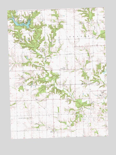
DeLong, IL USGS Topographic Map
Click on map above to begin viewing in our Map Viewer.

This topographic map contains these locations and features:
Feature Name Type Latitude Longitude GNIS ID View Map
Barnett School (historical)SchoolN40.8611°W90.2587°403916View Map
Bliss School (historical)SchoolN40.7514°W90.2912°404563View Map
Brunk CreekStreamN40.8281°W90.3298°405007View Map
Brush CreekStreamN40.7828°W90.2729°405021View Map
Brush Creek CemeteryCemeteryN40.8725°W90.3362°1719594View Map
Burnside (historical)Populated PlaceN40.7695°W90.2735°422520View Map
Camp ShaubenaLocaleN40.8592°W90.3535°405501View Map
Cashman School (historical)SchoolN40.7878°W90.3485°405683View Map
Cornfield College School (historical)SchoolN40.7875°W90.3012°406599View Map
Davies Landing Strip (historical)AirportN40.7889°W90.2596°1720335View Map
De Long Fire DepartmentBuildingN40.8167°W90.3029°2640370View Map
DeLongPopulated PlaceN40.8167°W90.3046°407021View Map
Delong Post Office (historical)Post OfficeN40.8167°W90.3040°1815946View Map
Earl School (historical)SchoolN40.8170°W90.3568°407588View Map
Elias Bragg CemeteryCemeteryN40.8011°W90.2826°1719591View Map
Elwell School (historical)SchoolN40.8248°W90.2690°407974View Map
Good Samaritan RetreatLocaleN40.8723°W90.3426°1719641View Map
Harper CemeteryCemeteryN40.7928°W90.2548°1719647View Map
Harper School (historical)SchoolN40.7953°W90.2632°409830View Map
Haynes CemeteryCemeteryN40.8309°W90.2985°1719649View Map
Haynes Church (historical)ChurchN40.8311°W90.3001°409964View Map
HermonPopulated PlaceN40.7570°W90.3198°410099View Map
Hermon Christian CemeteryCemeteryN40.7586°W90.3204°1815973View Map
Hermon Methodist CemeteryCemeteryN40.7586°W90.3196°1815974View Map
Lake BrackenReservoirN40.8619°W90.3570°404770View Map
Lake Bracken Country ClubLocaleN40.8620°W90.3535°425082View Map
Lake Bracken DamDamN40.8575°W90.3487°1691468View Map
Middle Grove School (historical)SchoolN40.7734°W90.3585°413504View Map
Oak Grove School (historical)SchoolN40.8442°W90.3637°414809View Map
Orange ChapelChurchN40.8386°W90.2629°415154View Map
Township of ChestnutCivilN40.7575°W90.2720°428802View Map
Township of OrangeCivilN40.8450°W90.2706°429500View Map
Way School (historical)SchoolN40.7514°W90.2540°420659View Map
White School (historical)SchoolN40.8450°W90.3001°1719715View Map

Note: Coordinates in the location and feature list above are referenced to NAD83 datum.


Copyright (C) 2008-2024 Ryan Niemi / Sunset Dynamics ... All Rights Reserved